Union County, Arkansas
Union County is a county located on the central southern border of the U.S. state of Arkansas. As of the 2010 census, the population was 41,639.[1] The county seat is El Dorado. The county was formed on November 2, 1829, and named in recognition of the citizens' petition for a new county, which said that they were petitioning "in the spirit of Union and Unity." The county is directly adjacent to the south to Union Parish in the state of Louisiana.
Union County | |
|---|---|
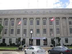 Union County Courthouse in El Dorado | |
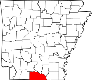 Location within the U.S. state of Arkansas | |
 Arkansas's location within the U.S. | |
| Coordinates: 33°11′14″N 92°35′29″W | |
| Country | |
| State | |
| Founded | November 2, 1829 |
| Seat | El Dorado |
| Largest city | El Dorado |
| Area | |
| • Total | 1,055 sq mi (2,730 km2) |
| • Land | 1,039 sq mi (2,690 km2) |
| • Water | 16 sq mi (40 km2) 1.5%% |
| Population (2010) | |
| • Total | 41,639 |
| • Estimate (2019) | 38,682 |
| • Density | 40/sq mi (20/km2) |
| Time zone | UTC−6 (Central) |
| • Summer (DST) | UTC−5 (CDT) |
| Congressional district | 4th |
| Website | www |
The El Dorado, AR Micropolitan Statistical Area includes all of Union County.
Called by boosters the "Queen City of South Arkansas", El Dorado was at the heart of the 1920s oil boom in South Arkansas. More recently, the city has been called "Arkansas's Original Boomtown," as it emphasizes its historic assets for heritage tourism.[2] The chemical and timber industries became important during and after World War II, and still have a place in the economy.
History
Union County was formed on November 2, 1829, from portions of Clark and Hempstead counties. Areas along the waterways were originally developed for cotton plantations in the antebellum years, and planters depended on large groups of enslaved African-American workers to generate their profits.
On January 10, 1921 Dr. Samuel T. Busey hit oil with a well about a mile south of El Dorado, leading to an oil boom that attracted thousands of workers and speculators. His first well produced for fewer than two months, but by 1923, "El Dorado boasted fifty-nine oil contracting companies, thirteen oil distributors and refiners, and twenty-two oil production companies. The city was flooded with so many people that no bed space was available for them, leading to whole neighborhoods of tents and hastily constructed shacks to be erected throughout the city. The city's population reached a high of nearly 30,000 in 1925 during the boom before dropping to 16,241 by 1930 and rising to 25,000 by 1960."[3] Oil production fell markedly in the early 1930s, in part due to companies' financial difficulties during the Great Depression. It recovered later in the decade.
During World War II, chemical plants were established in the county, but their production declined after the war. Exploitation of Arkansas forests led to growth in the timber industry in the county. Oil, chemical and timber industries are still important to the economy, although in lesser proportion.
Geography
According to the U.S. Census Bureau, the county has a total area of 1,055 square miles (2,730 km2), of which 1,039 square miles (2,690 km2) is land and 16 square miles (41 km2) (1.5%) is water.[4] It is the largest county by area in Arkansas. Union County, along with Columbia County, has the largest bromine reserve in the United States. The lowest point in the state of Arkansas is located on the Ouachita River in Union County and Ashley County, where it flows out of Arkansas and into Louisiana.
Adjacent counties
- Ouachita County (northwest)
- Calhoun County (north)
- Bradley County (northeast)
- Ashley County (east)
- Morehouse Parish, Louisiana (southeast)
- Union Parish, Louisiana (south)
- Claiborne Parish, Louisiana (southwest)
- Columbia County (west)
National protected area
Demographics
| Historical population | |||
|---|---|---|---|
| Census | Pop. | %± | |
| 1830 | 640 | — | |
| 1840 | 2,889 | 351.4% | |
| 1850 | 10,298 | 256.5% | |
| 1860 | 12,288 | 19.3% | |
| 1870 | 10,571 | −14.0% | |
| 1880 | 13,419 | 26.9% | |
| 1890 | 14,977 | 11.6% | |
| 1900 | 22,495 | 50.2% | |
| 1910 | 30,723 | 36.6% | |
| 1920 | 29,691 | −3.4% | |
| 1930 | 55,800 | 87.9% | |
| 1940 | 50,461 | −9.6% | |
| 1950 | 49,686 | −1.5% | |
| 1960 | 49,518 | −0.3% | |
| 1970 | 45,428 | −8.3% | |
| 1980 | 48,573 | 6.9% | |
| 1990 | 46,719 | −3.8% | |
| 2000 | 45,629 | −2.3% | |
| 2010 | 41,639 | −8.7% | |
| Est. 2019 | 38,682 | [5] | −7.1% |
| U.S. Decennial Census[6] 1790–1960[7] 1900–1990[8] 1990–2000[9] 2010–2016[1] | |||
As of the 2000 census,[11] there were 45,629 people, 17,989 households, and 12,646 families residing in the county. The population density was 44 people per square mile (17/km²). There were 20,676 housing units at an average density of 20 per square mile (8/km²). The racial makeup of the county was 66.15% White, 31.97% Black or African American, 0.24% Native American, 0.40% Asian, 0.01% Pacific Islander, 0.46% from other races, and 0.77% from two or more races. 1.14% of the population were Hispanic or Latino of any race.
There were 17,989 households out of which 32.20% had children under the age of 18 living with them, 51.30% were married couples living together, 15.20% had a female householder with no husband present, and 29.70% were non-families. 26.90% of all households were made up of individuals and 12.10% had someone living alone who was 65 years of age or older. The average household size was 2.48 and the average family size was 3.00.
In the county, the population was spread out with 25.90% under the age of 18, 8.30% from 18 to 24, 27.00% from 25 to 44, 22.70% from 45 to 64, and 16.10% who were 65 years of age or older. The median age was 38 years. For every 100 females there were 91.60 males. For every 100 females age 18 and over, there were 86.00 males.
The median income for a household in the county was $29,809, and the median income for a family was $36,805. Males had a median income of $31,868 versus $19,740 for females. The per capita income for the county was $16,063. About 14.70% of families and 18.70% of the population were below the poverty line, including 25.80% of those under age 18 and 14.30% of those age 65 or over.
Government
Over The past few election cycles Union County has trended heavily towards the GOP. The last democrat (as of 2016) to carry this county was Bill Clinton in 1996.
| Year | GOP | Dem | Others |
|---|---|---|---|
| 2016 | 61.89% 10,456 | 34.66% 5,855 | 3.45% 583 |
| 2012 | 62.29% 10,699 | 36.07% 6,196 | 1.64% 282 |
| 2008 | 62.15% 10,677 | 36.03% 6,190 | 1.82% 312 |
| 2004 | 58.89% 10,502 | 39.65% 7,071 | 1.45% 259 |
| 2000 | 55.40% 8,647 | 40.11% 6,261 | 4.49% 701 |
| 1996 | 37.97% 6,053 | 52.53% 8,373 | 9.50% 1,514 |
| 1992 | 39.32% 7,305 | 47.29% 8,786 | 13.40% 2,489 |
| 1988 | 61.32% 10,581 | 34.37% 5,931 | 4.31% 744 |
| 1984 | 65.74% 12,333 | 33.09% 6,208 | 1.16% 218 |
| 1980 | 55.10% 9,401 | 40.16% 6,852 | 4.74% 810 |
| 1976 | 48.93% 7,918 | 51.03% 8,257 | 0.04% 7 |
| 1972 | 76.72% 11,925 | 22.72% 3,531 | 0.56% 87 |
| 1968 | 28.60% 4,919 | 25.74% 4,426 | 45.66% 7,853 |
| 1964 | 54.38% 8,472 | 44.60% 6,948 | 1.03% 160 |
| 1960 | 41.51% 5,631 | 47.92% 6,500 | 10.57% 1,434 |
| 1956 | 39.75% 5,059 | 55.44% 7,055 | 4.81% 612 |
| 1952 | 41.11% 5,266 | 58.67% 7,515 | 0.23% 29 |
| 1948 | 12.46% 1,039 | 67.01% 5,588 | 20.53% 1,712 |
| 1944 | 15.26% 833 | 84.70% 4,624 | 0.04% 2 |
| 1940 | 9.15% 489 | 90.59% 4,842 | 0.26% 14 |
| 1936 | 5.76% 254 | 93.94% 4,141 | 0.29% 13 |
| 1932 | 4.27% 245 | 94.61% 5,429 | 1.12% 64 |
| 1928 | 33.95% 1,612 | 65.88% 3,128 | 0.17% 8 |
| 1924 | 16.84% 450 | 73.59% 1,967 | 9.58% 256 |
| 1920 | 21.29% 493 | 76.12% 1,763 | 2.59% 60 |
| 1916 | 13.90% 273 | 86.10% 1,691 | 0.00% 0 |
| 1912 | 10.25% 152 | 73.50% 1,090 | 16.25% 241 |
| 1908 | 27.23% 535 | 71.60% 1,407 | 1.17% 23 |
| 1904 | 23.57% 297 | 75.79% 955 | 0.63% 8 |
| 1900 | 21.05% 336 | 77.57% 1,238 | 1.38% 22 |
| 1896 | 7.56% 148 | 89.37% 1,749 | 3.07% 60 |
Transportation
Major highways
.svg.png)


Communities
Towns
Unincorporated communities
- Mount Holly
- Old Union
- Lawson
- New London
- Lapile
- Moro Bay
- Parkers Chapel
Townships
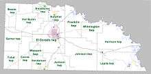
Townships in Arkansas are the divisions of a county. Each township includes unincorporated areas; some may have incorporated cities or towns within part of their boundaries. Arkansas townships have limited purposes in modern times. However, the United States Census does list Arkansas population based on townships (sometimes referred to as "county subdivisions" or "minor civil divisions"). Townships are also of value for historical purposes in terms of genealogical research. Each town or city is within one or more townships in an Arkansas county based on census maps and publications. The townships of Union County are listed below; listed in parentheses are the cities, towns, and/or census-designated places that are fully or partially inside the township. [13][14]
- Boone
- Cornie
- El Dorado (El Dorado)
- Franklin (Calion)
- Garner
- Harrison
- Henderson (Junction City)
- Jackson
- Johnson
- Lapile (Felsenthal, Huttig, Strong)
- Norphlet (Norphlet)
- Smackover (Smackover)
- Tubal
- Van Buren
- Wesson
- Wilmington
See also
- List of lakes in Union County, Arkansas
- National Register of Historic Places listings in Union County, Arkansas
References
- "State & County QuickFacts". United States Census Bureau. Retrieved May 19, 2014.
- Bridges, Kenneth. "El Dorado (Union County)". Encyclopedia of Arkansas. Retrieved 2 June 2015.
- Kenneth Bridges, "El Dorado (Union County)", 2017, Encyclopedia of Arkansas Culture and History; accessed 28 April 2018
- "2010 Census Gazetteer Files". United States Census Bureau. August 22, 2012. Retrieved August 27, 2015.
- "Population and Housing Unit Estimates". Retrieved September 28, 2019.
- "U.S. Decennial Census". United States Census Bureau. Retrieved August 27, 2015.
- "Historical Census Browser". University of Virginia Library. Retrieved August 27, 2015.
- Forstall, Richard L., ed. (March 27, 1995). "Population of Counties by Decennial Census: 1900 to 1990". United States Census Bureau. Retrieved August 27, 2015.
- "Census 2000 PHC-T-4. Ranking Tables for Counties: 1990 and 2000" (PDF). United States Census Bureau. April 2, 2001. Retrieved August 27, 2015.
- Based on 2000 census data
- "U.S. Census website". United States Census Bureau. Retrieved 2011-05-14.
- "Dave Leip's Atlas of U.S. Presidential Elections". Retrieved November 18, 2016.
- 2011 Boundary and Annexation Survey (BAS): Union County, AR (PDF) (Map). U. S. Census Bureau. Retrieved 2011-08-07.
- "Arkansas: 2010 Census Block Maps - County Subdivision". United States Census Bureau. Retrieved May 29, 2014.
External links
- Union County, Arkansas official site
- Union County, Arkansas entry on the Encyclopedia of Arkansas History & Culture
Places adjacent to Union County, Arkansas | |
|---|---|
Municipalities and communities of Union County, Arkansas, United States | ||
|---|---|---|
| Cities | Map of Arkansas highlighting Union County | |
| Town | ||
| Unincorporated communities | ||

| Authority control |
|
|---|