National Register of Historic Places listings in Union County, Arkansas
This is a list of the National Register of Historic Places listings in Union County, Arkansas.
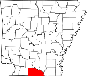
Location of Union County in Arkansas
This is intended to be a complete list of the properties and districts on the National Register of Historic Places in Union County, Arkansas, United States. The locations of National Register properties and districts for which the latitude and longitude coordinates are included below, may be seen in a map.[1]
There are 33 properties and districts listed on the National Register in the county.
- This National Park Service list is complete through NPS recent listings posted August 14, 2020.[2]
Current listings
| [3] | Name on the Register[4] | Image | Date listed[5] | Location | City or town | Description |
|---|---|---|---|---|---|---|
| 1 | Bank of Commerce | 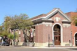 Bank of Commerce |
March 25, 1982 (#82002145) |
200 N. Washington St. 33°12′45″N 92°39′52″W |
El Dorado | |
| 2 | Dual State Monument | 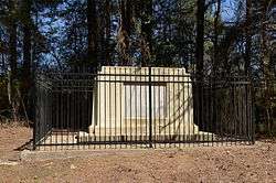 Dual State Monument |
September 11, 2000 (#99001354) |
County Road 86 33°00′39″N 92°22′05″W |
Aurelle | Extends into Union Parish, Louisiana |
| 3 | El Dorado Apartments | 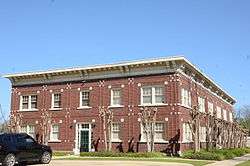 El Dorado Apartments |
December 1, 1983 (#83003549) |
420 Wilson Pl. 33°12′22″N 92°39′37″W |
El Dorado | |
| 4 | El Dorado Commercial Historic District | 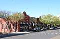 El Dorado Commercial Historic District |
August 21, 2003 (#03000773) |
Courthouse Square, portions of Main, Jefferson, Washington, Jackson, Cedar, and Locust Sts. 33°12′40″N 92°39′45″W |
El Dorado | |
| 5 | El Dorado Confederate Monument | 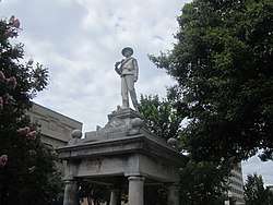 El Dorado Confederate Monument |
April 26, 1996 (#96000463) |
Courthouse lawn, near the junction of N. Main St. and S. Washington 33°12′43″N 92°39′48″W |
El Dorado | |
| 6 | El Dorado Junior College Building | 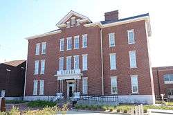 El Dorado Junior College Building |
September 13, 1978 (#78000633) |
300 S. West Ave. 33°12′34″N 92°39′58″W |
El Dorado | |
| 7 | Exchange Bank |  Exchange Bank |
December 16, 1986 (#86003304) |
Washington and Oak Sts. 33°12′47″N 92°39′49″W |
El Dorado | |
| 8 | First Presbyterian Church | 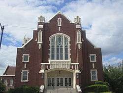 First Presbyterian Church |
May 14, 1991 (#91000579) |
300 E. Main 33°12′44″N 92°39′41″W |
El Dorado | |
| 9 | Goodwin Field Administration Building | August 2, 2018 (#100002479) |
418 Airport Dr. 33°12′58″N 92°48′42″W |
El Dorado | ||
| 10 | Griffin Auto Company Building | 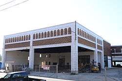 Griffin Auto Company Building |
May 25, 2001 (#01000525) |
117 E. Locust St. 33°12′36″N 92°39′45″W |
El Dorado | |
| 11 | Henley-Riley Houses | June 26, 2017 (#100001235) |
2523 and 2525 Calion Rd. 33°14′14″N 92°39′25″W |
El Dorado | ||
| 12 | Mahony Historic District |  Mahony Historic District |
December 19, 2011 (#11000899) |
Roughly bounded by Champagnolle Rd., the alley between N. Madison and Euclid Aves., Lee Ave., and E. 5th St. 33°13′12″N 92°39′25″W |
El Dorado | |
| 13 | Masonic Temple | 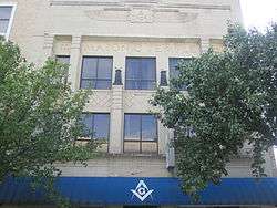 Masonic Temple |
April 12, 2001 (#01000349) |
106-108 N. Washington 33°12′44″N 92°39′49″W |
El Dorado | |
| 14 | D. McDonald House | 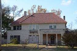 D. McDonald House |
December 27, 1990 (#90001949) |
800 S. Broadway 33°21′49″N 92°43′33″W |
Smackover | |
| 15 | Henry Crawford McKinney House | 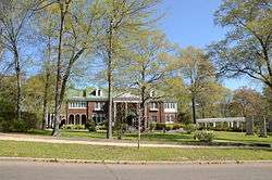 Henry Crawford McKinney House |
September 1, 1983 (#83001157) |
510 E. Faulkner 33°13′00″N 92°39′39″W |
El Dorado | |
| 16 | J.H. McWilliams House |  J.H. McWilliams House |
September 12, 2002 (#02001044) |
323 W. Oak St. 33°12′38″N 92°39′47″W |
El Dorado | |
| 17 | W. F. & Estelle McWilliams House | 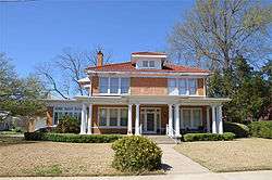 W. F. & Estelle McWilliams House |
September 30, 2013 (#13000791) |
314 Summit Ave. 33°12′33″N 92°40′03″W |
El Dorado | |
| 18 | Mount Moriah Masonic Lodge No. 18 |  Mount Moriah Masonic Lodge No. 18 |
March 13, 1987 (#87000442) |
Off Highway 172 33°16′18″N 92°49′36″W |
Lisbon | |
| 19 | Municipal Building | 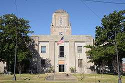 Municipal Building |
June 30, 1983 (#83001167) |
204 N. West Ave. 33°12′43″N 92°39′50″W |
El Dorado | |
| 20 | Charles H. Murphy Sr. House | 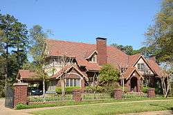 Charles H. Murphy Sr. House |
September 8, 1983 (#83001168) |
900 N. Madison Ave. 33°13′14″N 92°39′37″W |
El Dorado | |
| 21 | J.T. Murphy No 1 Crater | 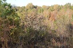 J.T. Murphy No 1 Crater |
January 24, 2008 (#07001435) |
Firetower Rd., 0.75 miles (1.21 km) north of its junction with Baugh St. 33°20′38″N 92°40′06″W |
Norphlet | |
| 22 | Murphy-Hill Historic District | 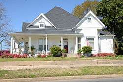 Murphy-Hill Historic District |
September 20, 2007 (#07000974) |
Roughly bounded by E. 5th St., N. Jefferson St., E. Peach St., N. Madison St., and E. Faulkner St. 33°13′04″N 92°39′39″W |
El Dorado | |
| 23 | Oakland | January 28, 2019 (#100003358) |
3800 Calion Rd. 33°15′00″N 92°39′24″W |
El Dorado | ||
| 24 | Matthew Rainey House | 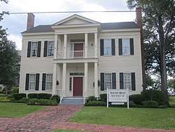 Matthew Rainey House |
November 6, 1974 (#74000501) |
510 N. Jackson St. 33°12′53″N 92°39′44″W |
El Dorado | Now the Newton House Museum |
| 25 | Randolph James House | 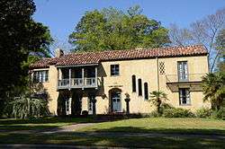 Randolph James House |
May 14, 2012 (#12000277) |
1212 N. Madison Ave. 33°13′23″N 92°39′35″W |
El Dorado | |
| 26 | Rialto Theatre |  Rialto Theatre |
August 21, 1986 (#86001888) |
117 E. Cedar St. 33°12′38″N 92°39′47″W |
El Dorado | |
| 27 | Rumph Mortuary | June 26, 2017 (#100001237) |
312 W. Oak 33°12′49″N 92°39′58″W |
El Dorado | ||
| 28 | Scotland Cemetery | 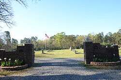 Scotland Cemetery |
September 28, 2005 (#05001081) |
U.S. Route 167, 3 miles (4.8 km) west of Junction City 33°02′59″N 92°45′03″W |
Junction City | |
| 29 | Smackover Historic Commercial District | 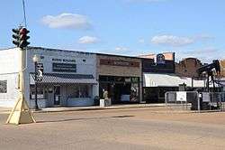 Smackover Historic Commercial District |
June 14, 1990 (#90000884) |
601-628 Broadway 33°21′55″N 92°43′29″W |
Smackover | |
| 30 | Joel Smith House |  Joel Smith House |
August 31, 1990 (#90001220) |
Junction of U.S. Route 167 and County Road 5 33°07′38″N 92°38′19″W |
El Dorado | |
| 31 | Smith-McCurry House | 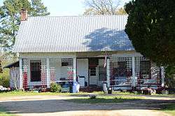 Smith-McCurry House |
October 15, 1992 (#92001394) |
Northern side of Highway 15, 3.5 miles (5.6 km) east of El Dorado 33°13′16″N 92°35′26″W |
El Dorado | |
| 32 | Union County Courthouse | 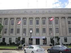 Union County Courthouse |
June 30, 1983 (#83001169) |
Union Sq. 33°12′43″N 92°39′50″W |
El Dorado | |
| 33 | Willett House | 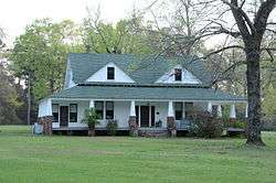 Willett House |
September 14, 1995 (#95001103) |
6563 Mount Holly Rd. 33°16′09″N 92°47′34″W |
Lisbon |
Former listings
| [3] | Name on the Register | Image | Date listed | Date removed | Location | City or town | Summary |
|---|---|---|---|---|---|---|---|
| 1 | Garrett House | November 21, 1974 (#74000500) | June 3, 1986 | 210 Peach St. |
El Dorado | ||
| 2 | Ouachita River Bridge | 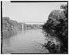 Ouachita River Bridge |
April 9, 1990 (#90000507) | August 11, 1999 | US 167, over the Ouachita River |
Calion | Replaced in 1993. |
| 3 | SAU at El Dorado | December 22, 1982 (#82000939) | September 24, 2004 | Summit at Block Streets |
El Dorado |
See also
| Wikimedia Commons has media related to National Register of Historic Places in Union County, Arkansas. |
References
- The latitude and longitude information provided in this table was derived originally from the National Register Information System, which has been found to be fairly accurate for about 99% of listings. Some locations in this table may have been corrected to current GPS standards.
- "National Register of Historic Places: Weekly List Actions". National Park Service, United States Department of the Interior. Retrieved on August 14, 2020.
- Numbers represent an ordering by significant words. Various colorings, defined here, differentiate National Historic Landmarks and historic districts from other NRHP buildings, structures, sites or objects.
- "National Register Information System". National Register of Historic Places. National Park Service. March 13, 2009.
- The eight-digit number below each date is the number assigned to each location in the National Register Information System database, which can be viewed by clicking the number.
| Topics | |
|---|---|
| Lists by state |
|
| Lists by insular areas | |
| Lists by associated state | |
| Other areas | |
| Related | |
| |
Municipalities and communities of Union County, Arkansas, United States | ||
|---|---|---|
| Cities | Map of Arkansas highlighting Union County | |
| Town | ||
| Unincorporated communities | ||
This article is issued from Wikipedia. The text is licensed under Creative Commons - Attribution - Sharealike. Additional terms may apply for the media files.