1900 United States Census
The United States Census of 1900, conducted by the Census Office on June 1, 1900,[1] determined the resident population of the United States to be 76,212,168, an increase of 21 percent over the 62,979,766 persons enumerated during the 1890 Census.
| Twelfth Census of the United States | |
|---|---|
 Seal of the United States Census Bureau | |
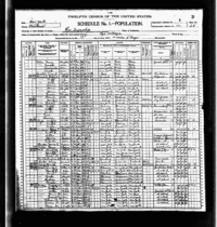 Example of Population Schedule from the 1900 Census | |
| General information | |
| Country | United States |
| Date taken | June 1, 1900 |
| Total population | 76,212,168 |
| Percent change | |
| Most populous state | New York 7,268,894 |
| Least populous state | Nevada 42,335 |
The census saw the nation's largest city, New York, more than double in size due to the consolidation with Brooklyn, becoming in the process the first American city to record a population of over three million.
Census questions
The 1900 census collected the following information:[2]
- address
- name
- relationship to head of family
- sex
- race (listed as "Color or race" on the census)
- age, month and year born
- marital status and, if married, number of years married
- for women, number of children born and number now living
- place of birth of person, and their parents
- if foreign born, year of immigration and whether naturalized
- occupation
- months not employed
- school
- ability to speak English
- whether on a farm farmer
- home owned or rented, and, if owned, whether mortgaged
Full documentation for the 1900 census, including census forms and enumerator instructions, is available from the Integrated Public Use Microdata Series.
Data availability
The original census enumeration sheets were microfilmed by the Census Bureau in the 1940s; after which the original sheets were destroyed.[3] The microfilmed census is available in rolls from the National Archives and Records Administration. Several organizations also host images of the microfilmed census online, and digital indices.
Microdata from the 1900 census are freely available through the Integrated Public Use Microdata Series. Aggregate data for small areas, together with electronic boundary files, can be downloaded from the National Historical Geographic Information System.
State rankings
| Rank | State | Population as of 1900 Census |
Population as of 1890 Census |
Change | Percent change |
|---|---|---|---|---|---|
| 1 | 7,268,894 | 5,997,853 | 1,271,041 |
21.2% | |
| 2 | 6,302,115 | 5,258,113 | 1,044,002 |
19.9% | |
| 3 | 4,821,550 | 3,826,352 | 995,198 |
26.0% | |
| 4 | 4,157,545 | 3,672,329 | 485,216 |
13.2% | |
| 5 | 3,106,665 | 2,679,185 | 427,480 |
16.0% | |
| 6 | 3,048,710 | 2,235,527 | 813,183 |
36.4% | |
| 7 | 2,805,346 | 2,238,947 | 566,399 |
25.3% | |
| 8 | 2,516,462 | 2,192,404 | 324,058 |
14.8% | |
| 9 | 2,420,982 | 2,093,890 | 327,092 |
15.6% | |
| 10 | 2,231,853 | 1,912,297 | 319,556 |
16.7% | |
| 11 | 2,216,331 | 1,837,353 | 378,978 |
20.6% | |
| 12 | 2,147,174 | 1,858,635 | 288,539 |
15.5% | |
| 13 | 2,069,042 | 1,693,330 | 375,712 |
22.2% | |
| 14 | 2,020,616 | 1,767,518 | 253,098 |
14.3% | |
| 15 | 1,893,810 | 1,617,949 | 275,861 |
17.1% | |
| 16 | 1,883,669 | 1,444,933 | 438,736 |
30.4% | |
| 17 | 1,854,184 | 1,655,980 | 198,204 |
12.0% | |
| 18 | 1,828,697 | 1,513,401 | 315,296 |
20.8% | |
| 19 | 1,751,394 | 1,310,283 | 441,111 |
33.7% | |
| 20 | 1,551,270 | 1,289,600 | 261,670 |
20.3% | |
| 21 | 1,485,053 | 1,213,398 | 271,655 |
22.4% | |
| 22 | 1,470,495 | 1,428,108 | 42,387 |
3.0% | |
| 23 | 1,381,625 | 1,118,588 | 263,037 |
23.5% | |
| 24 | 1,340,316 | 1,151,149 | 189,167 |
16.4% | |
| 25 | 1,311,564 | 1,128,211 | 183,353 |
16.3% | |
| 26 | 1,188,044 | 1,042,390 | 145,654 |
14.0% | |
| 27 | 1,066,300 | 1,062,656 | 3,644 |
0.3% | |
| 28 | 958,800 | 762,794 | 196,006 |
25.7% | |
| 29 | 908,420 | 746,258 | 162,162 |
21.7% | |
| – | 790,391 | 258,657 | 531,734 |
205.6% | |
| 30 | 694,466 | 661,086 | 33,380 |
5.0% | |
| 31 | 539,700 | 413,249 | 126,451 |
30.6% | |
| 32 | 528,542 | 391,422 | 137,120 |
35.0% | |
| 33 | 518,103 | 357,232 | 160,871 |
45.0% | |
| 34 | 428,556 | 345,506 | 83,050 |
24.0% | |
| 35 | 413,536 | 317,704 | 95,832 |
30.2% | |
| 36 | 411,588 | 376,530 | 35,058 |
9.3% | |
| 37 | 401,570 | 348,600 | 52,970 |
15.2% | |
| 38 | 343,641 | 332,422 | 11,219 |
3.4% | |
| 39 | 319,146 | 190,983 | 128,163 |
67.1% | |
| – | 278,718 | 230,392 | 48,326 |
21.0% | |
| 40 | 276,749 | 210,779 | 65,970 |
31.3% | |
| 41 | 243,329 | 142,924 | 100,405 |
70.3% | |
| – | 195,310 | 160,282 | 35,028 |
21.9% | |
| 42 | 184,735 | 168,493 | 16,242 |
9.6% | |
| 43 | 161,772 | 88,548 | 73,224 |
82.7% | |
| – | 154,001 | – | – | – | |
| – | 122,931 | 88,243 | 34,688 |
39.3% | |
| 44 | 92,531 | 62,555 | 29,976 |
47.9% | |
| – | 63,592 | 32,052 | 31,540 |
98.4% | |
| 45 | 42,335 | 47,355 | -5,020 |
-10.6% |
City rankings
References
- "1900 Overview", History, US Census Bureau
- "Library Bibliography Bulletin 88, New York State Census Records, 1790–1925". New York State Library. October 1981. p. 45 (p. 51 of PDF). Archived from the original on January 30, 2009. Retrieved December 15, 2008.
- Algonquin Area Public Library District. "Census Secrets" (PDF). Retrieved May 17, 2012.
- Population of the 100 Largest Cities and Other Urban Places in the United States: 1790 to 1990, U.S. Census Bureau, 1998
- "Regions and Divisions". U.S. Census Bureau. Archived from the original on December 3, 2016. Retrieved September 9, 2016.
External links
| Wikimedia Commons has media related to 1900 United States Census. |
- 1901 U.S Census Report Contains 1900 Census results
- Historic US Census data
- http://census.gov/population/www/censusdata/PopulationofStatesandCountiesoftheUnitedStates1790-1990.pdf
| Authority control |
|
|---|