Franklin County, Arkansas
Franklin County is a county located in the U.S. state of Arkansas. As of the 2010 census, the population was 18,125.[1] The county has two county seats, Charleston and Ozark.[2] The county was formed on December 19, 1837, and named for Benjamin Franklin,[3] American statesman. To the north of the Arkansas River, which bisects Franklin County, the county is wet and alcohol is sold in liquor stores, bars and local vineyards. To the south of the Arkansas River, the county is dry.
Franklin County | |
|---|---|
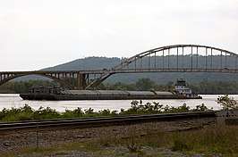 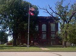 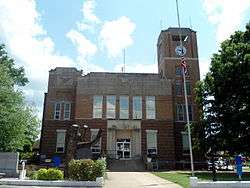 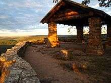 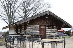 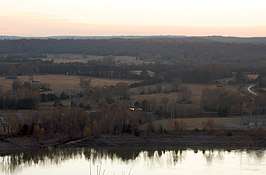 Clockwise from top: The Ozark Bridge over the Arkansas River, Franklin County Courthouse in Ozark, the Wiederkehr Wine Cellar near Altus, Sunset from Reed Mountain overlooking the Arkansas River Valley, Overlook at White Rock Mountain in the Ozark National Forest, Franklin County Courthouse in Charleston | |
 Flag | |
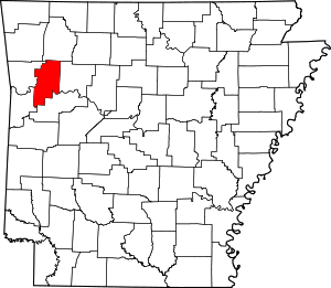 Location within the U.S. state of Arkansas | |
 Arkansas's location within the U.S. | |
| Coordinates: 35°31′15″N 93°52′33″W | |
| Country | |
| State | |
| Founded | December 19, 1837 |
| Named for | Benjamin Franklin |
| Seat | Ozark (northern district); Charleston (southern district) |
| Largest city | Ozark |
| Area | |
| • Total | 620 sq mi (1,600 km2) |
| • Land | 609 sq mi (1,580 km2) |
| • Water | 11 sq mi (30 km2) 1.7%% |
| Population (2010) | |
| • Total | 18,125 |
| • Estimate (2019) | 17,715 |
| • Density | 29/sq mi (11/km2) |
| Time zone | UTC−6 (Central) |
| • Summer (DST) | UTC−5 (CDT) |
| Congressional district | 4th |
History
Franklin County was carved out of Crawford County in December 1837. At that time, Franklin was significantly larger than it is at present, encompassing part of present-day Logan County which was formed in 1871.
Initially, the county had a single courthouse at Ozark. Later, after complaints about how difficult it was to cross the river at times, a second courthouse was established at Charleston, sometime in the 1890s.
The reality television show, The Simple Life, starring Nicole Richie and Paris Hilton was filmed in Altus in 2003.
Geography
According to the U.S. Census Bureau, the county has a total area of 620 square miles (1,600 km2), of which 609 square miles (1,580 km2) is land and 11 square miles (28 km2) (1.7%) is water.[4]
Major highways
.svg.png)


Adjacent counties
- Madison County (north)
- Johnson County (east)
- Logan County (southeast)
- Sebastian County (southwest)
- Crawford County (west)
National protected area
- Ozark National Forest (part)
Demographics
| Historical population | |||
|---|---|---|---|
| Census | Pop. | %± | |
| 1840 | 2,665 | — | |
| 1850 | 3,972 | 49.0% | |
| 1860 | 7,298 | 83.7% | |
| 1870 | 9,627 | 31.9% | |
| 1880 | 14,951 | 55.3% | |
| 1890 | 19,934 | 33.3% | |
| 1900 | 17,395 | −12.7% | |
| 1910 | 20,638 | 18.6% | |
| 1920 | 19,364 | −6.2% | |
| 1930 | 15,762 | −18.6% | |
| 1940 | 15,683 | −0.5% | |
| 1950 | 12,358 | −21.2% | |
| 1960 | 10,213 | −17.4% | |
| 1970 | 11,301 | 10.7% | |
| 1980 | 14,705 | 30.1% | |
| 1990 | 14,897 | 1.3% | |
| 2000 | 17,771 | 19.3% | |
| 2010 | 18,125 | 2.0% | |
| Est. 2019 | 17,715 | [5] | −2.3% |
| U.S. Decennial Census[6] 1790–1960[7] 1900–1990[8] 1990–2000[9] 2010–2016[1] | |||
As of the 2000 census,[11] there were 17,771 people, 6,882 households, and 4,961 families residing in the county. The population density was 29 people per square mile (11/km²). There were 7,673 housing units at an average density of 13 per square mile (5/km²). The racial makeup of the county was 96.17% White, 0.62% Black or African American, 0.80% Native American, 0.26% Asian, 0.06% Pacific Islander, 0.74% from other races, and 1.35% from two or more races. 1.74% of the population were Hispanic or Latino of any race.
There were 6,882 households out of which 32.40% had children under the age of 18 living with them, 59.20% were married couples living together, 8.80% had a female householder with no husband present, and 27.90% were non-families. 24.60% of all households were made up of individuals and 12.40% had someone living alone who was 65 years of age or older. The average household size was 2.51 and the average family size was 2.99.
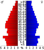
In the county, the population was spread out with 25.80% under the age of 18, 8.50% from 18 to 24, 26.70% from 25 to 44, 23.20% from 45 to 64, and 15.80% who were 65 years of age or older. The median age was 38 years. For every 100 females, there were 98.00 males. For every 100 females age 18 and over, there were 95.80 males.
The median income for a household in the county was $30,848, and the median income for a family was $36,189. Males had a median income of $27,907 versus $18,822 for females. The per capita income for the county was $14,616. About 10.60% of families and 15.20% of the population were below the poverty line, including 16.20% of those under age 18 and 15.70% of those age 65 or over.
Government
Over The past few election cycles Franklin county has trended heavily towards the GOP. The last democrat (as of 2016) to carry this county was Bill Clinton in 1996.
| Year | GOP | DEM | Others |
|---|---|---|---|
| 2016 | 74.43% 5,039 | 20.32% 1,376 | 5.24% 355 |
| 2012 | 70.81% 4,631 | 26.39% 1,726 | 2.80% 183 |
| 2008 | 68.12% 4,411 | 28.86% 1,869 | 3.01% 195 |
| 2004 | 57.36% 4,181 | 41.27% 3,008 | 1.37% 100 |
| 2000 | 53.37% 3,277 | 43.55% 2,674 | 3.08% 189 |
| 1996 | 36.30% 2,246 | 52.83% 3,269 | 10.88% 673 |
| 1992 | 37.04% 2,495 | 47.76% 3,217 | 15.20% 1,024 |
| 1988 | 58.93% 3,588 | 40.37% 2,458 | 0.71% 43 |
| 1984 | 64.04% 4,382 | 35.06% 2,399 | 0.91% 62 |
| 1980 | 53.66% 3,448 | 42.27% 2,716 | 4.08% 262 |
| 1976 | 34.76% 1,973 | 65.24% 3,703 | |
| 1972 | 74.60% 3,678 | 25.40% 1,252 | 0.00% 0 |
| 1968 | 29.02% 1,333 | 25.02% 1,149 | 45.96% 2,111 |
| 1964 | 36.76% 1,580 | 62.47% 2,685 | 0.77% 33 |
| 1960 | 43.48% 1,631 | 53.99% 2,025 | 2.53% 95 |
| 1956 | 41.03% 1,137 | 58.25% 1,614 | 0.72% 20 |
| 1952 | 40.74% 1,215 | 59.09% 1,762 | 0.17% 5 |
| 1948 | 18.69% 391 | 76.05% 1,591 | 5.26% 110 |
| 1944 | 27.75% 457 | 72.13% 1,188 | 0.12% 2 |
| 1940 | 16.60% 319 | 83.30% 1,601 | 0.10% 2 |
| 1936 | 15.35% 345 | 84.11% 1,890 | 0.53% 12 |
| 1932 | 12.30% 275 | 84.83% 1,896 | 2.86% 64 |
| 1928 | 36.53% 774 | 62.72% 1,329 | 0.76% 16 |
| 1924 | 23.05% 422 | 64.88% 1,188 | 12.07% 221 |
| 1920 | 32.15% 769 | 62.79% 1,502 | 5.06% 121 |
| 1916 | 25.74% 582 | 74.26% 1,679 | 0.00% 0 |
| 1912 | 14.75% 258 | 63.64% 1,113 | 21.61% 378 |
| 1908 | 27.40% 565 | 63.58% 1,311 | 9.02% 186 |
| 1904 | 34.94% 593 | 57.04% 968 | 8.01% 136 |
| 1900 | 25.74% 485 | 72.56% 1,367 | 1.70% 32 |
| 1896 | 18.99% 424 | 78.19% 1,746 | 2.82% 63 |
Communities
Cities
- Altus
- Branch
- Charleston (county seat)
- Ozark (county seat)
- Wiederkehr Village
Town
Townships
Townships in Arkansas are the divisions of a county. Each township includes unincorporated areas; some may have incorporated cities or towns within part of their boundaries. Arkansas townships have limited purposes in modern times. However, the United States Census does list Arkansas population based on townships (sometimes referred to as "county subdivisions" or "minor civil divisions"). Townships are also of value for historical purposes in terms of genealogical research. Each town or city is within one or more townships in an Arkansas county based on census maps and publications. The townships of Franklin County are listed below; listed in parentheses are the cities, towns, and/or census-designated places that are fully or partially inside the township. [13][14]
- Alix (part of Wiederkehr Village)
- Barham
- Black Oak
- Boston
- Cobb
- Cravens
- Donald (most of Branch)
- Grover
- Hogan (Altus, Denning, part of Wiederkehr Village)
- Hurricane
- Ivy
- Limestone
- McIlroy
- Middle
- Mill Creek
- Miller
- Morgan
- Mountain
- Mulberry
- Prairie (Charleston, small part of Branch)
- Shores
- Six Mile
- Walker
- Wallace
- Watalula
- Weaver
- White Oak (Ozark, most of Wiederkehr Village)
- White Rock
- Wittich
See also
- List of lakes in Franklin County, Arkansas
- National Register of Historic Places listings in Franklin County, Arkansas
- Gary Stubblefield
- Bill Gossage
References
- "State & County QuickFacts". United States Census Bureau. Archived from the original on June 7, 2011. Retrieved May 20, 2014.
- "Find a County". National Association of Counties. Archived from the original on 2011-05-31. Retrieved 2011-06-07.
- Gannett, Henry (1905). The Origin of Certain Place Names in the United States. Govt. Print. Off. pp. 131.
- "2010 Census Gazetteer Files". United States Census Bureau. August 22, 2012. Retrieved August 26, 2015.
- "Population and Housing Unit Estimates". Retrieved September 28, 2019.
- "U.S. Decennial Census". United States Census Bureau. Retrieved August 26, 2015.
- "Historical Census Browser". University of Virginia Library. Retrieved August 26, 2015.
- Forstall, Richard L., ed. (March 27, 1995). "Population of Counties by Decennial Census: 1900 to 1990". United States Census Bureau. Retrieved August 26, 2015.
- "Census 2000 PHC-T-4. Ranking Tables for Counties: 1990 and 2000" (PDF). United States Census Bureau. April 2, 2001. Retrieved August 26, 2015.
- Based on 2000 census data
- "U.S. Census website". United States Census Bureau. Retrieved 2011-05-14.
- "Dave Leip's Atlas of U.S. Presidential Elections". Retrieved November 18, 2016.
- 2011 Boundary and Annexation Survey (BAS): Franklin County, AR (PDF) (Map). U. S. Census Bureau. Archived from the original (PDF) on 2012-10-19. Retrieved 2011-08-25.
- "Arkansas: 2010 Census Block Maps - County Subdivision". United States Census Bureau. Retrieved May 28, 2014.
Further reading
- Shropshire, Lola. Franklin County, Arkansas: Images of America, Arcadia Publishing, 128 pages, Aug 2000 ISBN 0-7385-0882-9
| Wikisource has original text related to this article: |
Places adjacent to Franklin County, Arkansas | ||||||||||
|---|---|---|---|---|---|---|---|---|---|---|
| ||||||||||
Municipalities and communities of Franklin County, Arkansas, United States | ||
|---|---|---|
| Cities | Map of Arkansas highlighting Franklin County | |
| Town | ||
| Unincorporated communities | ||
| Ghost towns | ||

| Authority control |
|
|---|