List of rivers of Arkansas
For a list of dams and reservoirs in Arkansas, see List of Arkansas dams and reservoirs Rivers are listed by drainage basin, by size, and alphabetically.
List of rivers in Arkansas (U.S. state).
By drainage basin
This list is arranged by drainage basin, with respective tributaries indented under each larger stream's name.
Red River
- Mississippi River
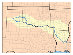
- Red River
- Black River (LA)
- Tensas River (LA)
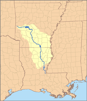
- Ouachita River
- Boeuf River
- Bayou D'Arbonne (LA)
- Cornie Bayou
- Bayou Bartholomew
- Saline River
- Moro Creek
- Smackover Creek
- Little Missouri River
- Terre Noire Creek
- Terre Rouge Creek
- Antoine River
- Caddo River
- Loggy Bayou (LA)
- Flat River (LA)
- Red Chute Bayou (LA)
- Bodcau Bayou and Creek
- Red Chute Bayou (LA)
- Bayou Dorcheat
- Flat River (LA)
- Sulphur River
- McKinney Bayou
- Little River
- Saline River
- Cossatot River
- Little Cossatot River
- Rolling Fork
- Mountain Fork
- Black River (LA)
- Red River
Arkansas River
- Mississippi River
- Arkansas River
- Bayou Meto
- Little Maumelle River
- Maumelle River
- Fourche La Fave River
- Cadron Creek
- Point Remove Creek
- Petit Jean River
- Illinois Bayou
- Big Piney Creek
- Mulberry River
- Poteau River
- Lee Creek
- Illinois River
- Flint Creek
- Neosho River (OK)
- Elk River (OK)
- Arkansas River
White River
- Mississippi River
- White River
- Arkansas Post Canal
- La Grue Bayou
- Big Creek
- Cache River
- Bayou des Arc
- Little Red River
- Village Creek
- Black River
- Strawberry River
- Spring River
- Fourche River
- Current River
- Little Black River
- North Fork River
- Buffalo River
- Little Buffalo River
- Crooked Creek
- Kings River
- White River
St. Francis River
- Mississippi River
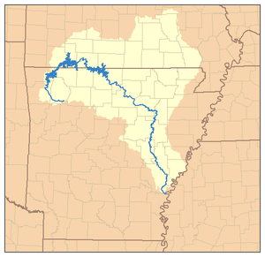
- St. Francis River
- L'Anguille River
- Tyronza River
- Little River
- St. Francis River
By size
Rivers are measured by their mean annual flow of water in cubic feet per second (cfs). One cubic foot equals .0283 cubic meters.
| River | cubic feet per second flow | Location of monitoring station | Notes |
|---|---|---|---|
| Mississippi River | 671,500 | near Vicksburg, Mississippi | |
| Arkansas River | 47,970 | Murray Dam, near Little Rock | |
| White River | 26,760 | near De Valls Bluff | |
| Red River | 19,230 | near Spring Bank | |
| Ouachita River | 11,012 | near Louisiana border | |
| St. Francis | 10,000 | below junction with L'Anguille River | estimated from limited data from US Army Corps of Engineers. See notes, below |
| Black River | 9,893 | near Elgin Ferry | |
| Little River | 4,621 | near Millwood Lake | no measurement gauge nearby; probably 1,000 – 2,000 cfs higher flow |
| Current River | 2,802 | near Doniphan, Missouri | |
| Saline River | 2,629 | near Rye | |
| Little Red River | 1,777 | near Dewey | |
| Spring River | 1,432 | near Imboden | |
| Buffalo River | 1,379 | near Harriet | |
| Cache River | 1,369 | near Cotton Plant | |
| Bayou Bartholomew | 1,221 | near Portland | |
| Eleven Point River | 1,157 | near Ravenden Springs | |
| L'Anguille River | 1,085 | near Palestine | |
| Petit Jean River | 828 | near Danville | |
| Crooked Creek | 669 | near Yellville | |
| Illinois River | 622 | near Siloam Springs | larger downstream in Oklahoma |
| Kings River | 582 | near Berryville | |
| Mulberry River | 557 | near Mulberry | |
| Lee Creek | 531 | near Van Buren | |
| Big Piney Creek | 481 | near Dover | |
| Smackover Creek | 415 | near Smackover | |
| Saline River | 385 | near Lockesburg | |
| Illinois Bayou | 379 | near Scottsville | |
| Mammoth Spring | 351 | near Mammoth Spring | |
| War Eagle Creek | 295 | near Hindsville | |
| Antoine Creek | 278 | near Antoine | |
| Cadron Creek | 271 | near Guy | |
| Caddo River | 266 | near Caddo Gap | upper course, larger downstream |
| West Fork Point Remove Creek | 257 | near Hattieville | |
| Moro Creek | 256 | near Fordyce | |
| Bayou Macon | 240 | near Eudora | |
| South Fork of Little Red River | 238 | near Clinton | |
| Cossatot River | 187 | near Vandervoort | upper course, larger downstream |
| Richland Creek | 179 | near Goshen | |
| West Fork White River | 166 | near Fayetteville | |
| Little Missouri River | 148 | near Langley | |
| James Fork | 147 | near Hackett | |
| Osage Creek | 134 | near Elm Springs | |
| Richland Creek | 118 | near Witts Spring | |
| Bear Creek | 108 | near Silver Hill | |
| Rolling Fork River | ? | no measurement gauge, but hundreds of cfs | |
| Strawberry River | ? | no measurement gauge, but hundreds of cfs |
Notes and sources: There are two Richland Creeks and two Saline Rivers in Arkansas. Flow of rivers differs substantially between years and seasons. Source for all rivers except St. Francis is the "USGS Water-Data Report – 2012" at http://waterdata.usgs.gov/ar/nwis/current/?type=flow&group_key=basin_cd; The flow of the St. Francis River flow is estimated from US Army Corps of Engineers data at https://archive.is/20130708123645/http://w3.mvm.usace.army.mil/hydraulics/docs/historic/sfdata/sf13284d
Alphabetically
- Antoine River
- Arkansas River
- Bayou De View
- Bayou des Arc
- Bayou Macon
- Bennetts River
- Big Piney Creek
- Big Sugar Creek
- Black River
- Boeuf River
- Buffalo National River or Buffalo River
- Cache River
- Caddo River
- Cossatot River
- Current River
- Dorcheat Bayou
- Eleven Point River
- Flint Creek
- Fourche La Fave River
- Fourche River
- Glazypeau Creek
- Illinois River
- James Fork
- Kings River
- L'Anguille River
- L'Eau Frais Creek
- Lee Creek
- Little Antoine River
- Little Black River
- Little Buffalo River
- Little Cossatot River
- Little Maumelle River
- Little Missouri River
- Little Red River
- Little River (Red River tributary) in southwestern Arkansas
- Little River (St. Francis River tributary) in northeastern Arkansas
- Little Strawberry River
- Little Sugar Creek
- Maumelle River
- Mississippi River
- Mountain Fork
- Mulberry River
- North Fork River
- Ouachita River
- Petit Jean River
- Poteau River
- Red River
- Rolling Fork
- Sager Creek
- St. Francis River
- Saline River (Little River tributary) in southwestern Arkansas
- Saline River (Ouachita River tributary) in southern Arkansas
- Spring River
- Strawberry River
- Sulphur River
- Tanyard Creek
- Tyronza River
- White River
References
- USGS Geographic Names Information Service
- USGS Hydrologic Unit Map – State of Arkansas (1974)
See also
- List of rivers in the United States
