Madison County, Arkansas
Madison County is a county located in the U.S. state of Arkansas. As of the 2010 census, the population was 15,717.[1] The county seat is Huntsville.[2] The county was formed on September 30, 1836, and named for James Madison,[3] fourth President of the United States.
Madison County | |
|---|---|
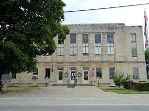 Madison County Courthouse in Huntsville | |
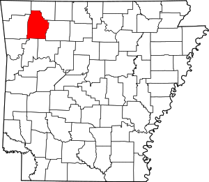 Location within the U.S. state of Arkansas | |
 Arkansas's location within the U.S. | |
| Coordinates: 36°01′38″N 93°41′45″W | |
| Country | |
| State | |
| Founded | September 30, 1836 |
| Named for | James Madison |
| Seat | Huntsville |
| Largest city | Huntsville |
| Area | |
| • Total | 837 sq mi (2,170 km2) |
| • Land | 834 sq mi (2,160 km2) |
| • Water | 2.8 sq mi (7 km2) 0.3%% |
| Population (2010) | |
| • Total | 15,717 |
| • Estimate (2019) | 16,576 |
| • Density | 19/sq mi (7.3/km2) |
| Time zone | UTC−6 (Central) |
| • Summer (DST) | UTC−5 (CDT) |
| Congressional district | 4th |
| Website | madisoncogov |
Madison County is part of the Northwest Arkansas region.
Geography
According to the U.S. Census Bureau, the county has a total area of 837 square miles (2,170 km2), of which 834 square miles (2,160 km2) is land and 2.8 square miles (7.3 km2) (0.3%) is water.[4]
Adjacent counties
- Carroll County (north)
- Newton County (east)
- Johnson County (southeast)
- Franklin County (south)
- Crawford County (southwest)
- Washington County (west)
- Benton County (northwest)
National protected area
- Ozark National Forest (part)
Demographics
| Historical population | |||
|---|---|---|---|
| Census | Pop. | %± | |
| 1840 | 2,775 | — | |
| 1850 | 4,823 | 73.8% | |
| 1860 | 7,740 | 60.5% | |
| 1870 | 8,231 | 6.3% | |
| 1880 | 11,455 | 39.2% | |
| 1890 | 17,402 | 51.9% | |
| 1900 | 19,864 | 14.1% | |
| 1910 | 16,056 | −19.2% | |
| 1920 | 14,918 | −7.1% | |
| 1930 | 13,334 | −10.6% | |
| 1940 | 14,531 | 9.0% | |
| 1950 | 11,734 | −19.2% | |
| 1960 | 9,068 | −22.7% | |
| 1970 | 9,453 | 4.2% | |
| 1980 | 11,373 | 20.3% | |
| 1990 | 11,618 | 2.2% | |
| 2000 | 14,243 | 22.6% | |
| 2010 | 15,717 | 10.3% | |
| Est. 2019 | 16,576 | [5] | 5.5% |
| U.S. Decennial Census[6] 1790–1960[7] 1900–1990[8] 1990–2000[9] 2010–2016[1] | |||
As of the 2000 census,[11] there were 14,243 people, 5,463 households, and 4,080 families residing in the county. The population density was 7/km² (17/mi²). There were 6,537 housing units at an average density of 3/km² (8/mi²). The racial makeup of the county was 95.94% White, 0.11% Black or African American, 1.22% Native American, 0.06% Asian, 0.09% Pacific Islander, 1.47% from other races, and 1.10% from two or more races. 3.06% of the population were Hispanic or Latino of any race.
There were 5,463 households out of which 33.90% had children under the age of 18 living with them, 63.00% were married couples living together, 7.90% had a female householder with no husband present, and 25.30% were non-families. 22.40% of all households were made up of individuals and 10.40% had someone living alone who was 65 years of age or older. The average household size was 2.59 and the average family size was 3.03.
In the county, the population was spread out with 26.80% under the age of 18, 7.50% from 18 to 24, 27.00% from 25 to 44, 24.30% from 45 to 64, and 14.40% who were 65 years of age or older. The median age was 38 years. For every 100 females, there were 99.70 males. For every 100 females age 18 and over, there were 97.30 males.
The median income for a household in the county was $27,895, and the median income for a family was $32,910. Males had a median income of $24,911 versus $18,786 for females. The per capita income for the county was $14,736. About 14.70% of families and 18.60% of the population were below the poverty line, including 24.60% of those under age 18 and 18.00% of those age 65 or over.
Government
During the Secession Convention of 1861, Arkansas voted to leave the Union and join the Confederate States of America. When Chairman David Walker called for a second vote seeking a unanimous decision, only Madison County representative Isaac Murphy refused to change his vote.[12] Murphy would later be appointed Governor of Arkansas during Reconstruction under Abraham Lincoln's conciliatory policy.
Madison County is strongly Republican, and voted for the Republican candidate several times even when Arkansas was part of the "Solid South".
| Year | GOP | Dem | Others |
|---|---|---|---|
| 2016 | 72.04% 4,928 | 23.21% 1,588 | 4.75% 325 |
| 2012 | 64.91% 4,263 | 31.96% 2,099 | 3.14% 206 |
| 2008 | 62.77% 3,972 | 33.88% 2,144 | 3.35% 212 |
| 2004 | 60.67% 3,873 | 37.92% 2,421 | 1.41% 90 |
| 2000 | 60.18% 3,387 | 36.51% 2,055 | 3.30% 186 |
| 1996 | 43.01% 2,303 | 46.76% 2,504 | 10.23% 548 |
| 1992 | 42.41% 2,238 | 45.76% 2,415 | 11.82% 624 |
| 1988 | 58.72% 3,067 | 40.32% 2,106 | 0.96% 50 |
| 1984 | 61.65% 3,516 | 37.40% 2,133 | 0.95% 54 |
| 1980 | 54.50% 3,180 | 41.71% 2,434 | 3.79% 221 |
| 1976 | 46.09% 2,502 | 53.91% 2,926 | |
| 1972 | 64.09% 3,372 | 35.91% 1,889 | 0.00% 0 |
| 1968 | 47.14% 2,320 | 31.98% 1,574 | 20.89% 1,028 |
| 1964 | 42.26% 1,997 | 57.45% 2,715 | 0.30% 14 |
| 1960 | 58.20% 2,445 | 40.51% 1,702 | 1.29% 54 |
| 1956 | 53.54% 2,525 | 46.35% 2,186 | 0.11% 5 |
| 1952 | 57.51% 2,868 | 42.31% 2,110 | 0.18% 9 |
| 1948 | 51.22% 2,201 | 47.50% 2,041 | 1.28% 55 |
| 1944 | 54.25% 2,120 | 45.75% 1,788 | 0.00% 0 |
| 1940 | 48.91% 2,107 | 50.97% 2,196 | 0.12% 5 |
| 1936 | 46.86% 1,484 | 53.02% 1,679 | 0.13% 4 |
| 1932 | 43.12% 2,197 | 55.01% 2,803 | 1.86% 95 |
| 1928 | 61.33% 2,760 | 38.16% 1,717 | 0.51% 23 |
| 1924 | 46.85% 1,263 | 49.52% 1,335 | 3.64% 98 |
| 1920 | 53.10% 1,715 | 45.29% 1,463 | 1.61% 52 |
| 1916 | 47.78% 1,332 | 52.22% 1,456 | 0.00% 0 |
| 1912 | 38.91% 786 | 46.14% 932 | 14.95% 302 |
| 1908 | 50.28% 1,541 | 47.01% 1,441 | 2.71% 83 |
| 1904 | 50.94% 1,160 | 47.08% 1,072 | 1.98% 45 |
| 1900 | 46.52% 1,289 | 53.23% 1,475 | 0.25% 7 |
| 1896 | 42.25% 1,260 | 56.64% 1,689 | 1.11% 33 |
Transportation
Major highways


Airport
The Huntsville Municipal Airport is a public-use airport located two nautical miles (4 km) southwest of the central business district of Huntsville.[14]
Communities
City
- Huntsville (county seat)
Towns
Unincorporated communities
Townships
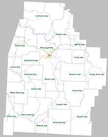
Townships in Arkansas are the divisions of a county. Each township includes unincorporated areas; some may have incorporated cities or towns within part of their boundaries. Arkansas townships have limited purposes in modern times. However, the United States Census does list Arkansas population based on townships (sometimes referred to as "county subdivisions" or "minor civil divisions"). Townships are also of value for historical purposes in terms of genealogical research. Each town or city is within one or more townships in an Arkansas county based on census maps and publications. The townships of Madison County are listed below; listed in parentheses are the cities, towns, and/or census-designated places that are fully or partially inside the township. [15][16]
| Township | FIPS code | ANSI code (GNIS ID) |
Population center(s) |
Pop. (2010) |
Pop. density (/mi²) |
Pop. density (/km²) |
Total area (mi²) |
Total area (km²) |
Land area (mi²) |
Land area (km²) |
Water area (mi²) |
Water area (km²) |
Geographic coordinates |
|---|---|---|---|---|---|---|---|---|---|---|---|---|---|
| Alabam | 05-90009 | 00068839 | 1,261 | 21.90 | 8.46 | 57.903 | 150.0 | 57.572 | 149.1 | 0.331 | 0.8573 | 36.191194°N 93.669170°W | |
| Bohannan | 05-90392 | 00068840 | 631 | 36.81 | 14.21 | 17.202 | 44.55 | 17.140 | 44.39 | 0.062 | 0.1606 | 36.085717°N 93.821228°W | |
| Boston | 05-90414 | 00068841 | 168 | 2.54 | 0.98 | 66.351 | 171.8 | 66.267 | 171.6 | 0.084 | 0.2176 | 35.849404°N 93.576730°W | |
| Bowen | 05-90426 | 00068842 | 486 | 15.18 | 5.86 | 32.123 | 83.20 | 32.013 | 82.91 | 0.110 | 0.2849 | 35.975305°N 93.722794°W | |
| California | 05-90426 | 00068842 | 1,303 | 15.36 | 5.93 | 85.034 | 220.2 | 84.848 | 219.8 | 0.186 | 0.4817 | 36.255402°N 93.770360°W | |
| Hilburn | 05-91722 | 00068844 | St. Paul | 310 | 16.39 | 6.33 | 18.942 | 49.06 | 18.914 | 48.99 | 0.028 | 0.07252 | 35.797425°N 93.760126°W |
| Japton | 05-91902 | 00068845 | 441 | 17.28 | 6.67 | 25.603 | 66.31 | 25.528 | 66.12 | 0.075 | 0.1942 | 35.955531°N 93.793701°W | |
| Kentucky | 05-92028 | 00068846 | 265 | 5.82 | 2.25 | 45.546 | 118.0 | 45.508 | 117.9 | 0.038 | 0.09842 | 35.822760°N 93.677824°W | |
| Kings River | 05-92055 | 00068847 | 769 | 12.16 | 4.69 | 63.474 | 164.4 | 63.229 | 163.8 | 0.245 | 0.6345 | 36.035554°N 93.503218°W | |
| Lamar | 05-92103 | 00068848 | 949 | 33.88 | 13.08 | 28.138 | 72.88 | 28.010 | 72.55 | 0.128 | 0.3315 | 36.032938°N 93.909403°W | |
| Lincoln | 05-92208 | 00068849 | 229 | 9.19 | 3.55 | 24.982 | 64.70 | 24.920 | 64.54 | 0.062 | 0.1606 | 35.902011°N 93.686265°W | |
| Marble | 05-92367 | 00068850 | 318 | 19.48 | 7.52 | 16.398 | 42.47 | 16.323 | 42.28 | 0.166 | 0.4299 | 36.131296°N 93.598757°W | |
| Mill Creek | 05-92481 | 00068851 | 610 | 9.44 | 3.65 | 64.711 | 167.6 | 64.590 | 167.3 | 0.121 | 0.3134 | 35.845829°N 93.826426°W | |
| Prairie | 05-93000 | 00068852 | Hindsville | 1,632 | 31.40 | 12.12 | 52.182 | 135.2 | 51.976 | 134.6 | 0.206 | 0.5335 | 36.140250°N 93.870069°W |
| Purdy | 05-93048 | 00068853 | 314 | 2.45 | 8.67 | 14.029 | 36.33 | 13.989 | 36.23 | 0.040 | 0.1036 | 36.088293°N 93.592540°W | |
| Richland | 05-93144 | 00068854 | 567 | 21.56 | 8.32 | 26.372 | 68.30 | 26.299 | 68.11 | 0.073 | 0.1891 | 36.022251°N 93.835944°W | |
| Valley | 05-93759 | 00068855 | 517 | 13.88 | 5.36 | 37.414 | 96.90 | 37.235 | 96.44 | 0.179 | 0.4636 | 35.850483°N 93.918223°W | |
| Venus | 05-93792 | 00068856 | 244 | 6.65 | 2.53 | 36.783 | 95.27 | 36.717 | 95.10 | 0.066 | 0.1709 | 35.939655°N 93.605466°W | |
| War Eagle | 05-93888 | 00068857 | Huntsville | 4,037 | 67.55 | 26.08 | 60.177 | 155.9 | 59.762 | 154.8 | 0.415 | 1.075 | 36.091926°N 93.717540°W |
| Wharton | 05-93976 | 01986189 | 418 | 12.24 | 4.72 | 34.308 | 88.86 | 34.160 | 88.47 | 0.148 | 0.3833 | 36.008463°N 93.619431°W | |
| White River | 05-94017 | 00068859 | 248 | 8.48 | 3.27 | 29.317 | 75.93 | 29.255 | 75.77 | 0.062 | 0.1606 | 35.948524°N 93.892882°W | |
| Source: "Census 2010 U.S. Gazetteer Files: County Subdivisions in Arkansas". U.S. Census Bureau, Geography Division. Archived from the original on 2014-05-31.
Source: "Census 2010 U.S. Gazetteer Files". U.S. Census Bureau, Geography Division. | |||||||||||||
Notable residents
- Orval E. Faubus (1910–1994), governor of Arkansas during the desegregation days, was from the Combs community near Huntsville. He is buried in Combs Cemetery.[17]
- Ronnie Hawkins, rockabilly singer. His backing band, The Hawks, later played with Bob Dylan and eventually became The Band.
- Danny L. Patrick, Republican member of the Arkansas House of Representatives from Madison and Carroll counties from 1967 to 1970.[18]
- John Selman, outlaw and lawman, best known for killing John Wesley Hardin in 1895, was born in Madison County.
- Charles Whorton Jr., Democrat Member of the Arkansas House of Representatives 1991 to1998[19], Madison County Judge 1973 to 1988[20], Madison County Clerk 1955 to 1972
See also
- List of lakes in Madison County, Arkansas
- National Register of Historic Places listings in Madison County, Arkansas
References
- "State & County QuickFacts". United States Census Bureau. Archived from the original on June 7, 2011. Retrieved May 23, 2014.
- "Find a County". National Association of Counties. Retrieved 2011-06-07.
- Gannett, Henry (1905). The Origin of Certain Place Names in the United States. U.S. Government Printing Office. p. 196.
- "2010 Census Gazetteer Files". United States Census Bureau. August 22, 2012. Retrieved August 27, 2015.
- "County Population Totals and Components of Change: 2010-2018". United States Census Bureau. Retrieved June 2, 2019.
- "U.S. Decennial Census". United States Census Bureau. Retrieved August 27, 2015.
- "Historical Census Browser". University of Virginia Library. Retrieved August 27, 2015.
- Forstall, Richard L., ed. (March 27, 1995). "Population of Counties by Decennial Census: 1900 to 1990". United States Census Bureau. Retrieved August 27, 2015.
- "Census 2000 PHC-T-4. Ranking Tables for Counties: 1990 and 2000" (PDF). United States Census Bureau. April 2, 2001. Retrieved August 27, 2015.
- Based on 2000 census data
- "U.S. Census website". United States Census Bureau. Retrieved 2011-05-14.
- The Edge of Conflict: Arkansas in the Civil War. PBS. 1995.
- "Dave Leip's Atlas of U.S. Presidential Elections". Retrieved November 18, 2016.
- FAA Airport Master Record for H34 (Form 5010 PDF). Federal Aviation Administration. Effective 25 August 2011.
- 2011 Boundary and Annexation Survey (BAS): Madison County, AR (PDF) (Map). U. S. Census Bureau. Archived from the original (PDF) on 2012-10-19. Retrieved 2011-07-27.
- "Arkansas: 2010 Census Block Maps - County Subdivision". United States Census Bureau. Retrieved June 28, 2014.
- http://www.encyclopediaofarkansas.net/encyclopedia/entry-detail.aspx?entryID=930
- "Danny Lee Patrick", Arkansas Democrat-Gazette, July 29, 2009
- "Representative Charles Whorton (Representative) - Arkansas State Legislature". www.arkleg.state.ar.us. Retrieved 2020-04-01.
- "Just Who is Judge Charles Whorton Jr". The Madison County Record. 1983-12-15. p. 19. Retrieved 2020-04-01.
External links
Places adjacent to Madison County, Arkansas | ||||||||||
|---|---|---|---|---|---|---|---|---|---|---|
| ||||||||||
Municipalities and communities of Madison County, Arkansas, United States | ||
|---|---|---|
| City | Map of Arkansas highlighting Madison County | |
| Towns | ||
| Townships | ||
| Unincorporated communities |
| |
| Ghost towns |
| |

| Authority control |
|
|---|