National Register of Historic Places listings in Franklin County, Arkansas
This is a list of the National Register of Historic Places listings in Franklin County, Arkansas.
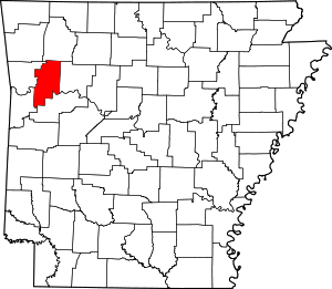
Location of Franklin County in Arkansas
This is intended to be a complete list of the properties and districts on the National Register of Historic Places in Franklin County, Arkansas, United States. The locations of National Register properties and districts for which the latitude and longitude coordinates are included below, may be seen in a map.[1]
There are 22 properties and districts listed on the National Register in the county.
- This National Park Service list is complete through NPS recent listings posted August 14, 2020.[2]
Current listings
| [3] | Name on the Register[4] | Image | Date listed[5] | Location | City or town | Description |
|---|---|---|---|---|---|---|
| 1 | Altus Well Shed-Gazebo | 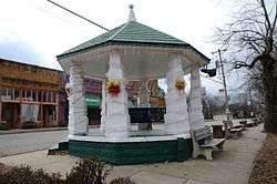 Altus Well Shed-Gazebo |
September 12, 1996 (#96001005) |
Northwestern corner of the junction of N. Franklin and E. Main Sts. 35°26′46″N 93°45′44″W |
Altus | |
| 2 | Bristow Hotel | 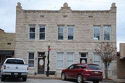 Bristow Hotel |
February 18, 1999 (#99000225) |
112 S. 2nd St. 35°29′10″N 93°49′33″W |
Ozark | |
| 3 | Center Cross School | 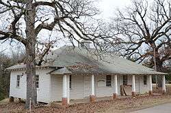 Center Cross School |
October 8, 1992 (#92001351) |
County Road 95, west of Altus 35°26′14″N 93°47′17″W |
Altus | |
| 4 | Charleston Commercial Historic District | 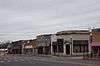 Charleston Commercial Historic District |
May 29, 2008 (#08000462) |
Main St. roughly from Highway 217 to Tilden St. 35°17′50″N 94°02′15″W |
Charleston | |
| 5 | First Methodist Episcopal Church, South | 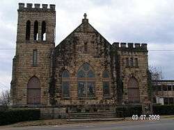 First Methodist Episcopal Church, South |
September 4, 1992 (#92001154) |
503 W. Commercial St. 35°29′13″N 93°49′46″W |
Ozark | |
| 6 | Franklin County Courthouse | 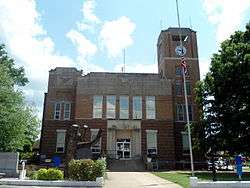 Franklin County Courthouse |
September 22, 1995 (#95001123) |
211 W. Commercial St. 35°29′11″N 93°49′36″W |
Ozark | |
| 7 | Franklin County Courthouse, Southern District | 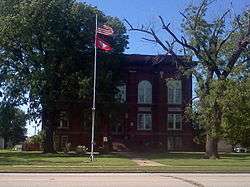 Franklin County Courthouse, Southern District |
October 18, 1976 (#76000407) |
Highway 22 35°17′47″N 94°02′11″W |
Charleston | |
| 8 | Franklin County Jail | 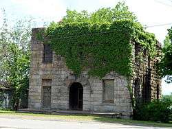 Franklin County Jail |
June 23, 1982 (#82002114) |
3rd and River Sts. 35°29′06″N 93°49′37″W |
Ozark | |
| 9 | German-American Bank | 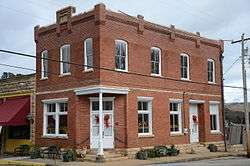 German-American Bank |
September 13, 1990 (#90001448) |
Junction of Franklin and Main Sts. 35°26′47″N 93°45′42″W |
Altus | |
| 10 | Gray Spring Recreation Area-Forest Service Road 1003 Historic District | 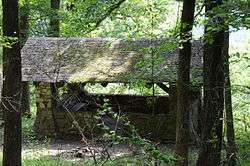 Gray Spring Recreation Area-Forest Service Road 1003 Historic District |
September 11, 1995 (#94001616) |
Forest Service Rd. 1003 in the Ozark-St. Francis National Forest 35°40′16″N 93°54′14″W |
Cass | |
| 11 | Johnson County Line-Ozark-Crawford County Line Road, Altus Segment |  Johnson County Line-Ozark-Crawford County Line Road, Altus Segment |
February 24, 2010 (#10000033) |
Connector Rd. between Robin Way and Pierce Rd. 35°28′25″N 93°46′52″W |
Altus | |
| 12 | Missouri-Pacific Depot-Altus | 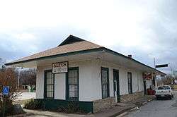 Missouri-Pacific Depot-Altus |
July 8, 1992 (#92000597) |
U.S. Highway 64 35°26′48″N 93°45′45″W |
Altus | |
| 13 | Missouri-Pacific Depot-Ozark | 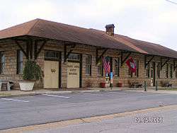 Missouri-Pacific Depot-Ozark |
June 11, 1992 (#92000598) |
South of the junction of River and 1st Sts. 35°29′06″N 93°49′31″W |
Ozark | |
| 14 | Mulberry River Bridge | 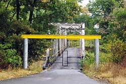 Mulberry River Bridge |
January 24, 2007 (#06001272) |
County Road 67 35°31′57″N 94°02′27″W |
Pleasant Hill | Extends into Crawford County |
| 15 | Mulberry River Bridge |  Mulberry River Bridge |
January 24, 2007 (#06001275) |
Highway 23 35°40′18″N 93°49′46″W |
Turner's Bend | |
| 16 | O'Kane-Jacobs House | 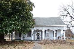 O'Kane-Jacobs House |
May 14, 1991 (#91000585) |
Rossville Rd. 35°26′34″N 93°45′41″W |
Altus | |
| 17 | Our Lady of Perpetual Help Church | 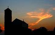 Our Lady of Perpetual Help Church |
May 3, 1976 (#76000406) |
North of Altus 35°27′08″N 93°45′30″W |
Altus | |
| 18 | Ozark Courthouse Square Historic District | 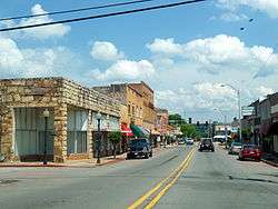 Ozark Courthouse Square Historic District |
December 27, 2002 (#02001599) |
Roughly W. Commercial, W. Main, 2nd, and 3rd Sts. on Courthouse Sq. 35°29′11″N 93°49′36″W |
Ozark | |
| 19 | Shelton-Rich Farmstead | 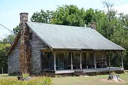 Shelton-Rich Farmstead |
November 20, 1989 (#89001423) |
Address Restricted |
Webb City | |
| 20 | Singleton Family Cemetery | 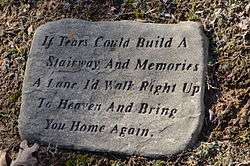 Singleton Family Cemetery |
September 28, 2005 (#05001074) |
Highway 22 35°17′47″N 94°04′41″W |
Charleston | |
| 21 | Merle Whitman Tourist Cabin | 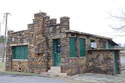 Merle Whitman Tourist Cabin |
November 8, 2006 (#06000980) |
200 N. Bell St. 35°29′20″N 93°49′19″W |
Ozark | |
| 22 | Wiederkehr Wine Cellar | 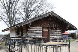 Wiederkehr Wine Cellar |
May 2, 1977 (#77000252) |
North of Altus at St. Mary's Mountain 35°32′56″N 93°45′04″W |
Altus |
Former listings
| [3] | Name on the Register | Image | Date listed | Date removed | Location | City or town | Summary |
|---|---|---|---|---|---|---|---|
| 1 | The Cabins | 1977 (#77000253) | July 20, 2000 | W of Ozark on AR 219 |
Ozark |
See also
| Wikimedia Commons has media related to National Register of Historic Places in Franklin County, Arkansas. |
References
- The latitude and longitude information provided in this table was derived originally from the National Register Information System, which has been found to be fairly accurate for about 99% of listings. Some locations in this table may have been corrected to current GPS standards.
- "National Register of Historic Places: Weekly List Actions". National Park Service, United States Department of the Interior. Retrieved on August 14, 2020.
- Numbers represent an ordering by significant words. Various colorings, defined here, differentiate National Historic Landmarks and historic districts from other NRHP buildings, structures, sites or objects.
- "National Register Information System". National Register of Historic Places. National Park Service. March 13, 2009.
- The eight-digit number below each date is the number assigned to each location in the National Register Information System database, which can be viewed by clicking the number.
| Topics | |
|---|---|
| Lists by state |
|
| Lists by insular areas | |
| Lists by associated state | |
| Other areas | |
| Related | |
| |
Municipalities and communities of Franklin County, Arkansas, United States | ||
|---|---|---|
| Cities | Map of Arkansas highlighting Franklin County | |
| Town | ||
| Unincorporated communities | ||
| Ghost towns | ||
This article is issued from Wikipedia. The text is licensed under Creative Commons - Attribution - Sharealike. Additional terms may apply for the media files.