Saline River (Ouachita River tributary)
The Saline River, also known as Saline Creek, is a 202-mile-long (325 km)[2] tributary of the Ouachita River in the south central portion of the U.S. state of Arkansas.[3]
| Saline River | |
|---|---|
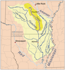 Location of the Saline River within the Ouachita watershed | |
| Location | |
| Country | United States |
| State | Arkansas |
| Physical characteristics | |
| Source | |
| • location | Ouachita Mountains, Saline County, Arkansas |
| • elevation | 259 ft (79 m) |
| Mouth | |
• location | Ouachita River |
| Length | 202 mi (325 km) |
| Discharge | |
| • location | Rye, Arkansas |
| • average | 2,629 cu/ft. per sec.[1] |
The Saline River begins in the eastern foothills of the Ouachita Mountains in Saline and Garland counties and is one of the last free-flowing rivers in the Ouachita River Basin. The river has four headwater tributaries, the South Fork, the Middle Fork, the Alum Fork, and the North Fork, which merge northwest of the city of Benton.[4][5]
The upper section of the Saline is a clear, cold-water stream with a series of fast running shoals interspersed with quiet pools. The central section of the river has clear to murky water with long slower moving pools interrupted by short stretches of fast water. The lower section is sluggish with murky water. The L'Aigle Creek (Saline River of the Ouachita River) connects to the Saline River near where the Saline River connects to the Ouachita River. During parts of the year the lower stretches of the river can be somewhat clogged with brush or trees.
After the merge of the three forks the river flattens and travels through Grant, Cleveland, Bradley, and Ashley counties.
The river reaches its confluence with the Ouachita River in the marshy area north of Lake Jack Lee within the Felsenthal National Wildlife Refuge.[6]
The Saline is relatively free of development. The river runs through dense forests which are home to bear, deer, mink, otters, beaver, muskrats, turkey, squirrel as well as alligators in southern sections of the river. The river provides excellent fishing, scenery, and wilderness floating.
Smallmouth, largemouth, rock bass, and spotted bass as well as warmouth, longear, green sunfish, bluegills, channel catfish, and crappie inhabit the river.
Picknicking and swimming facilities are available at Jenkins' Ferry Historical Monument south of Sheridan which commemorates the Battle of Jenkins' Ferry during the American Civil War.
See also
References
- USGS data
- U.S. Geological Survey. National Hydrography Dataset high-resolution flowline data. The National Map, accessed June 3, 2011
- Arthur C. Benke, Colbert E. Cushing (2005). Rivers of North America. Academic Press. pp. 265. ISBN 0-12-088253-1.
- Arkansas Atlas & Gazeteer, DeLorme, 2nd ed., 2004, p.49 ISBN 0899333451
- GNIS Saline River source streams
- Arkansas Atlas & Gazeteer, DeLorme, 2nd ed., 2004, p.63 ISBN 0899333451
| Authority control |
|
|---|