Wittes
Wittes is a commune in the Pas-de-Calais department in the Hauts-de-France region of France.
Wittes | |
|---|---|
_mairie_et_monument_aux_morts.JPG) The town hall and monument to the dead of Wittes | |
Location of Wittes 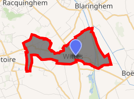
| |
 Wittes  Wittes | |
| Coordinates: 50°40′13″N 2°23′33″E | |
| Country | France |
| Region | Hauts-de-France |
| Department | Pas-de-Calais |
| Arrondissement | Saint-Omer |
| Canton | Aire-sur-la-Lys |
| Intercommunality | Pays de Saint-Omer |
| Government | |
| • Mayor (2016-2020) | Pascal Danvin |
| Area 1 | 3.92 km2 (1.51 sq mi) |
| Population (2017-01-01)[1] | 961 |
| • Density | 250/km2 (630/sq mi) |
| Time zone | UTC+01:00 (CET) |
| • Summer (DST) | UTC+02:00 (CEST) |
| INSEE/Postal code | 62901 /62120 |
| Elevation | 17–41 m (56–135 ft) (avg. 21 m or 69 ft) |
| 1 French Land Register data, which excludes lakes, ponds, glaciers > 1 km2 (0.386 sq mi or 247 acres) and river estuaries. | |
Geography
Wittes is located 9 miles (14 km) southeast of Saint-Omer, at the N43 and D197 road junction and on the banks of the small river Melde, a tributary of the Lys river.
Population
| Year | Pop. | ±% |
|---|---|---|
| 2006 | 797 | — |
| 2007 | 813 | +2.0% |
| 2008 | 828 | +1.8% |
| 2009 | 865 | +4.5% |
| 2010 | 874 | +1.0% |
| 2011 | 872 | −0.2% |
| 2012 | 870 | −0.2% |
| 2013 | 869 | −0.1% |
| 2014 | 859 | −1.2% |
| 2015 | 913 | +6.3% |
| 2016 | 937 | +2.6% |
Places of interest
- The church of St.Omer, dating from the nineteenth century.
gollark: Beginners should simply memorize the entire Linux kernel manual.
gollark: Your computers have multiple other computers in them, some of which might contain even more computers.
gollark: ALL is computers.
gollark: No networking means no(t as many) possible exploits!
gollark: Obviously the correct OS is TempleOS.
External links
| Wikimedia Commons has media related to Wittes. |
- Official commune website (in French)
- Wittes on the Quid website (in French)
| Authority control |
|
|---|
This article is issued from Wikipedia. The text is licensed under Creative Commons - Attribution - Sharealike. Additional terms may apply for the media files.