Hocquinghen
Hocquinghen is a commune in the Pas-de-Calais department in the Hauts-de-France region of France.
Hocquinghen | |
|---|---|
_city_limit_sign.JPG) The road into Hocquinghen | |
 Coat of arms | |
Location of Hocquinghen 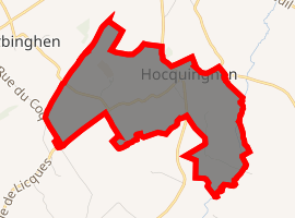
| |
 Hocquinghen  Hocquinghen | |
| Coordinates: 50°46′10″N 1°56′20″E | |
| Country | France |
| Region | Hauts-de-France |
| Department | Pas-de-Calais |
| Arrondissement | Calais |
| Canton | Calais-2 |
| Intercommunality | CC Pays d'Opale |
| Government | |
| • Mayor (2008–2014) | Christian Andrieu |
| Area 1 | 1.94 km2 (0.75 sq mi) |
| Population (2017-01-01)[1] | 112 |
| • Density | 58/km2 (150/sq mi) |
| Time zone | UTC+01:00 (CET) |
| • Summer (DST) | UTC+02:00 (CEST) |
| INSEE/Postal code | 62455 /62850 |
| Elevation | 63–115 m (207–377 ft) (avg. 81 m or 266 ft) |
| 1 French Land Register data, which excludes lakes, ponds, glaciers > 1 km2 (0.386 sq mi or 247 acres) and river estuaries. | |
Geography
A very small farming village located 13 miles (19 km) south of Calais, on the D215 and D206E crossroads.
Population
| Year | 1962 | 1968 | 1975 | 1982 | 1990 | 1999 | 2006 |
|---|---|---|---|---|---|---|---|
| Population | 75 | 97 | 86 | 74 | 85 | 100 | 102 |
| From the year 1962 on: No double counting—residents of multiple communes (e.g. students and military personnel) are counted only once. | |||||||
Places of interest
- The church of St. Omer, dating from the sixteenth century.
- The nineteenth-century chateau.
- An eighteenth-century presbytery.
gollark: Well, it would be "using" cats if it involved strapping cameras to cats or something.
gollark: True, true.
gollark: Additionally, imagine not using JPEG XL.
gollark: <@!336962240848855040> Is it a surveillance botnet *for* cats, or *using* cats?
gollark: Probably, but as it's *very* georedundant the latency would be high (and that would take effort to set up).
References
- "Populations légales 2017". INSEE. Retrieved 6 January 2020.
| Wikimedia Commons has media related to Hocquinghen. |
| Authority control |
|
|---|
This article is issued from Wikipedia. The text is licensed under Creative Commons - Attribution - Sharealike. Additional terms may apply for the media files.