Dury, Pas-de-Calais
Dury is a commune in the Pas-de-Calais department in the Hauts-de-France region of France.
Dury | |
|---|---|
_-_Rue_de_la_mairie.JPG) The centre of Dury | |
 Coat of arms | |
Location of Dury 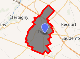
| |
 Dury  Dury | |
| Coordinates: 50°14′51″N 3°00′32″E | |
| Country | France |
| Region | Hauts-de-France |
| Department | Pas-de-Calais |
| Arrondissement | Arras |
| Canton | Brebières |
| Intercommunality | CC Osartis Marquion |
| Government | |
| • Mayor (2008–2014) | Claude Bachelet |
| Area 1 | 5.31 km2 (2.05 sq mi) |
| Population (2017-01-01)[1] | 350 |
| • Density | 66/km2 (170/sq mi) |
| Time zone | UTC+01:00 (CET) |
| • Summer (DST) | UTC+02:00 (CEST) |
| INSEE/Postal code | 62280 /62156 |
| Elevation | 52–77 m (171–253 ft) (avg. 71 m or 233 ft) |
| 1 French Land Register data, which excludes lakes, ponds, glaciers > 1 km2 (0.386 sq mi or 247 acres) and river estuaries. | |
Geography
A farming village 10 miles (16.1 km) southeast of Arras at the junction of the D956 and D9E roads. The A26 autoroute closely passes by the village.
Population
| Year | 1962 | 1968 | 1975 | 1982 | 1990 | 1999 |
|---|---|---|---|---|---|---|
| Population | 305 | 308 | 275 | 251 | 306 | 295 |
| From the year 1962 on: No double counting—residents of multiple communes (e.g. students and military personnel) are counted only once. | ||||||
Places of interest
- The church of St.Martin, dating from the twentieth century.
- Two Commonwealth War Graves Commission cemeteries.
gollark: No, I don't have 6727.
gollark: 8148, now.
gollark: No, I removed those last week, they were cluttering my computer.
gollark: Well, it would DISprove it if there was a small counterexample, but there may not be.
gollark: IT'S GOLLARIOUS, YOU :BEES: :BISMUTH1: :SMALL_STELLATED_DODECAHEDRON:.
External links
| Wikimedia Commons has media related to Dury (Pas-de-Calais). |
| Authority control |
|
|---|
This article is issued from Wikipedia. The text is licensed under Creative Commons - Attribution - Sharealike. Additional terms may apply for the media files.