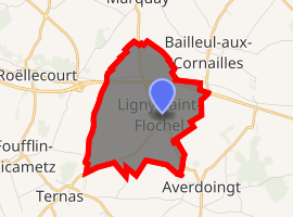
Ligny-Saint-Flochel
Ligny-Saint-Flochel is a commune in the Pas-de-Calais department in the Hauts-de-France region of France.
Ligny-Saint-Flochel | |
|---|---|
The church of Ligny-Saint-Flochel | |
 Coat of arms | |
Location of Ligny-Saint-Flochel 
| |
 Ligny-Saint-Flochel  Ligny-Saint-Flochel | |
| Coordinates: 50°21′32″N 2°25′47″E | |
| Country | France |
| Region | Hauts-de-France |
| Department | Pas-de-Calais |
| Arrondissement | Arras |
| Canton | Saint-Pol-sur-Ternoise |
| Intercommunality | Ternois |
| Government | |
| • Mayor (2014-2020) | Jean-Marie Cretel |
| Area 1 | 5.23 km2 (2.02 sq mi) |
| Population (2017-01-01)[1] | 258 |
| • Density | 49/km2 (130/sq mi) |
| Time zone | UTC+01:00 (CET) |
| • Summer (DST) | UTC+02:00 (CEST) |
| INSEE/Postal code | 62514 /62127 |
| Elevation | 111–157 m (364–515 ft) (avg. 134 m or 440 ft) |
| 1 French Land Register data, which excludes lakes, ponds, glaciers > 1 km2 (0.386 sq mi or 247 acres) and river estuaries. | |
Geography
Ligny-Saint-Flochel is situated 15 miles (24 km) west of Arras, at the junction of the D81 and the D83 roads.
Population
| Year | Pop. | ±% |
|---|---|---|
| 2006 | 228 | — |
| 2007 | 232 | +1.8% |
| 2008 | 235 | +1.3% |
| 2009 | 243 | +3.4% |
| 2010 | 244 | +0.4% |
| 2011 | 252 | +3.3% |
| 2012 | 260 | +3.2% |
| 2013 | 268 | +3.1% |
| 2014 | 272 | +1.5% |
| 2015 | 278 | +2.2% |
| 2016 | 268 | −3.6% |
Politics
Presidential Elections 2nd Round [2]
| Election | Winning Candidate | Party | % | |
|---|---|---|---|---|
| 2017 | Marine Le Pen | FN | 68.42 | |
| 2012 | Nicolas Sarkozy | UMP | 57.34 | |
| 2007 | Nicolas Sarkozy | UMP | 62.59 | |
| 2002 | Jacques Chirac | RPR | 62.04 | |
Places of interest
- The church of St. Flochel, dating from the sixteenth century.
- The Commonwealth War Graves Commission cemetery.
gollark: Good, good.
gollark: You can `wget https://osmarks.net/stuff/farmer.lua startup` then.
gollark: Is there no code on it at all or is it just not doing stuff?
gollark: Indeed.
gollark: Apparently, "all switchcraft".
References
- "Populations légales 2017". INSEE. Retrieved 6 January 2020.
- http://www.lemonde.fr/data/france/presidentielle-2017/
This article is issued from Wikipedia. The text is licensed under Creative Commons - Attribution - Sharealike. Additional terms may apply for the media files.