Saint-Michel-sous-Bois
Saint-Michel-sous-Bois is a commune in the Pas-de-Calais department in the Hauts-de-France region of France.
Saint-Michel-sous-Bois | |
|---|---|
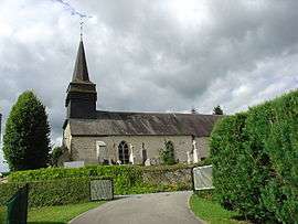 The church of Saint-Michel-sous-Bois | |
 Coat of arms | |
Location of Saint-Michel-sous-Bois 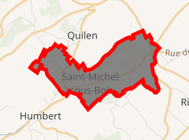
| |
 Saint-Michel-sous-Bois  Saint-Michel-sous-Bois | |
| Coordinates: 50°30′52″N 1°55′57″E | |
| Country | France |
| Region | Hauts-de-France |
| Department | Pas-de-Calais |
| Arrondissement | Montreuil |
| Canton | Lumbres |
| Intercommunality | CC Haut Pays du Montreuillois |
| Government | |
| • Mayor (2001–2008) | René Lecerf |
| Area 1 | 5.66 km2 (2.19 sq mi) |
| Population (2017-01-01)[1] | 119 |
| • Density | 21/km2 (54/sq mi) |
| Time zone | UTC+01:00 (CET) |
| • Summer (DST) | UTC+02:00 (CEST) |
| INSEE/Postal code | 62762 /62650 |
| Elevation | 68–190 m (223–623 ft) (avg. 94 m or 308 ft) |
| 1 French Land Register data, which excludes lakes, ponds, glaciers > 1 km2 (0.386 sq mi or 247 acres) and river estuaries. | |
Geography
Saint-Michel-sous-Bois is located 9 miles (15.5 km) northeast of Montreuil-sur-Mer on the D129 road.
Population
| 1962 | 1968 | 1975 | 1982 | 1990 | 1999 | 2006 |
|---|---|---|---|---|---|---|
| 111 | 124 | 122 | 125 | 106 | 89 | 112 |
| Census count starting from 1962: Population without duplicates | ||||||
Places of interest
- The church of St. Michel, dating from the seventeenth century
gollark: https://images-ext-1.discordapp.net/external/imeAQuzmAKuZ7RqL0wfUQS-vScpNX44sH6Qrfu7zKm0/https/media.discordapp.net/attachments/740645364196966431/744555048599683102/image0-1.gif?width=410&height=421
gollark: State machines ARE a cool type of machine, but a *game*?
gollark: Fix or be declared a class-53Y apioform.
gollark: <@319753218592866315> fix
gollark: ··
References
- "Populations légales 2017". INSEE. Retrieved 6 January 2020.
| Wikimedia Commons has media related to Saint-Michel-sous-Bois. |
| Authority control |
|
|---|
This article is issued from Wikipedia. The text is licensed under Creative Commons - Attribution - Sharealike. Additional terms may apply for the media files.