Haravesnes
Haravesnes is a commune in the Pas-de-Calais department in the Hauts-de-France region of France.
Haravesnes | |
|---|---|
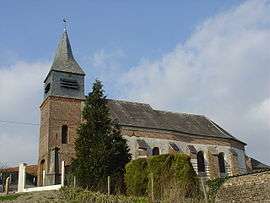 The church of Haravesnes | |
 Coat of arms | |
Location of Haravesnes 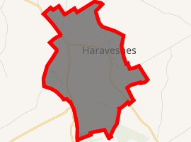
| |
 Haravesnes  Haravesnes | |
| Coordinates: 50°17′16″N 2°07′51″E | |
| Country | France |
| Region | Hauts-de-France |
| Department | Pas-de-Calais |
| Arrondissement | Arras |
| Canton | Auxi-le-Château |
| Intercommunality | CC Ternois |
| Government | |
| • Mayor (2008–2014) | Claude Cordonnier |
| Area 1 | 2.4 km2 (0.9 sq mi) |
| Population (2017-01-01)[1] | 50 |
| • Density | 21/km2 (54/sq mi) |
| Time zone | UTC+01:00 (CET) |
| • Summer (DST) | UTC+02:00 (CEST) |
| INSEE/Postal code | 62411 /62390 |
| Elevation | 62–139 m (203–456 ft) (avg. 108 m or 354 ft) |
| 1 French Land Register data, which excludes lakes, ponds, glaciers > 1 km2 (0.386 sq mi or 247 acres) and river estuaries. | |
Geography
A very small farming village situated 29 miles (47 km) west of Arras, on the D117 road.
Population
| Year | 1962 | 1968 | 1975 | 1982 | 1990 | 1999 |
|---|---|---|---|---|---|---|
| Population | 67 | 80 | 71 | 59 | 45 | 36 |
| From the year 1962 on: No double counting—residents of multiple communes (e.g. students and military personnel) are counted only once. | ||||||
Places of interest
- An eighteenth-century farmhouse.
- The church of Notre-Dame, dating from the eighteenth century.
gollark: As well as ender modems and such, so you can get full CC computation and GPS and movement.
gollark: See, you can put computers in minecarts, and then put kinetic augments on those.
gollark: If you're making OC drones, consider cartdrones™ instead?
gollark: Also, the only ones I've used have annoyingly high key travel, thus bad.
gollark: Mechanical ones are big and expensive.
References
- "Populations légales 2017". INSEE. Retrieved 6 January 2020.
| Wikimedia Commons has media related to Haravesnes. |
| Authority control |
|
|---|
This article is issued from Wikipedia. The text is licensed under Creative Commons - Attribution - Sharealike. Additional terms may apply for the media files.