Longuenesse
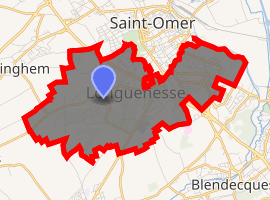
Longuenesse is a commune in the Pas-de-Calais department in the Hauts-de-France region of France.
Longuenesse | |
|---|---|
The town hall of Longuenesse | |
 Coat of arms | |
Location of Longuenesse 
| |
 Longuenesse  Longuenesse | |
| Coordinates: 50°44′11″N 2°14′18″E | |
| Country | France |
| Region | Hauts-de-France |
| Department | Pas-de-Calais |
| Arrondissement | Saint-Omer |
| Canton | Longuenesse |
| Intercommunality | Pays de Saint-Omer |
| Government | |
| • Mayor | Jean-Marie Barbier |
| Area 1 | 8.4 km2 (3.2 sq mi) |
| Population (2017-01-01)[1] | 11,023 |
| • Density | 1,300/km2 (3,400/sq mi) |
| Time zone | UTC+01:00 (CET) |
| • Summer (DST) | UTC+02:00 (CEST) |
| INSEE/Postal code | 62525 /62219 |
| Elevation | 3–79 m (9.8–259.2 ft) (avg. 75 m or 246 ft) |
| 1 French Land Register data, which excludes lakes, ponds, glaciers > 1 km2 (0.386 sq mi or 247 acres) and river estuaries. | |
Geography
Longuenesse is a large suburb of Saint-Omer, one mile southwest of the centre, on the D208 road.
Population
| 1962 | 1968 | 1975 | 1982 | 1990 | 1999 | 2006 |
|---|---|---|---|---|---|---|
| 3623 | 4794 | 9397 | 11,970 | 12,604 | 12,518 | 12,018 |
| Census count starting from 1962: Population without duplicates | ||||||
Places of interest
- The church of St.Quentin, dating from the nineteenth century.
- An old abbey hostel.
- The fountain of Saint-Quentin.
- Vestiges of a monastery founded in 1298.
Twin towns
.svg.png)
gollark: Oh, it must be banned from posting images in here.
gollark: Hmm. That *is* the right command. Weird.
gollark: ... how do I work mathbot.
gollark: =tex \int_0^2 x^2 dx = \frac{x^3}{3}
gollark: Observe:
References
- "Populations légales 2017". INSEE. Retrieved 6 January 2020.
| Wikimedia Commons has media related to Longuenesse. |
This article is issued from Wikipedia. The text is licensed under Creative Commons - Attribution - Sharealike. Additional terms may apply for the media files.