Ramecourt, Pas-de-Calais
Ramecourt is a commune in the Pas-de-Calais department in the Hauts-de-France region of France.
Ramecourt | |
|---|---|
 The church of Ramecourt | |
 Coat of arms | |
Location of Ramecourt 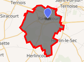
| |
 Ramecourt  Ramecourt | |
| Coordinates: 50°22′16″N 2°18′49″E | |
| Country | France |
| Region | Hauts-de-France |
| Department | Pas-de-Calais |
| Arrondissement | Arras |
| Canton | Saint-Pol-sur-Ternoise |
| Intercommunality | CC Ternois |
| Government | |
| • Mayor (2008–2014) | Dequidt Denis |
| Area 1 | 8.09 km2 (3.12 sq mi) |
| Population (2017-01-01)[1] | 382 |
| • Density | 47/km2 (120/sq mi) |
| Time zone | UTC+01:00 (CET) |
| • Summer (DST) | UTC+02:00 (CEST) |
| INSEE/Postal code | 62686 /62130 |
| Elevation | 85–146 m (279–479 ft) (avg. 97 m or 318 ft) |
| 1 French Land Register data, which excludes lakes, ponds, glaciers > 1 km2 (0.386 sq mi or 247 acres) and river estuaries. | |
Geography
Ramecourt is a suburb of Saint-Pol, situated 25 miles (40 km) west of Arras, at the junction of the D101 and D102 roads.
Population
| 1962 | 1968 | 1975 | 1982 | 1990 | 1999 | 2006 |
|---|---|---|---|---|---|---|
| 284 | 303 | 313 | 298 | 324 | 341 | 341 |
| Census count starting from 1962: Population without duplicates | ||||||
Places of interest
- The church of St.Leger, dating from the seventeenth century.
- The eighteenth-century chateau.
gollark: I'm heavpoot, we've been clear on this for a while.
gollark: Heavpoot == tux1 confirmed?
gollark: It's suspiciously similar to the heavpoot aesthetic.
gollark: I'm sure you'd like to think so.
gollark: This is incorrect, as all wikis are in fact mere projections or slices of WE.
References
- "Populations légales 2017". INSEE. Retrieved 6 January 2020.
| Wikimedia Commons has media related to Ramecourt (Pas-de-Calais). |
| Authority control |
|
|---|
This article is issued from Wikipedia. The text is licensed under Creative Commons - Attribution - Sharealike. Additional terms may apply for the media files.