Beaumetz-lès-Aire
Beaumetz-lès-Aire is a commune in the Pas-de-Calais department in the Hauts-de-France region in northern France.
Beaumetz-lès-Aire | |
|---|---|
The road into Beaumetz-lès-Aire | |
 Coat of arms | |
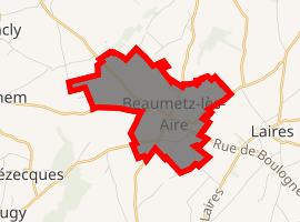
Location of Beaumetz-lès-Aire 
| |
 Beaumetz-lès-Aire  Beaumetz-lès-Aire | |
| Coordinates: 50°32′32″N 2°13′41″E | |
| Country | France |
| Region | Hauts-de-France |
| Department | Pas-de-Calais |
| Arrondissement | Saint-Omer |
| Canton | Fruges |
| Intercommunality | Communauté d'agglomération du Pays de Saint-Omer |
| Government | |
| • Mayor (2014-2020) | Auxence Wigneron |
| Area 1 | 4.43 km2 (1.71 sq mi) |
| Population (2017-01-01)[1] | 239 |
| • Density | 54/km2 (140/sq mi) |
| Time zone | UTC+01:00 (CET) |
| • Summer (DST) | UTC+02:00 (CEST) |
| INSEE/Postal code | 62095 /62960 |
| Elevation | 145–188 m (476–617 ft) (avg. 180 m or 590 ft) |
| 1 French Land Register data, which excludes lakes, ponds, glaciers > 1 km2 (0.386 sq mi or 247 acres) and river estuaries. | |
Geography
A village located 12 miles (18 km) south of Saint-Omer, at the junction of the D92, D130 and D159 roads.
Population
| Year | Pop. | ±% |
|---|---|---|
| 1962 | 300 | — |
| 1968 | 309 | +3.0% |
| 1975 | 286 | −7.4% |
| 1982 | 281 | −1.7% |
| 1990 | 229 | −18.5% |
| 1999 | 240 | +4.8% |
| 2006 | 222 | −7.5% |
| 2007 | 220 | −0.9% |
| 2009 | 218 | −0.9% |
| 2012 | 236 | +8.3% |
| 2015 | 241 | +2.1% |
Sights
- The nineteenth century church of St. John.
gollark: Those are separate.
gollark: And I can't see why people go around doing gambling and failing to understand basic statistics and probability, and yet.
gollark: No, they buy things because they (think they (should)) value them for some reason, which is not the same thing.
gollark: Fungible basically means that you can have multiple interchangeable units of a thing. Currencies are fungible because all "£5 notes" are worth £5 and it doesn't matter much which unit you have.
gollark: Basically, a cryptocurrency-based token which says that you "own" a thing.
References
- "Populations légales 2017". INSEE. Retrieved 6 January 2020.
| Wikimedia Commons has media related to Beaumetz-lès-Aire. |
This article is issued from Wikipedia. The text is licensed under Creative Commons - Attribution - Sharealike. Additional terms may apply for the media files.