Oblinghem
Oblinghem is a commune in the Pas-de-Calais department in the Hauts-de-France region of France.
Oblinghem | |
|---|---|
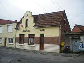 The town hall of Oblinghem | |
 Coat of arms | |
Location of Oblinghem 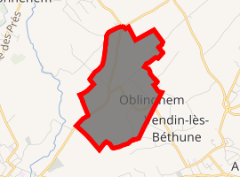
| |
 Oblinghem  Oblinghem | |
| Coordinates: 50°32′59″N 2°35′58″E | |
| Country | France |
| Region | Hauts-de-France |
| Department | Pas-de-Calais |
| Arrondissement | Béthune |
| Canton | Béthune |
| Intercommunality | CA Béthune-Bruay, Artois-Lys Romane |
| Government | |
| • Mayor (2008–2014) | André Carpentier |
| Area 1 | 1.27 km2 (0.49 sq mi) |
| Population (2017-01-01)[1] | 379 |
| • Density | 300/km2 (770/sq mi) |
| Time zone | UTC+01:00 (CET) |
| • Summer (DST) | UTC+02:00 (CEST) |
| INSEE/Postal code | 62632 /62920 |
| Elevation | 19–25 m (62–82 ft) (avg. 21 m or 69 ft) |
| 1 French Land Register data, which excludes lakes, ponds, glaciers > 1 km2 (0.386 sq mi or 247 acres) and river estuaries. | |
Geography
Oblignhem is situated about 2 miles (3.2 km) northwest of Béthune and 24 miles (38.6 km) southwest of Lille, on the D180 road.
Population
| 1962 | 1968 | 1975 | 1982 | 1990 | 1999 | 2006 | |
|---|---|---|---|---|---|---|---|
| 213 | 232 | 230 | 221 | 223 | 225 | 236 | 220 |
| Census count starting from 1962: Population without duplicates | |||||||
gollark: what?
gollark: OpenNIC?
gollark: £10/year or so.
gollark: purchase sinthorion.osmarks.tk™
gollark: ææææ ħ
External links
| Wikimedia Commons has media related to Oblinghem. |
- Official website of the community of communes (in French)
| Authority control |
|
|---|
This article is issued from Wikipedia. The text is licensed under Creative Commons - Attribution - Sharealike. Additional terms may apply for the media files.