Rocquigny, Pas-de-Calais
Rocquigny is a commune in the Pas-de-Calais department in the Hauts-de-France region of France.
Rocquigny | |
|---|---|
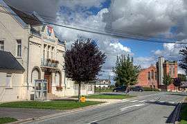
 The town hall and church of Rocquigny | |
 Coat of arms | |
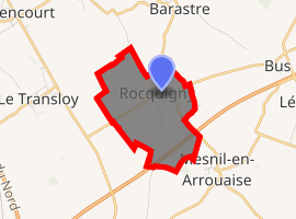
Location of Rocquigny 
| |
 Rocquigny  Rocquigny | |
| Coordinates: 50°03′37″N 2°55′46″E | |
| Country | France |
| Region | Hauts-de-France |
| Department | Pas-de-Calais |
| Arrondissement | Arras |
| Canton | Bapaume |
| Intercommunality | CC Sud-Artois |
| Government | |
| • Mayor (2008–2014) | Marguerite Lefebvre |
| Area 1 | 3.73 km2 (1.44 sq mi) |
| Population (2017-01-01)[1] | 285 |
| • Density | 76/km2 (200/sq mi) |
| Time zone | UTC+01:00 (CET) |
| • Summer (DST) | UTC+02:00 (CEST) |
| INSEE/Postal code | 62715 /62450 |
| Elevation | 113–137 m (371–449 ft) (avg. 132 m or 433 ft) |
| 1 French Land Register data, which excludes lakes, ponds, glaciers > 1 km2 (0.386 sq mi or 247 acres) and river estuaries. | |
Geography
Rocquigny lies about 20 miles (32 km) south of Arras, at the junction of the D19 and D20 roads. The A2 autoroute passes by some half-mile distant.
Population
| 1962 | 1968 | 1975 | 1982 | 1990 | 1999 | 2006 |
|---|---|---|---|---|---|---|
| 331 | 356 | 296 | 271 | 274 | 281 | 295 |
| Census count starting from 1962: Population without duplicates | ||||||
Places of interest
- The church of Notre-Dame, rebuilt along with the rest of the village, after the First World War. The building is now abandoned as the steeple is in a state of collapse due to faulty concrete.
gollark: They can
gollark: Security through obscurity isn't.
gollark: Just go for "extremely insecure CC phones".
gollark: Then don't sell it as secure.
gollark: Some offense.
External links
| Wikimedia Commons has media related to Rocquigny (Pas-de-Calais). |
- Rocquigny on the Quid website (in French)
This article is issued from Wikipedia. The text is licensed under Creative Commons - Attribution - Sharealike. Additional terms may apply for the media files.