Buissy
Buissy is a commune in the Pas-de-Calais department in the Hauts-de-France region in northern France.
Buissy | |
|---|---|
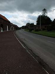 The main road of Buissy | |
 Coat of arms | |
Location of Buissy 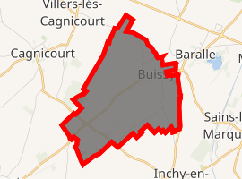
| |
 Buissy  Buissy | |
| Coordinates: 50°12′25″N 3°02′31″E | |
| Country | France |
| Region | Hauts-de-France |
| Department | Pas-de-Calais |
| Arrondissement | Arras |
| Canton | Bapaume |
| Intercommunality | CC Osartis Marquion |
| Government | |
| • Mayor (2008–2014) | Dominique Blary |
| Area 1 | 6.87 km2 (2.65 sq mi) |
| Population (2017-01-01)[1] | 263 |
| • Density | 38/km2 (99/sq mi) |
| Time zone | UTC+01:00 (CET) |
| • Summer (DST) | UTC+02:00 (CEST) |
| INSEE/Postal code | 62184 /62860 |
| Elevation | 47–91 m (154–299 ft) (avg. 58 m or 190 ft) |
| 1 French Land Register data, which excludes lakes, ponds, glaciers > 1 km2 (0.386 sq mi or 247 acres) and river estuaries. | |
Geography
A farming village located 15 miles (24 km) southeast of Arras on the D14 road, at the junction with the D19.
Population
| Year | Pop. | ±% |
|---|---|---|
| 1962 | 247 | — |
| 1968 | 255 | +3.2% |
| 1975 | 212 | −16.9% |
| 1982 | 202 | −4.7% |
| 1990 | 216 | +6.9% |
| 1999 | 229 | +6.0% |
| 2009 | 242 | +5.7% |
Sights
- The church of St. Médard, dating from the sixteenth century
- The Quéant Road Cemetery, overseen by the Commonwealth War Graves Commission.
gollark: https://wiki.computercraft.cc/GPS_Hosts
gollark: <@!604910206635343874> Use "looking at", silly.
gollark: Consume bees.
gollark: What does that mean?
gollark: Why not just make it so that the server can be rebooted by anyone ever via an HTTP API?
External links
| Wikimedia Commons has media related to Buissy. |
| Authority control |
|
|---|
This article is issued from Wikipedia. The text is licensed under Creative Commons - Attribution - Sharealike. Additional terms may apply for the media files.