Boubers-lès-Hesmond
Boubers-lès-Hesmond is a commune in the Pas-de-Calais département in the Hauts-de-France region in northern France.
Boubers-lès-Hesmond | |
|---|---|
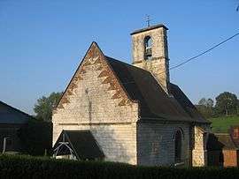 The church of Boubers-lès-Hesmond | |
 Coat of arms | |
Location of Boubers-lès-Hesmond 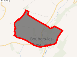
| |
 Boubers-lès-Hesmond  Boubers-lès-Hesmond | |
| Coordinates: 50°28′34″N 1°57′00″E | |
| Country | France |
| Region | Hauts-de-France |
| Department | Pas-de-Calais |
| Arrondissement | Montreuil |
| Canton | Auxi-le-Château |
| Intercommunality | CC Sept Vallées |
| Government | |
| • Mayor (2008-2014) | Francis Tetard |
| Area 1 | 1.74 km2 (0.67 sq mi) |
| Population (2017-01-01)[1] | 88 |
| • Density | 51/km2 (130/sq mi) |
| Time zone | UTC+01:00 (CET) |
| • Summer (DST) | UTC+02:00 (CEST) |
| INSEE/Postal code | 62157 /62990 |
| Elevation | 46–132 m (151–433 ft) (avg. 53 m or 174 ft) |
| 1 French Land Register data, which excludes lakes, ponds, glaciers > 1 km2 (0.386 sq mi or 247 acres) and river estuaries. | |
Geography
Boubers-lès-Hesmond is a small village situated some 10 miles (16 km) east of Montreuil-sur-Mer on the D149 road.
Population
| Year | Pop. | ±% |
|---|---|---|
| 1962 | 80 | — |
| 1968 | 90 | +12.5% |
| 1975 | 85 | −5.6% |
| 1982 | 71 | −16.5% |
| 1990 | 71 | +0.0% |
| 1999 | 77 | +8.5% |
| 2009 | 71 | −7.8% |
| 2010 | 72 | +1.4% |
gollark: Well, I would *consider* it, but wouldn't want to be stuck in a stupidly immersive virtual world.
gollark: Well, there are various issues, really. Random bugs and stuff crashing your brain, random bugs allowing other people to meddle with your brain, things deliberately designed to give up data and whatnot...
gollark: Well, both are problems, really.
gollark: "Wow, this Facebook™ neural implant is free as long as I tick this option to send my thoughts to Facebook!"
gollark: Inevitably.
External links
| Wikimedia Commons has media related to Boubers-lès-Hesmond. |
- Boubers-lès-Hesmond on the Quid website (in French)
This article is issued from Wikipedia. The text is licensed under Creative Commons - Attribution - Sharealike. Additional terms may apply for the media files.