Pommera
Pommera is a commune in the Pas-de-Calais department in the Hauts-de-France region of France.
Pommera | |
|---|---|
 The chateau of Pommera | |
Location of Pommera 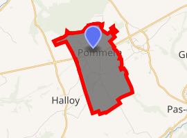
| |
 Pommera  Pommera | |
| Coordinates: 50°10′27″N 2°26′24″E | |
| Country | France |
| Region | Hauts-de-France |
| Department | Pas-de-Calais |
| Arrondissement | Arras |
| Canton | Avesnes-le-Comte |
| Intercommunality | CC Campagnes de l'Artois |
| Government | |
| • Mayor (2008–2014) | Fabien Senaux |
| Area 1 | 4.42 km2 (1.71 sq mi) |
| Population (2017-01-01)[1] | 306 |
| • Density | 69/km2 (180/sq mi) |
| Time zone | UTC+01:00 (CET) |
| • Summer (DST) | UTC+02:00 (CEST) |
| INSEE/Postal code | 62663 /62760 |
| Elevation | 130–167 m (427–548 ft) (avg. 171 m or 561 ft) |
| 1 French Land Register data, which excludes lakes, ponds, glaciers > 1 km2 (0.386 sq mi or 247 acres) and river estuaries. | |
Geography
Pommera is situated 20 miles (32 km) southwest of Arras, on the N25 road.
Population
| 1962 | 1968 | 1975 | 1982 | 1990 | 1999 | 2006 |
|---|---|---|---|---|---|---|
| 283 | 293 | 277 | 260 | 238 | 245 | 285 |
| Census count starting from 1962: Population without duplicates | ||||||
Places of interest
- The church of St.Marguerite, dating from the nineteenth century.
- The 18th century Château de Pommera
- The Château de Grena dating from the eighteenth century.
- A chapel.
gollark: This would actually be really interesting if true.
gollark: This is so stupid. Honestly, soul harvesters are *decades* old now.
gollark: COVID-19 was created by unknown parties after being funded in a Kickstarter which was taken as a joke.
gollark: COVID-19 was created by sapient *giant squid* as part of an ongoing war against the bats, and spread to humans accidentally.
gollark: COVID-19 was created by sapient bats attempting to manipulate mankind into becoming their slaves.
References
- "Populations légales 2017". INSEE. Retrieved 6 January 2020.
| Wikimedia Commons has media related to Pommera. |
| Authority control |
|
|---|
This article is issued from Wikipedia. The text is licensed under Creative Commons - Attribution - Sharealike. Additional terms may apply for the media files.