Farbus
Farbus is a commune in the Pas-de-Calais department in the Hauts-de-France region of France. It is located 7 kilometres from the Canadian National Vimy Memorial dedicated to the Battle of Vimy Ridge (part of the Battle of Arras) and the missing First World War Canadian soldiers with no known grave; the Memorial is also the site of two Canadian cemeteries.[2]
Farbus | |
|---|---|
The town hall of Farbus | |
 Coat of arms | |
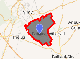
Location of Farbus 
| |
 Farbus  Farbus | |
| Coordinates: 50°21′28″N 2°49′30″E | |
| Country | France |
| Region | Hauts-de-France |
| Department | Pas-de-Calais |
| Arrondissement | Arras |
| Canton | Arras-2 |
| Intercommunality | Communauté urbaine d'Arras |
| Government | |
| • Mayor (2008–2014) | Jean-François Dépret |
| Area 1 | 3.49 km2 (1.35 sq mi) |
| Population (2017-01-01)[1] | 557 |
| • Density | 160/km2 (410/sq mi) |
| Time zone | UTC+01:00 (CET) |
| • Summer (DST) | UTC+02:00 (CEST) |
| INSEE/Postal code | 62324 /62580 |
| Elevation | 61–139 m (200–456 ft) (avg. 76 m or 249 ft) |
| 1 French Land Register data, which excludes lakes, ponds, glaciers > 1 km2 (0.386 sq mi or 247 acres) and river estuaries. | |
Geography
A farming village situated 6 miles (9.7 km) northeast of Arras, at the junction of the D50 and D51 roads.
Population
| Year | 1962 | 1968 | 1975 | 1982 | 1990 | 1999 |
|---|---|---|---|---|---|---|
| Population | 436 | 430 | 473 | 460 | 529 | 532 |
| From the year 1962 on: No double counting—residents of multiple communes (e.g. students and military personnel) are counted only once. | ||||||
Places of interest
- The church of St. Ranulphe, rebuilt after World War I
- The nearby Canadian National Vimy Memorial
gollark: <@700434270157668514> Have you not seen that message get posted *quite often* with the names changed on fairly popular servers?
gollark: Oh no, not the IP that they can trivially obtain (for me, as I run a website off my network connection) via DNS!
gollark: Well, yes, I'm sure someone sent it and it exists as a message.
gollark: Also, these things are wrong and bad™ constantly.
gollark: <@700434270157668514> no.
References
- "Populations légales 2017". INSEE. Retrieved 6 January 2020.
- "Canadian National Vimy Memorial, France". The Great War UK. The Great War UK. 2015. Retrieved 31 March 2017.
The ridge runs in a direction from Givenchy-en-Gohelle in the north-west to Farbus in the south-east.
| Wikimedia Commons has media related to Farbus. |
This article is issued from Wikipedia. The text is licensed under Creative Commons - Attribution - Sharealike. Additional terms may apply for the media files.