Remilly-Wirquin
Remilly-Wirquin is a commune in the Pas-de-Calais department in the Hauts-de-France region of France.
Remilly-Wirquin | |
|---|---|
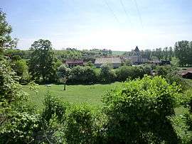
 A general view of Remilly-Wirquin | |
 Coat of arms | |
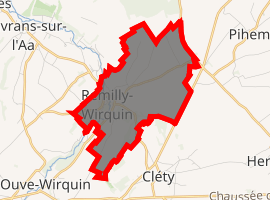
Location of Remilly-Wirquin 
| |
 Remilly-Wirquin  Remilly-Wirquin | |
| Coordinates: 50°40′09″N 2°10′04″E | |
| Country | France |
| Region | Hauts-de-France |
| Department | Pas-de-Calais |
| Arrondissement | Saint-Omer |
| Canton | Lumbres |
| Intercommunality | Pays de Lumbres |
| Government | |
| • Mayor | René Denuncq |
| Area 1 | 5.23 km2 (2.02 sq mi) |
| Population (2017-01-01)[1] | 349 |
| • Density | 67/km2 (170/sq mi) |
| Time zone | UTC+01:00 (CET) |
| • Summer (DST) | UTC+02:00 (CEST) |
| INSEE/Postal code | 62702 /62380 |
| Elevation | 47–135 m (154–443 ft) (avg. 52 m or 171 ft) |
| 1 French Land Register data, which excludes lakes, ponds, glaciers > 1 km2 (0.386 sq mi or 247 acres) and river estuaries. | |
Geography
Remilly-Wirquin lies about 8 miles (13 km) southwest of Saint-Omer, on the D192 road, by the banks of the river Aa.
Population
| 1962 | 1968 | 1975 | 1982 | 1990 | 1999 | 2006 |
|---|---|---|---|---|---|---|
| 198 | 215 | 234 | 283 | 327 | 315 | 348 |
| Census count starting from 1962: Population without duplicates | ||||||
Places of interest
- The church of St.Omer, dating from the thirteenth century.
gollark: Your sample size is three (3).
gollark: (it effectively does a horrible depth first traversal of an automaton thing matching all permutations of a string, to reify that traversal as an actual dictionary, which it then matches against in that version and flattens to convert to a regex in the improved one)
gollark: `without = s[:i] + s[i + 1:]` ← it's meant to exclude all indices but `i`.
gollark: Okay, never mind, the slice there is fine, I did it wrong in *another* thing which somehow worked.
gollark: (Although the slice there is a bit wrong and I don't know why it works anyway)
External links
| Wikimedia Commons has media related to Remilly-Wirquin. |
- Remilly-Wirquin on the Quid website (in French)
This article is issued from Wikipedia. The text is licensed under Creative Commons - Attribution - Sharealike. Additional terms may apply for the media files.