Guémappe
Guémappe is a commune in the Pas-de-Calais department in the Hauts-de-France region of France.
Guémappe | |
|---|---|
 The church of Guémappe | |
 Coat of arms | |
Location of Guémappe 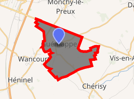
| |
 Guémappe  Guémappe | |
| Coordinates: 50°15′16″N 2°53′24″E | |
| Country | France |
| Region | Hauts-de-France |
| Department | Pas-de-Calais |
| Arrondissement | Arras |
| Canton | Arras-3 |
| Intercommunality | CU Arras |
| Government | |
| • Mayor (2008–2014) | Reynald Roche |
| Area 1 | 4.52 km2 (1.75 sq mi) |
| Population (2017-01-01)[1] | 336 |
| • Density | 74/km2 (190/sq mi) |
| Time zone | UTC+01:00 (CET) |
| • Summer (DST) | UTC+02:00 (CEST) |
| INSEE/Postal code | 62392 /62128 |
| Elevation | 52–92 m (171–302 ft) (avg. 66 m or 217 ft) |
| 1 French Land Register data, which excludes lakes, ponds, glaciers > 1 km2 (0.386 sq mi or 247 acres) and river estuaries. | |
Geography
A small farming village situated 8 miles (13 km) southeast of Arras, at the junction of the D34 and the D38 roads.
History
First noted as Gammapium in 1135. The seigneurie belonged to that of the Montmorency family at Wancourt. The village was the scene of heavy fighting in April 1917 and August 1918, during the First World War.
Population
| Year | 1962 | 1968 | 1975 | 1982 | 1990 | 1999 |
|---|---|---|---|---|---|---|
| Population | 240 | 250 | 240 | 248 | 343 | 392 |
| From the year 1962 on: No double counting—residents of multiple communes (e.g. students and military personnel) are counted only once. | ||||||
Places of interest
- The church of St. Leger, rebuilt, along with most of the village, after World War I.
gollark: I would be wary of advance planning like that. Especially considering the current situation.
gollark: Why not both?
gollark: Didn't someone find a while ago that there were 9012 members, but many fewer "styropyro fans"?
gollark: Yes, we can.
gollark: I mean, not the cat one, cats are mostly fine.
References
- "Populations légales 2017". INSEE. Retrieved 6 January 2020.
| Wikimedia Commons has media related to Guémappe. |
| Authority control |
|
|---|
This article is issued from Wikipedia. The text is licensed under Creative Commons - Attribution - Sharealike. Additional terms may apply for the media files.