Nabringhen
Nabringhen is a commune in the Pas-de-Calais department in the Hauts-de-France region of France.
Nabringhen | |
|---|---|
The road into Nabringhen | |
 Coat of arms | |
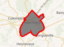
Location of Nabringhen 
| |
 Nabringhen  Nabringhen | |
| Coordinates: 50°44′42″N 1°51′46″E | |
| Country | France |
| Region | Hauts-de-France |
| Department | Pas-de-Calais |
| Arrondissement | Boulogne-sur-Mer |
| Canton | Desvres |
| Intercommunality | Desvres-Samer |
| Government | |
| • Mayor (2014-2020) | Hervé Brouart |
| Area 1 | 4.17 km2 (1.61 sq mi) |
| Population (2017-01-01)[1] | 212 |
| • Density | 51/km2 (130/sq mi) |
| Time zone | UTC+01:00 (CET) |
| • Summer (DST) | UTC+02:00 (CEST) |
| INSEE/Postal code | 62599 /62142 |
| Elevation | 65–202 m (213–663 ft) (avg. 125 m or 410 ft) |
| 1 French Land Register data, which excludes lakes, ponds, glaciers > 1 km2 (0.386 sq mi or 247 acres) and river estuaries. | |
Geography
Nabringhen is situated some 12 miles (19 km) east of Boulogne, at the junction of the N42 with the D224 and D206 roads.
Population
| Year | Pop. | ±% |
|---|---|---|
| 2004 | 158 | — |
| 2006 | 162 | +2.5% |
| 2007 | 163 | +0.6% |
| 2008 | 165 | +1.2% |
| 2009 | 166 | +0.6% |
| 2010 | 170 | +2.4% |
| 2011 | 168 | −1.2% |
| 2012 | 177 | +5.4% |
| 2013 | 186 | +5.1% |
| 2014 | 195 | +4.8% |
| 2015 | 203 | +4.1% |
| 2016 | 206 | +1.5% |
Places of interest
- The church of St.Marguerite, dating from the sixteenth century.
gollark: The electoral college? No.
gollark: Obamium?
gollark: That's hardly a few. I don't think there are good replacements for fossil fuel-type things for planes right now.
gollark: Well, it seems like you just claimed to before.
gollark: What are you defining as "few" here?
References
- "Populations légales 2017". INSEE. Retrieved 6 January 2020.
| Wikimedia Commons has media related to Nabringhen. |
This article is issued from Wikipedia. The text is licensed under Creative Commons - Attribution - Sharealike. Additional terms may apply for the media files.