Villers-au-Flos
Villers-au-Flos is a commune in the Pas-de-Calais department in the Hauts-de-France region of France.
Villers-au-Flos | |
|---|---|
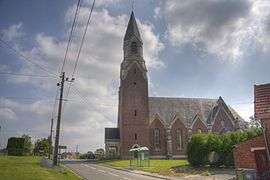
 The church of Villers-au-Flos | |
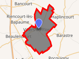
Location of Villers-au-Flos 
| |
 Villers-au-Flos  Villers-au-Flos | |
| Coordinates: 50°04′54″N 2°54′15″E | |
| Country | France |
| Region | Hauts-de-France |
| Department | Pas-de-Calais |
| Arrondissement | Arras |
| Canton | Bapaume |
| Intercommunality | CC Sud-Artois |
| Government | |
| • Mayor (2008–2014) | Marie-Christine Corniquet |
| Area 1 | 5.8 km2 (2.2 sq mi) |
| Population (2017-01-01)[1] | 272 |
| • Density | 47/km2 (120/sq mi) |
| Time zone | UTC+01:00 (CET) |
| • Summer (DST) | UTC+02:00 (CEST) |
| INSEE/Postal code | 62855 /62450 |
| Elevation | 113–133 m (371–436 ft) (avg. 110 m or 360 ft) |
| 1 French Land Register data, which excludes lakes, ponds, glaciers > 1 km2 (0.386 sq mi or 247 acres) and river estuaries. | |
Geography
Villers-au-Flos is situated some 19 miles (30.6 km) south of Arras, near the junction of the D11 and N17 roads.
Population
| Year | 1962 | 1968 | 1975 | 1982 | 1990 | 1999 | 2006 |
|---|---|---|---|---|---|---|---|
| Population | 231 | 237 | 202 | 187 | 192 | 196 | 190 |
| From the year 1962 on: No double counting—residents of multiple communes (e.g. students and military personnel) are counted only once. | |||||||
Places of interest
- The church of St.Pierre, rebuilt, as was the rest of the village, after the First World War.
- The German military cemetery.
gollark: Fun fact of the day: `...` is a valid Python expression.
gollark: I'm sure you'd like us to think so.
gollark: This was confirmed using data and algorithms.
gollark: Actually, he's a class N22 apioform.
gollark: YET.
This article is issued from Wikipedia. The text is licensed under Creative Commons - Attribution - Sharealike. Additional terms may apply for the media files.