Lespesses
Lespesses is a commune in the Pas-de-Calais department in the Hauts-de-France region of France.
Lespesses | |
|---|---|
_mairie.JPG) The town hall of Lespesses | |
 Coat of arms | |
Location of Lespesses 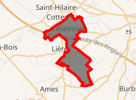
| |
 Lespesses  Lespesses | |
| Coordinates: 50°33′48″N 2°25′30″E | |
| Country | France |
| Region | Hauts-de-France |
| Department | Pas-de-Calais |
| Arrondissement | Béthune |
| Canton | Lillers |
| Intercommunality | CA Béthune-Bruay, Artois-Lys Romane |
| Government | |
| • Mayor (2008–2014) | Roger Dupont |
| Area 1 | 3.09 km2 (1.19 sq mi) |
| Population (2017-01-01)[1] | 405 |
| • Density | 130/km2 (340/sq mi) |
| Time zone | UTC+01:00 (CET) |
| • Summer (DST) | UTC+02:00 (CEST) |
| INSEE/Postal code | 62500 /62190 |
| Elevation | 33–84 m (108–276 ft) (avg. 40 m or 130 ft) |
| 1 French Land Register data, which excludes lakes, ponds, glaciers > 1 km2 (0.386 sq mi or 247 acres) and river estuaries. | |
Geography
A small farming village, situated some 10 miles (16.1 km) northwest of Béthune and 33 miles (53.1 km) west of Lille, on the D185 and D185e1, by the banks of the Nave River. The commune is separated into two parts by the A26 autoroute.
Population
| 1962 | 1968 | 1975 | 1982 | 1990 | 1999 | 2006 |
|---|---|---|---|---|---|---|
| 375 | 381 | 337 | 340 | 415 | 401 | 424 |
| Census count starting from 1962: Population without duplicates | ||||||
Places of interest
- The church of St. Martin, dating from the sixteenth century.
gollark: It should actually be fairly easy to make it mostly work.
gollark: No, Milo does.
gollark: It appears that I'll have to implement some incredibly accursed code to emulate an introspection module using the turtle API.
gollark: Can Milo be modified to not need introspection modules?
gollark: Excellent.
References
- "Populations légales 2017". INSEE. Retrieved 6 January 2020.
| Wikimedia Commons has media related to Lespesses. |
| Authority control |
|
|---|
This article is issued from Wikipedia. The text is licensed under Creative Commons - Attribution - Sharealike. Additional terms may apply for the media files.