Thélus
Thélus is a commune in the Pas-de-Calais department in the Hauts-de-France region of France. It is located 4 kilometres (2.5 mi) southeast of the Canadian National Vimy Memorial dedicated to the Battle of Vimy Ridge and the missing First World War Canadian soldiers with no known grave; the Memorial is also the site of two Canadian cemeteries.[2]
Thélus | |
|---|---|
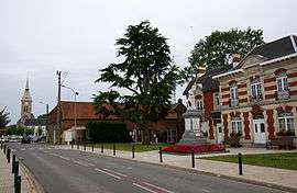
 The centre of Thélus | |
 Coat of arms | |
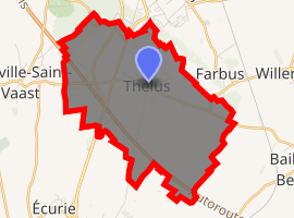
Location of Thélus 
| |
 Thélus  Thélus | |
| Coordinates: 50°21′20″N 2°48′05″E | |
| Country | France |
| Region | Hauts-de-France |
| Department | Pas-de-Calais |
| Arrondissement | Arras |
| Canton | Arras-2 |
| Intercommunality | Arras |
| Government | |
| • Mayor (2008–2014) | Bernard Milleville |
| Area 1 | 8.99 km2 (3.47 sq mi) |
| Population (2017-01-01)[1] | 1,204 |
| • Density | 130/km2 (350/sq mi) |
| Time zone | UTC+01:00 (CET) |
| • Summer (DST) | UTC+02:00 (CEST) |
| INSEE/Postal code | 62810 /62580 |
| Elevation | 88–143 m (289–469 ft) (avg. 121 m or 397 ft) |
| 1 French Land Register data, which excludes lakes, ponds, glaciers > 1 km2 (0.386 sq mi or 247 acres) and river estuaries. | |
Geography
Thélus lies 5 miles (8.0 km) north of Arras, at the junction of the N17 and D49 roads. Junction 7 of the A26 autoroute is less than a mile away.
Population
| 1962 | 1968 | 1975 | 1982 | 1990 | 1999 | 2006 |
|---|---|---|---|---|---|---|
| 659 | 703 | 853 | 887 | 998 | 1022 | 1204 |
| Census count starting in 1962: Population without duplicates | ||||||
Places of interest
- The church of St.Ranulphe, rebuilt, as was most of the village, after World War I.
- Two memorials to the Canadians who fell during the First World War.
- The Commonwealth War Graves Commission cemeteries.
gollark: Windows 11 is bad, so this is actually good.
gollark: That is not well-defined.
gollark: That was mean, so it didn't happen.
gollark: Your time complexity is LITERALLY O(3^n).
gollark: <@!326105835887394817> > “Hey,” I said as a girl walked into the room. She looked up, meeting eye contact for a second before looking back at the floor. “Do you know where we are?” She shook her head, still fiddling with her hands. “What’s your name?” Why do they not know where they are? Phones have GPS.
References
- "Populations légales 2017". INSEE. Retrieved 6 January 2020.
- "Canadian National Vimy Memorial, France". The Great War UK. The Great War UK. 2015. Retrieved 31 March 2017.
The ridge runs in a direction from Givenchy-en-Gohelle in the north-west to Farbus in the south-east.
External links
| Wikimedia Commons has media related to Thélus. |
This article is issued from Wikipedia. The text is licensed under Creative Commons - Attribution - Sharealike. Additional terms may apply for the media files.