Saint-Étienne-au-Mont
Saint-Étienne-au-Mont (English: Saint-Etienne-au-Mont, Dutch: Sint-Steven Berg) is a commune in the Pas-de-Calais department in the Hauts-de-France region of France near Boulogne-sur-Mer. Besides the main settlement Saint-Étienne-au-Mont, the commune consists of the two smaller settlements Pont-de-Briques and Écault.
Saint-Étienne-au-Mont | |
|---|---|
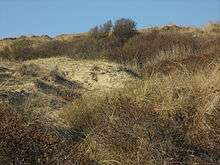
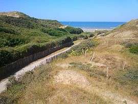 The route to Ecault beach | |
 Coat of arms | |
Location of Saint-Étienne-au-Mont 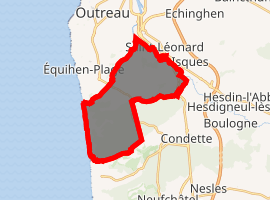
| |
 Saint-Étienne-au-Mont  Saint-Étienne-au-Mont | |
| Coordinates: 50°40′56″N 1°37′37″E | |
| Country | France |
| Region | Hauts-de-France |
| Department | Pas-de-Calais |
| Arrondissement | Boulogne-sur-Mer |
| Canton | Outreau |
| Intercommunality | Communauté d'agglomération du Boulonnais |
| Government | |
| • Mayor (2012–2014) | Brigitte Passebosc |
| Area 1 | 14.05 km2 (5.42 sq mi) |
| Population (2017-01-01)[1] | 5,076 |
| • Density | 360/km2 (940/sq mi) |
| Time zone | UTC+01:00 (CET) |
| • Summer (DST) | UTC+02:00 (CEST) |
| INSEE/Postal code | 62746 /62360 |
| Elevation | 3–113 m (9.8–370.7 ft) (avg. 7 m or 23 ft) |
| 1 French Land Register data, which excludes lakes, ponds, glaciers > 1 km2 (0.386 sq mi or 247 acres) and river estuaries. | |
Geography
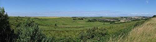
Saint-Étienne-au-Mont is a small farming and light industrial town situated some 3 miles (4.8 km) south of Boulogne, at the junction of the D52 and D940 roads. The Liane river flows from the north of the commune to the south-east. Beyond Écault lies the English Channel (in the west).
Population
| 1962 | 1968 | 1975 | 1982 | 1990 | 1999 | 2006 |
|---|---|---|---|---|---|---|
| 3423 | 4389 | 4301 | 4632 | 5037 | 4995 | 5112 |
| Census count starting from 1962: Population without duplicates | ||||||
Places of interest
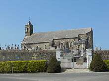
- The church of Saint-Léonard (in Saint-Léonard), a twelfth century church.
- The church of Sainte-Thérèse, a nineteenth century church.
- The St. Etienne-au-Mont Communal Cemetery (including the Commonwealth War Graves Commission cemetery)[2] created during World War I for men of the Chinese Labour Corps and of the South African Native Labour Corps.
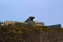
- The sand dunes along the beach and Aréna (a centre in Écault dedicated to the world of dunes).
- The Château de Pont-de-Briques (in Saint-Léonard), a registered monument[3]
- The Château d’Hardelot in Condette,[4] a castle dating from the middle of the nineteenth century
- The Château d'Audisque, dating from the eighteenth century and a registered monument.[5]
- The Pont-de-Briques, a bridge across the Liane
- The view from the Chapelle d'Écault (the church is also known as l'Église de Saint-Étienne and dates from the twelfth century)
- The PGL Le Pré Catelan Adventure Center (an adventure center for primary schools[6]) in Neufchâtel-Hardelot.
Hiking
To get a good idea of the area you can walk the Sentier de la Converserie.[7] The name is derived from the Converserie, a building on the site of a former leper colony. It encompasses Le Chemin des Juifs[8] and passes Aréna and the Château d’Hardelot (now the Centre Franco-brittanique de l'Entente Cordiale[9]) as well as the local cemetery (which contains de CWGC cemetery).
References
- "Populations légales 2017". INSEE. Retrieved 6 January 2020.
- The CWGC cemetery at St. Etienne-au-Mont
- Château de Pont-de-Briques in Base Merimee: IA00062560
- Château d’Hardelot in the Simple English Wikipedia
- Château d'Audisque in Base Merimee: IA00062536
- The PGL website
- Leaflet describing the route on the Boulonnais website
- The Way of the Jews on the Saint-Etienne-au-Mont website
- The Château d’Hardelot website
External links
| Wikimedia Commons has media related to Saint-Étienne-au-Mont. |
- Official town website (in French)
- Saint-Étienne-au-Mont on the Quid website (in French)
- The St. Etienne-au-Mont Communal Cemetery on the website "Remembrance Trails of the Great War in Northern France"
- ARENA - Centre d'interprétation de l'environnement (in French)
| Authority control |
|
|---|