Lamitan
Lamitan, officially the City of Lamitan (Chavacano: Ciudad de Lamitan; Yakan: Suidad Lamitanin; Tausūg: Dāira sin Lamitan), is a 6th class component city and capital of the province of Basilan, Philippines. According to the 2015 census, it has a population of 74,782 people.[3]
Lamitan | |
|---|---|
| City of Lamitan | |
 Lamitan City Hall | |
 Seal | |
| Motto(s): Lamitan Kong Mahal (Lamitan, My Love) | |
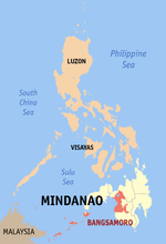
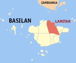 Map of Basilan with Lamitan highlighted | |
OpenStreetMap 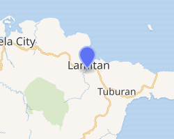
| |
.svg.png) Lamitan Location within the Philippines | |
| Coordinates: 6°39′N 122°08′E | |
| Country | |
| Region | Bangsamoro Autonomous Region in Muslim Mindanao (BARMM) |
| Province | Basilan |
| District | Lone District |
| Founded | 1886 |
| Cityhood | June 8, 2007 |
| Barangays | 45 (see Barangays) |
| Government | |
| • Type | Sangguniang Panlungsod |
| • Mayor | Rosita U. Furigay |
| • Vice Mayor | Roderick H. Furigay |
| • Congressman | Mujiv S. Hataman |
| • Electorate | 51,623 voters (2019) |
| Area | |
| • Total | 354.45 km2 (136.85 sq mi) |
| Population (2015 census)[3] | |
| • Total | 74,782 |
| • Density | 210/km2 (550/sq mi) |
| • Households | 14,751 |
| Economy | |
| • Income class | 6th city income class |
| • Poverty incidence | 37.55% (2015)[4] |
| • Revenue (₱) | 444,888,558.34 (2016) |
| Time zone | UTC+8 (PST) |
| ZIP code | 7302 |
| PSGC | |
| IDD : area code | +63 (0)62 |
| Climate type | tropical climate |
| Native languages | Chavacano Yakan Tagalog |
| Website | lamitancity |
The city is bounded on the east by the municipality of Tuburan, on the south by Tipo-Tipo, on the west by Isabela City and on the north by Basilan Strait.
On July 2016, the Basilan provincial government broke ground for the construction of the new provincial capitol inside the defunct 4,000-hectare University of the Philippines (UP) Land Grant in Barangay Santa Clara.[5][6]
Barangays
Lamitan is politically subdivided into 45 barangays.
- Arco
- Ba-as
- Baimbing
- Balagtasan
- Balas
- Balobo
- Bato
- Boheyakan
- Buahan
- Boheibu
- Bohesapa
- Bulingan
- Cabobo
- Campo Uno
- Colonia
- Calugusan
- Kulay Bato
- Limo-ok
- Lo-ok
- Lumuton
- Luksumbang
- Malo-ong Canal
- Malo-ong San Jose
- Parangbasak
- Santa Clara
- Tandong Ahas
- Tumakid
- Ubit
- Bohebessey
- Baungos
- Danit-Puntocan
- Sabong
- Sengal
- Ulame
- Bohenange
- Boheyawas
- Bulanting
- Lebbuh
- Maganda (Poblacion)
- Malakas (Poblacion)
- Maligaya (Poblacion)
- Malinis (Poblacion)
- Matatag (Poblacion)
- Matibay (Poblacion)
- Simbangon
Geography
The terrain is relatively plain along the coastal areas and hilly in some areas. The urban area is 2.5 meters above sea level and gently sloping to 300 meters toward the hinterlands.
Climate
The climatic condition is the same with other areas in the entire Basilan Island. It has a "D" type of climate and rainfall is evenly distributed throughout the year.
| Climate data for Lamitan City, Basilan | |||||||||||||
|---|---|---|---|---|---|---|---|---|---|---|---|---|---|
| Month | Jan | Feb | Mar | Apr | May | Jun | Jul | Aug | Sep | Oct | Nov | Dec | Year |
| Average high °C (°F) | 27 (81) |
27 (81) |
27 (81) |
28 (82) |
28 (82) |
28 (82) |
28 (82) |
28 (82) |
28 (82) |
28 (82) |
28 (82) |
28 (82) |
28 (82) |
| Average low °C (°F) | 27 (81) |
26 (79) |
27 (81) |
27 (81) |
28 (82) |
28 (82) |
27 (81) |
27 (81) |
27 (81) |
27 (81) |
27 (81) |
27 (81) |
27 (81) |
| Average precipitation mm (inches) | 106 (4.2) |
77 (3.0) |
91 (3.6) |
104 (4.1) |
236 (9.3) |
321 (12.6) |
325 (12.8) |
306 (12.0) |
227 (8.9) |
271 (10.7) |
204 (8.0) |
115 (4.5) |
2,383 (93.7) |
| Average rainy days | 15.3 | 13.8 | 17.7 | 15.5 | 23.1 | 24.5 | 24.3 | 24.6 | 21.1 | 22.9 | 20.1 | 16.6 | 239.5 |
| Source: Meteoblue [7] | |||||||||||||
Demographics
| Year | Pop. | ±% p.a. |
|---|---|---|
| 1960 | 35,160 | — |
| 1970 | 37,423 | +0.62% |
| 1975 | 39,703 | +1.19% |
| 1980 | 45,223 | +2.64% |
| 1990 | 47,859 | +0.57% |
| 1995 | 54,433 | +2.44% |
| 2000 | 58,709 | +1.63% |
| 2007 | 82,074 | +4.73% |
| 2010 | 68,996 | −6.12% |
| 2015 | 74,782 | +1.55% |
| Source: Philippine Statistics Authority[3][8][9][10] | ||
History
Cityhood
On June 18, 2007 voters in Lamitan ratified Republic Act 9393. 26,636 voted "yes" while only 177 voted against.
Historical sites
Datu Kalun Shrine – Built as a tribute to a famous Yakan leader and founder of Lamitan. His descendants are the Antonio-Cuevas-Pamaran clan.
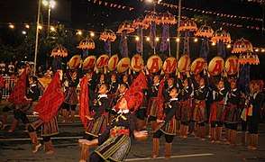
Museum of Lamitan – Showcases the color and highlights of the Lami-lamihan festival. It also serves as the information center for the development of this town.
Education
Tertiary
Lamitan is home to one (1) state college and three (3) private colleges. The Basilan State College is an extension college of the main SUC in Isabela City. The three HEIs are the Mindanao Autonomous College, the Mariam School of Nursing and Furigay Colleges, Inc. (FCI).
The Mariam School of Nursing was established in 2004 as part of its Chairwoman's educational outreach program and was named Mariam or Mother Mary - a unifying and guiding figure among the Christians and Muslims. Also offers 11 Tesda Qualifications for National Certificates.
Secondary
Lamitan City has Seven Secondary Schools: one Private Secondary School; the Claret School of Lamitan, one Laboratory School of Basilan State College and five National High Schools i.e. Lamitan National High School, Look National High School,Colony National High School,Ubit National High School and Parangbasak National High School.
Elementary
There are five districts that composed of thirty nine elementary schools namely; Lamitan East District, South District,Central District, West I District and West II District. There are four private elementary schools.
References
- "City". Quezon City, Philippines: Department of the Interior and Local Government. Retrieved 30 May 2013.
- "Province: Basilan". PSGC Interactive. Quezon City, Philippines: Philippine Statistics Authority. Retrieved 12 November 2016.
- Census of Population (2015). "ARMM – Autonomous Region in Muslim Mindanao". Total Population by Province, City, Municipality and Barangay. PSA. Retrieved 20 June 2016.
- "PSA releases the 2015 Municipal and City Level Poverty Estimates". Quezon City, Philippines. Retrieved 12 October 2019.
- http://www.philstar.com/nation/2016/02/28/1557698/armm-put-new-basilan-capitol
- http://www.philstar.com/nation/2016/02/28/1557698/armm-put-new-basilan-capitol
- "Lamitan City, Basilan : Average Temperatures and Rainfall". Meteoblue. Retrieved 29 January 2019.
- Census of Population and Housing (2010). "ARMM – Autonomous Region in Muslim Mindanao". Total Population by Province, City, Municipality and Barangay. NSO. Retrieved 29 June 2016.
- Censuses of Population (1903–2007). "ARMM – Autonomous Region in Muslim Mindanao". Table 1. Population Enumerated in Various Censuses by Province/Highly Urbanized City: 1903 to 2007. NSO.
- "Province of Basilan". Municipality Population Data. Local Water Utilities Administration Research Division. Retrieved 17 December 2016.
External links
| Wikimedia Commons has media related to Lamitan City. |
- Lamitan Profile at PhilAtlas.com
- Sun Star Zamboanga : Basilan province has two cities now
- Philippine Standard Geographic Code
- Philippine Census Information
Places adjacent to Lamitan | ||||||||||
|---|---|---|---|---|---|---|---|---|---|---|
| ||||||||||

| Authority control |
|
|---|