Omar, Sulu
Omar, officially the Municipality of Omar (Tausūg: Dāira sin Omar; Tagalog: Bayan ng Omar), is a — municipality in the province of Sulu, Philippines. According to the 2015 census, it has a population of 25,116 people.[3]
Omar | |
|---|---|
| Municipality of Omar | |
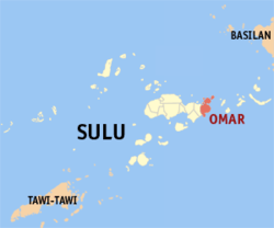 Map of Sulu with Omar highlighted | |
OpenStreetMap 
| |
.svg.png) Omar Location within the Philippines | |
| Coordinates: 5°59′00″N 121°24′00″E | |
| Country | |
| Region | Bangsamoro Autonomous Region in Muslim Mindanao (BARMM) |
| Province | Sulu |
| District | 2nd District |
| Founded | December 20, 2005 |
| Barangays | 8 (see Barangays) |
| Government | |
| • Type | Sangguniang Bayan |
| • Mayor | Abdulbaki J. Ajibon |
| • Vice Mayor | Juddin A. Pantasan |
| • Congressman | Munir M. Arbison |
| • Electorate | 14,874 voters (2019) |
| Area | |
| • Total | 180.98 km2 (69.88 sq mi) |
| Population (2015 census)[3] | |
| • Total | 25,116 |
| • Density | 140/km2 (360/sq mi) |
| • Households | 4,367 |
| Economy | |
| • Income class | no value |
| • Poverty incidence | 53.58% (2015)[4] |
| • Revenue (₱) | 58,101,966.26 (2016) |
| Time zone | UTC+8 (PST) |
| ZIP code | 7404 |
| PSGC | |
| IDD : area code | +63 (0)68 |
| Climate type | tropical climate |
| Native languages | Tausug Tagalog |
It was created out of the 8 barangays of Luuk, by virtue of Muslim Mindanao Autonomy Act No. 194,[5] which was subsequently ratified in a plebiscite held on July 18, 2007.[6]
Barangays
Omar is politically subdivided into 8 barangays.
- Andalan
- Angilan
- Capual Island
- Huwit-huwit
- Lahing-Lahing
- Niangkaan
- Sucuban
- Tangkuan
Climate
| Climate data for Omar, Sulu | |||||||||||||
|---|---|---|---|---|---|---|---|---|---|---|---|---|---|
| Month | Jan | Feb | Mar | Apr | May | Jun | Jul | Aug | Sep | Oct | Nov | Dec | Year |
| Average high °C (°F) | 27 (81) |
27 (81) |
27 (81) |
27 (81) |
28 (82) |
28 (82) |
28 (82) |
28 (82) |
28 (82) |
28 (82) |
28 (82) |
27 (81) |
28 (82) |
| Average low °C (°F) | 26 (79) |
26 (79) |
26 (79) |
27 (81) |
27 (81) |
27 (81) |
27 (81) |
27 (81) |
27 (81) |
27 (81) |
27 (81) |
27 (81) |
27 (81) |
| Average precipitation mm (inches) | 152 (6.0) |
120 (4.7) |
125 (4.9) |
132 (5.2) |
239 (9.4) |
301 (11.9) |
281 (11.1) |
268 (10.6) |
190 (7.5) |
263 (10.4) |
234 (9.2) |
179 (7.0) |
2,484 (97.9) |
| Average rainy days | 17.4 | 14.9 | 15.8 | 15.4 | 22.7 | 24.4 | 25.0 | 23.5 | 20.5 | 22.7 | 21.2 | 18.7 | 242.2 |
| Source: Meteoblue [7] | |||||||||||||
Demographics
| Year | Pop. | ±% p.a. |
|---|---|---|
| 2007 | 25,102 | — |
| 2010 | 18,098 | −11.22% |
| 2015 | 25,116 | +6.44% |
| Source: Philippine Statistics Authority[3][8][9][10] | ||
References
- "Municipality". Quezon City, Philippines: Department of the Interior and Local Government. Retrieved 31 May 2013.
- "Province: Sulu". PSGC Interactive. Quezon City, Philippines: Philippine Statistics Authority. Retrieved 12 November 2016.
- Census of Population (2015). "ARMM – Autonomous Region in Muslim Mindanao". Total Population by Province, City, Municipality and Barangay. PSA. Retrieved 20 June 2016.
- "PSA releases the 2015 Municipal and City Level Poverty Estimates". Quezon City, Philippines. Retrieved 12 October 2019.
- "Muslim Mindanao Autonomy Act No. 194; An Act Creating the Municipality of Omar in the Province of Sulu, Providing Funds Therefor, and for Other Purposes" (PDF). Regional Legislative Assembly, Autonomous Region in Muslim Mindanao. Retrieved 27 January 2016.
- MMA Act No. 194 : An Act Creating the Municipality of Omar in the Province of Sulu
- "Omar, Sulu : Average Temperatures and Rainfall". Meteoblue. Retrieved 31 January 2019.
- Census of Population and Housing (2010). "ARMM – Autonomous Region in Muslim Mindanao". Total Population by Province, City, Municipality and Barangay. NSO. Retrieved 29 June 2016.
- Censuses of Population (1903–2007). "ARMM – Autonomous Region in Muslim Mindanao". Table 1. Population Enumerated in Various Censuses by Province/Highly Urbanized City: 1903 to 2007. NSO.
- "Province of Sulu". Municipality Population Data. Local Water Utilities Administration Research Division. Retrieved 17 December 2016.
External links
- Omar Profile at PhilAtlas.com
- Memorandum Order No. 260
- Philippine Standard Geographic Code
- Philippine Census Information
- Local Governance Performance Management System
Places adjacent to Omar, Sulu | |
|---|---|
Jolo (capital) | |
| Municipalities | |
| Authority control |
|
|---|
This article is issued from Wikipedia. The text is licensed under Creative Commons - Attribution - Sharealike. Additional terms may apply for the media files.