Mambajao
Mambajao, officially the Municipality of Mambajao, is a 3rd class municipality and capital of the province of Camiguin, Philippines. According to the 2015 census, it has a population of 38,735 people.[3]
Mambajao | |
|---|---|
| Municipality of Mambajao | |
 Mambajao, viewed from Mt. Hibok-hibok | |
 Seal | |
| Nickname(s): Lanzones Capital of the Philippines | |
 Map of Camiguin with Mambajao highlighted | |
OpenStreetMap 
| |
.svg.png) Mambajao Location within the Philippines | |
| Coordinates: 9°15′N 124°43′E | |
| Country | |
| Region | Northern Mindanao (Region X) |
| Province | Camiguin |
| District | Lone District |
| Founded | July 6, 1855 |
| Barangays | 15 (see Barangays) |
| Government | |
| • Type | Sangguniang Bayan |
| • Mayor | Yñigo Jesus D. Romualdo |
| • Vice Mayor | Roldan A. Chan |
| • Congressman | Xavier Jesus D. Romualdo |
| • Electorate | 25,172 voters (2019) |
| Area | |
| • Total | 89.00 km2 (34.36 sq mi) |
| Population (2015 census)[3] | |
| • Total | 38,735 |
| • Density | 440/km2 (1,100/sq mi) |
| • Households | 8,542 |
| Economy | |
| • Income class | 3rd municipal income class |
| • Poverty incidence | 30.26% (2015)[4] |
| • Revenue (₱) | 117,615,805.11 (2016) |
| Time zone | UTC+8 (PST) |
| ZIP code | 9100 |
| PSGC | |
| IDD : area code | +63 (0)88 |
| Climate type | tropical rainforest climate |
| Native languages | Kinamigin language Cebuano Tagalog |
| Website | www |
Etymology
Mambajao is from Visayan mambahaw (archaic form of mamahaw), meaning "to eat breakfast"; from the root word bahaw, "leftover rice from [last night]".[5]
History
On January 4, 1855, Mambajao was separated from Catarman, and by July 6 that year it was proclaimed as a town, with Fr. Valero Salvo as its first parish priest.[6] On July 17, 1864, tremors were felt across the town, which were signs of an ongoing activity within an undersea volcano near Catarman. By May 1, 1871, the volcano erupted, decimating the town of Catarman, which lead to almost all of its inhabitants moving to Mambajao.[6] In January 1872, Barrio Agojo was transferred from Guinsiliban to Mambajao.[6]
The town's principal crop in the 19th century was abaca, while coffee and cacao were mostly produced for local consumption.[6] Sporadic fires were started from April 13, 1865 until 1881 by people attempting to burn down the town.[6] By the 1880s, the town had become cosmopolitan, for its population then included Spaniards, Tagalogs, Cebuanos, Leyteños, Samareños, Ilocanos, and others in addition to Camigueños and Boholanos.[6]
In 1942, the Japanese forces landed in the town of Mambajao.
Barangays
Mambajao is politically subdivided into 15 barangays.[7]
- Tupsan
- Benhaan
- Magting
- Anito
- Balbagon
- Pandan
- Soro-Soro
- Poblacion
- Baylao
- Tagdo
- Kuguita
- Bug ong
- Agoho
- Yumbing
- Naasag
Climate
| Climate data for Mambajao, Camiguin | |||||||||||||
|---|---|---|---|---|---|---|---|---|---|---|---|---|---|
| Month | Jan | Feb | Mar | Apr | May | Jun | Jul | Aug | Sep | Oct | Nov | Dec | Year |
| Average high °C (°F) | 28 (82) |
29 (84) |
30 (86) |
31 (88) |
31 (88) |
30 (86) |
30 (86) |
30 (86) |
30 (86) |
29 (84) |
29 (84) |
29 (84) |
30 (85) |
| Average low °C (°F) | 23 (73) |
22 (72) |
23 (73) |
23 (73) |
24 (75) |
25 (77) |
24 (75) |
24 (75) |
24 (75) |
24 (75) |
23 (73) |
23 (73) |
24 (74) |
| Average precipitation mm (inches) | 102 (4.0) |
85 (3.3) |
91 (3.6) |
75 (3.0) |
110 (4.3) |
141 (5.6) |
121 (4.8) |
107 (4.2) |
111 (4.4) |
144 (5.7) |
169 (6.7) |
139 (5.5) |
1,395 (55.1) |
| Average rainy days | 18.6 | 14.8 | 16.5 | 16.7 | 23.9 | 26.4 | 25.6 | 24.1 | 24.4 | 26.3 | 23.7 | 20.5 | 261.5 |
| Source: Meteoblue [8] | |||||||||||||
Demographics
| Year | Pop. | ±% p.a. |
|---|---|---|
| 1903 | 14,446 | — |
| 1918 | 21,308 | +2.62% |
| 1939 | 21,414 | +0.02% |
| 1948 | 25,193 | +1.82% |
| 1960 | 15,288 | −4.08% |
| 1970 | 18,673 | +2.02% |
| 1975 | 19,183 | +0.54% |
| 1980 | 21,337 | +2.15% |
| 1990 | 25,207 | +1.68% |
| 1995 | 27,770 | +1.83% |
| 2000 | 30,806 | +2.25% |
| 2007 | 35,308 | +1.90% |
| 2015 | 38,735 | +1.16% |
| Source: Philippine Statistics Authority[3][9][10][11] | ||
In the 2015 census, the population of Mambajao was 38,735 people,[3] with a density of 440 inhabitants per square kilometre or 1,100 inhabitants per square mile.
Infrastructure
The Camiguin Sports Complex (Also known as Cong. Pedro Palarca-Romualdo Tourism and Sports Complex) is a sports complex located in Mambajao, and hosts to the 2016 Northern Mindanao Regional Athletic Meet,[12] and Lanzones Festival events.
Notable people
- Mary "Maymay" Entrata, actress and singer who won the seventh edition of Pinoy Big Brother
References
- "Municipality". Quezon City, Philippines: Department of the Interior and Local Government. Retrieved 31 May 2013.
- "Province: Camiguin". PSGC Interactive. Quezon City, Philippines: Philippine Statistics Authority. Retrieved 12 November 2016.
- Census of Population (2015). "Region X (Northern Mindanao)". Total Population by Province, City, Municipality and Barangay. PSA. Retrieved 20 June 2016.
- "PSA releases the 2015 Municipal and City Level Poverty Estimates". Quezon City, Philippines. Retrieved 12 October 2019.
- Paredes, Francis Tom; Paredes, Sheila (2017). The Monosyllabic root -ao in Mindanao Languages. 8th Annual In-house Review of the Research Office of Agusan del Sur State College of Agriculture and Technology. Agusan del Sur State College of Agriculture and Technology.
- Elio, Vicente (1972). "The History of Camiguin". Philippine Studies. 20 (1): 135–137. ISSN 2244-1638. Retrieved 20 September 2019.
- Political subdivisions of Mambajao - Mambajao Official Website
- "Mambajao: Average Temperatures and Rainfall". Meteoblue. Retrieved 4 March 2020.
- Census of Population and Housing (2010). "Region X (Northern Mindanao)". Total Population by Province, City, Municipality and Barangay. NSO. Retrieved 29 June 2016.
- Censuses of Population (1903–2007). "Region X (Northern Mindanao)". Table 1. Population Enumerated in Various Censuses by Province/Highly Urbanized City: 1903 to 2007. NSO.
- "Province of Camiguin". Municipality Population Data. Local Water Utilities Administration Research Division. Retrieved 17 December 2016.
- "Northern Mindanao 2016 regional meet kicks off in Camiguin". The Manila Times. 9 July 2018.
External links
| Wikimedia Commons has media related to Mambajao, Camiguin. |
Mambajao (capital) | |
| Municipalities | |
| Regional Center | 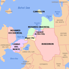 | |
|---|---|---|
| Provinces | ||
| Highly Urbanized Cities | ||
| Component Cities | ||
| Provincial Capitals | ||
| Municipalities |
| |
Mindanao, Republic of the Philippines | ||