Tamparan
Tamparan, officially the Municipality of Tamparan (Maranao: Inged a Tamparan; Tagalog: Bayan ng Tamparan), is a 5th class municipality in the province of Lanao del Sur, Philippines. According to the 2015 census, it has a population of 25,874 people.[3]
Tamparan | |
|---|---|
| Municipality of Tamparan | |
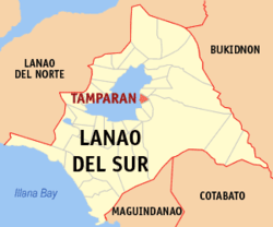 Map of Lanao del Sur with Tamparan highlighted | |
OpenStreetMap 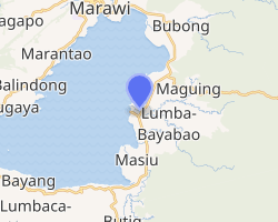
| |
.svg.png) Tamparan Location within the Philippines | |
| Coordinates: 7°52′44″N 124°19′59″E | |
| Country | |
| Region | Bangsamoro Autonomous Region in Muslim Mindanao (BARMM) |
| Province | Lanao del Sur |
| District | 1st District |
| Barangays | 44 (see Barangays) |
| Government | |
| • Type | Sangguniang Bayan |
| • Mayor | Mohammad Juhar D. Disomimba |
| • Vice Mayor | Alinor D. Tomawis |
| • Congressman | Ansaruddin Abdul Malik A. Adiong |
| • Electorate | 26,995 voters (2019) |
| Area | |
| • Total | 170.00 km2 (65.64 sq mi) |
| Population (2015 census)[3] | |
| • Total | 25,874 |
| • Density | 150/km2 (390/sq mi) |
| • Households | 2,022 |
| Economy | |
| • Income class | 5th municipal income class |
| • Poverty incidence | 68.52% (2015)[4] |
| • Revenue (₱) | 74,646,962.93 (2016) |
| Time zone | UTC+8 (PST) |
| ZIP code | 9704 |
| PSGC | |
| IDD : area code | +63 (0)63 |
| Climate type | tropical climate |
| Native languages | Maranao Tagalog |
| Website | www |
Geography
Tamparan is located on the eastern part of Lanao del Sur. It is bounded on the north by the Municipality of Taraka, on the south by Poona-Bayabao, and on the west by Lake Lanao.
Tamparan is approximately 27 kilometres (17 mi) from Marawi City, the biggest center in the province and also the nearest center of commercial activities to Tamparan. Tamparan and Marawi City are connected by road passing through the municipalities of Ditsaan-Ramain, Bubong, Buadi-Puso Buntong, Mulondo and Taraka. Tamparan is also accessible by water transportation through the Lake Lanao.
The municipality of Tamparan has a total land area of 17,000 hectares (42,000 acres) more or less. Agricultural area comprises 42.30%, built-up area is 5.46%, open grassland 48.60%, while roads/creeks and river constitute 3.64%.
Barangays
Tamparan is politically subdivided into 44 barangays.
- Bocalan
- Bangon
- Cabasaran
- Dilausan
- Lalabuan
- Lilod Tamparan
- Lindongan
- Linuk
- Occidental Linuk
- Linuk Oriental
- Lumbaca Ingud
- Lumbacaingud South
- Lumbaca Lilod
- Balutmadiar
- Mala-abangon
- Maliwanag
- Maidan Linuk
- Miondas
- New Lumbacaingud
- Pimbago-Pagalongan
- Piaparan (Not included)
- Pagayawan
- Picarabawan
- Poblacion I
- Poblacion II
- Poblacion III
- Poblacion IV
- Raya Miondas
- Raya Buadi Barao
- Raya Tamparan
- Salongabanding
- Saminunggay
- Talub
- Tatayawan North
- Tatayawan South
- Tubok
- Beruar
- Dasomalong
- Guinaopan
- Lumbac
- Minanga
- Lilod Tubok
- Mariatao Datu
- Pagalamatan Linuk
- Pindolonan Mariatao Sarip
Topography
The Municipality lies on the plain and slightly slopy area hence erosion is less. But due to its location along the lake, some of the areas are affected by the rise and fall of the lake water level.
Climate
The month of February has the lowest average temperature of 17.6 °C (63.7 °F) and the month of April has the highest with 28.8 °C (83.8 °F). A stable north-west wind blows from January to September. In the months of October and November, wind blows either north-west or north-south
Generally, the municipality is under the fourth type of climate characterized by even distribution of rainfall through the year. Heaviest rain is experienced in the months of January, May and July. Dry months are September and November.
| Climate data for Tamparan, Lanao de Sur | |||||||||||||
|---|---|---|---|---|---|---|---|---|---|---|---|---|---|
| Month | Jan | Feb | Mar | Apr | May | Jun | Jul | Aug | Sep | Oct | Nov | Dec | Year |
| Average high °C (°F) | 24 (75) |
24 (75) |
25 (77) |
26 (79) |
26 (79) |
25 (77) |
25 (77) |
25 (77) |
25 (77) |
25 (77) |
25 (77) |
25 (77) |
25 (77) |
| Average low °C (°F) | 20 (68) |
20 (68) |
20 (68) |
20 (68) |
21 (70) |
21 (70) |
20 (68) |
20 (68) |
20 (68) |
20 (68) |
20 (68) |
20 (68) |
20 (68) |
| Average precipitation mm (inches) | 159 (6.3) |
143 (5.6) |
166 (6.5) |
183 (7.2) |
357 (14.1) |
414 (16.3) |
333 (13.1) |
309 (12.2) |
289 (11.4) |
285 (11.2) |
253 (10.0) |
166 (6.5) |
3,057 (120.4) |
| Average rainy days | 18.4 | 17.2 | 20.6 | 23.4 | 29.3 | 29.2 | 29.9 | 29.4 | 27.7 | 28.7 | 25.5 | 19.9 | 299.2 |
| Source: Meteoblue [5] | |||||||||||||
History
Etymology and origin
Its name was derived from the Maranao word tamparan which literally means "frontge."
During the American colonial presence in the country Sultan Mangking Sugador was appointed by the American government as Municipal District President, a position equal to the rank of Municipal Mayor, although lesser in power than the latter. When asked by the American Officials about his name, the Sultan said “I am the Sultan of Tamparan,” referring to the dowa ka lokus-tribal leaders of Tamparan. Sultan Mangking Sugador became popular by his royal title that American officials started calling the town Tamparan.
Declaration
The creation of the Municipality of Tamparan could be traced way back the Commonwealth Government of the Philippines under then President Manuel L. Quezon. It was in the year 1940 President Quezon issued an Executive Order known as Commonwealth Act No. 592 creating Dansalan (now Marawi City) as regular municipality and Tamparan as its municipal district covering the areas (now municipalities) of Masiu, Taraka, Poona-Bayabao, Lumba Bayabao, Maguing, Mulondo, Bumbaran and Wao.
Tamparan District became a regular municipality on September 28, 1960 by virtue of Executive Order No. 405 and consequently declared Islamic Municipality pursuant to Batas Pambansa (PB) Number 33 on June 4, 1984.
Demographics
| Year | Pop. | ±% p.a. |
|---|---|---|
| 1918 | 3,308 | — |
| 1939 | 6,439 | +3.22% |
| 1948 | 11,743 | +6.90% |
| 1960 | 14,452 | +1.74% |
| 1970 | 11,939 | −1.89% |
| 1975 | 11,420 | −0.89% |
| 1980 | 10,196 | −2.24% |
| 1990 | 16,379 | +4.86% |
| 1995 | 17,507 | +1.26% |
| 2000 | 19,975 | +2.87% |
| 2007 | 27,875 | +4.70% |
| 2010 | 22,367 | −7.70% |
| 2015 | 25,874 | +2.81% |
| Source: Philippine Statistics Authority[3][6][7][8] | ||
Language and ethnicity
Majority of the Tamparanian (or Itamparanen in Meranau) traces their roots to Meranau ethnicity although there are also Tagalog, Bisaya and other ethnicity who migrated in the town. The vernacular language is Filipino in the form of Meranau, while Tagalog and English are the languages also widely used in education and business throughout the town.
Religion
Majority of Tamparanian are Muslims. Sunni Islam is the predominant religion and widely practiced. Many people have studied Islamic (Muslim) and Arabic education both within the country and abroad. Other religious group such as Christian could also be found in town.
Schools/universities
- Tamparan Populace Islamic College (TPIC)
- As-salihein Integrated School
- Mindanao State University - Tamparan
- Datu Palawan Disomimba Memorial National High School
References
- "Municipality". Quezon City, Philippines: Department of the Interior and Local Government. Retrieved 31 May 2013.
- "Province: Lanao del Sur". PSGC Interactive. Quezon City, Philippines: Philippine Statistics Authority. Retrieved 12 November 2016.
- Census of Population (2015). "ARMM – Autonomous Region in Muslim Mindanao". Total Population by Province, City, Municipality and Barangay. PSA. Retrieved 20 June 2016.
- "PSA releases the 2015 Municipal and City Level Poverty Estimates". Quezon City, Philippines. Retrieved 12 October 2019.
- "Tamparan, Lanao del Sur : Average Temperatures and Rainfall". Meteoblue. Retrieved 27 January 2019.
- Census of Population and Housing (2010). "ARMM – Autonomous Region in Muslim Mindanao". Total Population by Province, City, Municipality and Barangay. NSO. Retrieved 29 June 2016.
- Censuses of Population (1903–2007). "ARMM – Autonomous Region in Muslim Mindanao". Table 1. Population Enumerated in Various Censuses by Province/Highly Urbanized City: 1903 to 2007. NSO.
- "Province of Lanao del Sur". Municipality Population Data. Local Water Utilities Administration Research Division. Retrieved 17 December 2016.
External links
- Tamparan Profile at PhilAtlas.com
- Philippine Standard Geographic Code
- Tamparan Community Website
- Philippine Standard Geographic Code
- Philippine Census Information
- Local Governance Performance Management System
Places adjacent to Tamparan | ||||||||||
|---|---|---|---|---|---|---|---|---|---|---|
| ||||||||||