Datu Piang, Maguindanao
Datu Piang, officially the Municipality of Datu Piang (Maguindanaon: Ingud nu Datu Piang; Iranun: Inged a Datu Piang; Tagalog: Bayan ng Datu Piang), is a 2nd class municipality in the province of Maguindanao, Philippines. According to the 2015 census, it has a population of 25,600 people.[3]
Datu Piang | |
|---|---|
| Municipality of Datu Piang | |
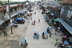 Datu Piang, 2008 | |
 Seal | |
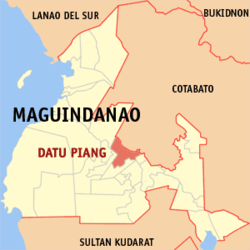 Map of Maguindanao with Datu Piang highlighted | |
OpenStreetMap 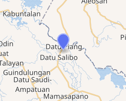
| |
.svg.png) Datu Piang Location within the Philippines | |
| Coordinates: 7°01′04″N 124°29′51″E | |
| Country | |
| Region | Bangsamoro Autonomous Region in Muslim Mindanao (BARMM) |
| Province | Maguindanao |
| District | 2nd District |
| Founded | November 25, 1936 |
| Barangays | 16 (see Barangays) |
| Government | |
| • Type | Sangguniang Bayan |
| • Mayor | Victor T. Samama |
| • Vice Mayor | Nasser S. Abpi |
| • Congressman | Esmael G. Mangudadatu |
| • Electorate | 14,515 voters (2019) |
| Area | |
| • Total | 302.97 km2 (116.98 sq mi) |
| Population (2015 census)[3] | |
| • Total | 25,600 |
| • Density | 84/km2 (220/sq mi) |
| • Households | 4,167 |
| Economy | |
| • Income class | 2nd municipal income class |
| • Poverty incidence | 57.52% (2015)[4] |
| • Revenue (₱) | 100,072,933.54 (2016) |
| Time zone | UTC+8 (PST) |
| ZIP code | 9607 |
| PSGC | |
| IDD : area code | +63 (0)64 |
| Climate type | tropical climate |
| Native languages | Maguindanao Tagalog |
| Website | www |
It is formerly known as Dulawan.
History
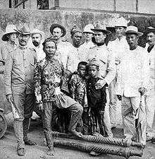
Created as Dulawan on November 25, 1936 by Executive Order No. 66[5] of Pres. Manuel L. Quezon, the municipality covered a large area of what is now mostly central Maguindanao and northern Sultan Kudarat. It is among the first municipalities of the old Cotabato province. Republic Act No. 1035, enacted on June 12, 1954 renamed the town to Datu Piang,[6] after an influential Muslim leader from the region during the American colonial period.[7]
In 1959, a large southern territory was made into the municipality of Ampatuan. Four years later the municipality of Maganoy was carved out its territory, which later on became the capital of Maguindanao, of which it was made part of on November 22, 1973.[8] Its remaining south-western barangays were merged with other barangays of Dinaig to form the municipality of Talayan in 1976.[9] Its area was reduced again on July 1, 2003, when 14 of its south-eastern barangays were separated to form the municipality of Datu Saudi-Ampatuan.[10]
On July 30, 2009, upon the ratification of Muslim Mindanao Autonomy Acts No. 225 (as amended by MMAA 252) and MMAA 222 (as amended by MMAA 253), the municipalities of Shariff Saydona Mustapha and Datu Salibo, respectively, were created from a total of 5 entire barangays and portions of 10 barangays from Datu Piang, in addition to other barangays from Datu Saudi-Ampatuan, Datu Unsay, Mamasapano and Shariff Nopak.
Barangays
Datu Piang is politically subdivided into 16 barangays.[11]
- Alonganan
- Ambadao
- Balanakan
- Balong
- Buayan (Rajahbuayan Mopakc)
- Dado
- Damabalas
- Duaminanga
- Kalipapa (Mopak)
- Kanguan[fn 1]
- Liong
- Magaslong
- Masigay
- Montay
- Poblacion (Dulawan)
- Reina Regente
Climate
| Climate data for Datu Piang, Maguindanao | |||||||||||||
|---|---|---|---|---|---|---|---|---|---|---|---|---|---|
| Month | Jan | Feb | Mar | Apr | May | Jun | Jul | Aug | Sep | Oct | Nov | Dec | Year |
| Average high °C (°F) | 32 (90) |
32 (90) |
33 (91) |
33 (91) |
32 (90) |
31 (88) |
30 (86) |
31 (88) |
31 (88) |
31 (88) |
31 (88) |
31 (88) |
32 (89) |
| Average low °C (°F) | 21 (70) |
21 (70) |
21 (70) |
22 (72) |
23 (73) |
23 (73) |
23 (73) |
23 (73) |
23 (73) |
23 (73) |
23 (73) |
22 (72) |
22 (72) |
| Average precipitation mm (inches) | 19 (0.7) |
14 (0.6) |
15 (0.6) |
18 (0.7) |
33 (1.3) |
42 (1.7) |
44 (1.7) |
42 (1.7) |
30 (1.2) |
31 (1.2) |
28 (1.1) |
17 (0.7) |
333 (13.2) |
| Average rainy days | 6.9 | 5.6 | 6.9 | 8.1 | 15.1 | 17.5 | 17.8 | 18.5 | 14.9 | 14.9 | 12.4 | 8.0 | 146.6 |
| Source: Meteoblue (modeled/calculated data, not measured locally) [13] | |||||||||||||
Demographics
|
| |||||||||||||||||||||||||||||||||||||||||||||
| Source: Philippine Statistics Authority[3][14][15][16] | ||||||||||||||||||||||||||||||||||||||||||||||
See also
- List of renamed cities and municipalities in the Philippines
Notes
- Created by MMA ACT. NO. 232 on December 6, 2008[12]
References
- "Municipality". Quezon City, Philippines: Department of the Interior and Local Government. Retrieved 31 May 2013.
- "Province: Maguindanao". PSGC Interactive. Quezon City, Philippines: Philippine Statistics Authority. Retrieved 12 November 2016.
- Census of Population (2015). "ARMM – Autonomous Region in Muslim Mindanao". Total Population by Province, City, Municipality and Barangay. PSA. Retrieved 20 June 2016.
- "PSA releases the 2015 Municipal and City Level Poverty Estimates". Quezon City, Philippines. Retrieved 12 October 2019.
- Municipality of Datu Piang (2002-05-07). "Municipal Basic Date". Retrieved 2008-05-19.
- Chan Robles Virtual Law Library (1998-07-19). "Republic Act No. 1035". Retrieved 2008-05-19.
- University of California Press. "Muslim Rulers and Rebels: Chapter 5 - America's Moros". Retrieved 2008-05-19.
- Chan Robles Virtual Law Library (1998-07-19). "Presidential Decree No. 341". Retrieved 2008-05-18.
- Chan Robles Virtual Law Library (1998-07-19). "Presidential Decree No. 1009". Retrieved 2008-05-18.
- Philippine Statistics Authority (2008-04-16). "2007 Census of Population - ARMM" (PDF). Archived from the original (PDF) on 2008-09-05. Retrieved 2008-05-19.
- National Statistical Coordination Board. "PSGC Interactive: Municipality/City: DATU PIANG". Archived from the original on 2008-11-19. Retrieved 2009-02-25.
- "PSGC Updates (October - December 2008)". National Statistical Coordination Board. Archived from the original on 2009-11-13. Retrieved 2009-02-25.
- "Datu Piang, Maguindanao : Average Temperatures and Rainfall". Meteoblue. Retrieved 19 January 2019.
- Census of Population and Housing (2010). "ARMM – Autonomous Region in Muslim Mindanao". Total Population by Province, City, Municipality and Barangay. NSO. Retrieved 29 June 2016.
- Censuses of Population (1903–2007). "ARMM – Autonomous Region in Muslim Mindanao". Table 1. Population Enumerated in Various Censuses by Province/Highly Urbanized City: 1903 to 2007. NSO.
- "Province of Maguindanao". Municipality Population Data. Local Water Utilities Administration Research Division. Retrieved 17 December 2016.
External links
- Datu Piang Profile at PhilAtlas.com
- Philippine Standard Geographic Code
- 1995 Philippine Census Information
- 2000 Philippine Census Information
- 2007 Philippine Census Information
- Local Governance Performance Management System
Buluan (capital) | |
| Municipalities |
|
| Independent component city |
|