Lumbatan
Lumbatan, officially the Municipality of Lumbatan (Maranao: Inged a Lumbatan; Tagalog: Bayan ng Lumbatan), is a 5th class municipality in the province of Lanao del Sur, Philippines. According to the 2015 census, it has a population of 19,105 people.[3]
Lumbatan | |
|---|---|
| Municipality of Lumbatan | |
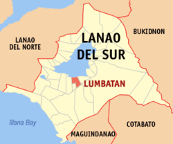 Map of Lanao del Sur with Lumbatan highlighted | |
OpenStreetMap 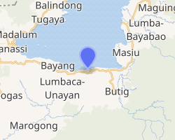
| |
.svg.png) Lumbatan Location within the Philippines | |
| Coordinates: 7°47′06″N 124°15′22″E | |
| Country | |
| Region | Bangsamoro Autonomous Region in Muslim Mindanao (BARMM) |
| Province | Lanao del Sur |
| District | 2nd District |
| Barangays | 21 (see Barangays) |
| Government | |
| • Type | Sangguniang Bayan |
| • Mayor | Allan "Bombi" I. Lao |
| • Vice Mayor | Mohiddin C. Mua |
| • Congressman | Yasser A. Balindong |
| • Electorate | 14,151 voters (2019) |
| Area | |
| • Total | 158.39 km2 (61.15 sq mi) |
| Population (2015 census)[3] | |
| • Total | 19,105 |
| • Density | 120/km2 (310/sq mi) |
| • Households | 2,263 |
| Economy | |
| • Income class | 5th municipal income class |
| • Poverty incidence | 65.79% (2015)[4] |
| • Revenue (₱) | 61,166,852.03 (2016) |
| Time zone | UTC+8 (PST) |
| ZIP code | 9307 |
| PSGC | |
| IDD : area code | +63 (0)63 |
| Climate type | tropical climate |
| Native languages | Maranao Tagalog |
| Website | www |
The town has a full view of Mount Makaturing.
Barangays
Lumbatan is politically subdivided into 21 barangays.
- Alog
- Gandamatu (not included).[5]
- Bayasungen (Raya Macadar)
- Buad
- Budi (Lake side of the Ranau)
- Dago-ok
- Dalama
- Dalipuga
- Lalapung
- Lumbac (Old name is Talbo)
- Lumbac Bacayawan (Tomarumpong Macadar / Aman village)
- Lunay
- Sugoda Tambac (not included)
- Macadar (Gandamatu City, Poblacion).
- Madaya (Tambac City), poblacion, (Sulayman Village).
- Maniokod (not included)
- Minanga Macadar
- Pantar
- Picotaan
- Poblacion (Lumbatan)
- Buadi Apha (not included) (Map from Hadjiunos residence down to Abaga falls)
- Tambac Oriental
- Tambac Occidental (not included)
- Bubong Macadar
- Penaring (Lilod a Macadar)
- Ligue
Climate
| Climate data for Lumbatan, Lanao del Sur | |||||||||||||
|---|---|---|---|---|---|---|---|---|---|---|---|---|---|
| Month | Jan | Feb | Mar | Apr | May | Jun | Jul | Aug | Sep | Oct | Nov | Dec | Year |
| Average high °C (°F) | 25 (77) |
26 (79) |
26 (79) |
26 (79) |
26 (79) |
25 (77) |
25 (77) |
25 (77) |
25 (77) |
25 (77) |
25 (77) |
26 (79) |
25 (78) |
| Average low °C (°F) | 19 (66) |
20 (68) |
20 (68) |
21 (70) |
21 (70) |
21 (70) |
20 (68) |
20 (68) |
20 (68) |
20 (68) |
20 (68) |
21 (70) |
20 (69) |
| Average precipitation mm (inches) | 236 (9.3) |
225 (8.9) |
244 (9.6) |
235 (9.3) |
304 (12.0) |
287 (11.3) |
200 (7.9) |
175 (6.9) |
158 (6.2) |
200 (7.9) |
287 (11.3) |
243 (9.6) |
2,794 (110.2) |
| Average rainy days | 24.3 | 22.3 | 26.0 | 27.2 | 28.3 | 27.2 | 25.8 | 24.8 | 22.2 | 25.4 | 27.2 | 25.8 | 306.5 |
| Source: Meteoblue [6] | |||||||||||||
Demographics
| Year | Pop. | ±% p.a. |
|---|---|---|
| 1918 | 2,596 | — |
| 1939 | 7,961 | +5.48% |
| 1948 | 9,284 | +1.72% |
| 1960 | 18,006 | +5.67% |
| 1970 | 17,790 | −0.12% |
| 1975 | 19,285 | +1.63% |
| 1980 | 8,750 | −14.61% |
| 1990 | 14,765 | +5.37% |
| 1995 | 15,505 | +0.92% |
| 2000 | 17,445 | +2.56% |
| 2007 | 24,036 | +4.52% |
| 2010 | 16,719 | −12.37% |
| 2015 | 19,105 | +2.57% |
| Source: Philippine Statistics Authority[3][7][8][9] | ||
History
Macadar, the old town of Lumbatan, Province of Sultan Mardan.[10] 2nd District in Lanao del Sur, (not use or not confirmed). ;Sultan Mardan in Macadar, was among to the 15th century rulers of the Sultanates of Lanao.
In 2004, nine barangays of Lumbatan were made into Lumbaca-Unayan, a separate municipality.
Barangay Ligue was created out of barangay Pantar in pursuant to Muslim Mindanao Autonomy Act No. 79 dated 27 October 1998, which was ratified through a plebiscite conducted by the COMELEC on March 25, 2006.[11]
References
- "Municipality". Quezon City, Philippines: Department of the Interior and Local Government. Retrieved 31 May 2013.
- "Province: Lanao del Sur". PSGC Interactive. Quezon City, Philippines: Philippine Statistics Authority. Retrieved 12 November 2016.
- Census of Population (2015). "ARMM – Autonomous Region in Muslim Mindanao". Total Population by Province, City, Municipality and Barangay. PSA. Retrieved 20 June 2016.
- "PSA releases the 2015 Municipal and City Level Poverty Estimates". Quezon City, Philippines. Retrieved 12 October 2019.
- maraming nakatira dito sa Barit de Gandamatu
- "Lumbatan, Lanao del Sur : Average Temperatures and Rainfall". Meteoblue. Retrieved 27 January 2019.
- Census of Population and Housing (2010). "ARMM – Autonomous Region in Muslim Mindanao". Total Population by Province, City, Municipality and Barangay. NSO. Retrieved 29 June 2016.
- Censuses of Population (1903–2007). "ARMM – Autonomous Region in Muslim Mindanao". Table 1. Population Enumerated in Various Censuses by Province/Highly Urbanized City: 1903 to 2007. NSO.
- "Province of Lanao del Sur". Municipality Population Data. Local Water Utilities Administration Research Division. Retrieved 17 December 2016.
- Txt msg Province of Sultan Mardan is also recommendation by the elders people of Unayan (i.g. General Mamarinta Lao and judge Mama Busran)
- National Statistical Coordination Board (2006-04-27). "2006 Factsheet". Archived from the original on 2007-09-30. Retrieved 2006-06-24.
External links
- Lumbatan Profile at PhilAtlas.com
- Philippine Standard Geographic Code
- Philippine Standard Geographic Code
- Philippine Census Information
- Local Governance Performance Management System
Places adjacent to Lumbatan | ||||||||||
|---|---|---|---|---|---|---|---|---|---|---|
| ||||||||||