Bayang
Bayang, officially the Municipality of Bayang (Maranao and Iranun: Inged a Bayang; Tagalog: Bayan ng Bayang), is a 5th class municipality in the province of Lanao del Sur, Philippines. According to the 2015 census, it has a population of 23,965 people.[3]
Bayang | |
|---|---|
| Municipality of Bayang | |
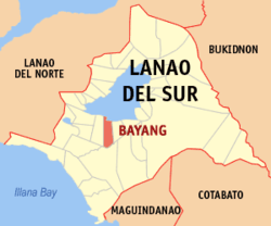 Map of Lanao del Sur with Bayang highlighted | |
OpenStreetMap 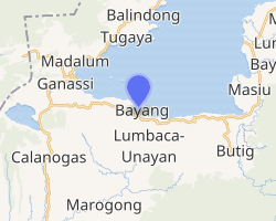
| |
.svg.png) Bayang Location within the Philippines | |
| Coordinates: 7°47′35″N 124°11′31″E | |
| Country | |
| Region | Bangsamoro Autonomous Region in Muslim Mindanao (BARMM) |
| Province | Lanao del Sur |
| District | 2nd District |
| Barangays | 49 (see Barangays) |
| Government | |
| • Type | Sangguniang Bayan |
| • Mayor | Aslani P. Balt |
| • Vice Mayor | Johanisah B. Radiamoda |
| • Congressman | Yasser A. Balindong |
| • Electorate | 16,453 voters (2019) |
| Area | |
| • Total | 230.00 km2 (88.80 sq mi) |
| Population (2015 census)[3] | |
| • Total | 23,965 |
| • Density | 100/km2 (270/sq mi) |
| • Households | 2,517 |
| Economy | |
| • Income class | 5th municipal income class |
| • Poverty incidence | 66.48% (2015)[4] |
| • Revenue (₱) | 65,472,033.25 (2016) |
| Time zone | UTC+8 (PST) |
| ZIP code | 9309 |
| PSGC | |
| IDD : area code | +63 (0)63 |
| Climate type | tropical climate |
| Native languages | Maranao Tagalog |
| Website | www |
Barangays
Bayang is politically subdivided into 49 barangays.
- Bagoaingud
- Bairan (Poblacion)
- Bandingun
- Biabi
- Bialaan
- Bubong Lilod
- Bubong Raya
- Cadayonan
- Cadingilan Occidental
- Cadingilan Oriental
- Condaraan Pob. (Condaraan Dimadap)
- Cormatan
- Gandamato
- Ilian
- Lalapung Central
- Lalapung Proper
- Lalapung Upper
- Linao
- Linuk (Poblacion)
- Liong
- Lumbac
- Cadayonan Lumbac
- Maliwanag
- Mapantao
- Mimbalawag
- Palao
- Pama-an
- Pamacotan
- Pantar
- Parao
- Patong
- Bayang Pobl.
- Porotan
- Rantian
- Cadayonan Raya
- Rinabor
- Samporna (Poblacion)
- Sapa
- Silid
- Sugod
- Sultan Pandapatan
- Sumbag (Poblacion)
- Tagoranao
- Tangcal
- Tangcal Proper
- Tomarompong
- Tomongcal Ligi
- Torogan
- Tuca (Poblacion)
Demographics
| Year | Pop. | ±% p.a. |
|---|---|---|
| 1918 | 1,982 | — |
| 1939 | 4,480 | +3.96% |
| 1948 | 4,817 | +0.81% |
| 1960 | 24,315 | +14.44% |
| 1970 | 23,772 | −0.23% |
| 1975 | 19,455 | −3.94% |
| 1980 | 18,811 | −0.67% |
| 1990 | 18,928 | +0.06% |
| 1995 | 20,060 | +1.09% |
| 2000 | 21,020 | +1.01% |
| 2007 | 24,185 | +1.95% |
| 2010 | 21,472 | −4.24% |
| 2015 | 23,965 | +2.11% |
| Source: Philippine Statistics Authority[3][5][6][7] | ||
Climate
| Climate data for Bayang, Lanao de Sur | |||||||||||||
|---|---|---|---|---|---|---|---|---|---|---|---|---|---|
| Month | Jan | Feb | Mar | Apr | May | Jun | Jul | Aug | Sep | Oct | Nov | Dec | Year |
| Average high °C (°F) | 25 (77) |
26 (79) |
26 (79) |
26 (79) |
26 (79) |
25 (77) |
25 (77) |
25 (77) |
25 (77) |
25 (77) |
25 (77) |
26 (79) |
25 (78) |
| Average low °C (°F) | 19 (66) |
20 (68) |
20 (68) |
21 (70) |
21 (70) |
21 (70) |
20 (68) |
20 (68) |
20 (68) |
20 (68) |
20 (68) |
20 (68) |
20 (68) |
| Average precipitation mm (inches) | 236 (9.3) |
225 (8.9) |
244 (9.6) |
235 (9.3) |
304 (12.0) |
287 (11.3) |
200 (7.9) |
175 (6.9) |
158 (6.2) |
200 (7.9) |
287 (11.3) |
243 (9.6) |
2,794 (110.2) |
| Average rainy days | 24.3 | 22.3 | 26.0 | 27.2 | 28.3 | 27.2 | 25.8 | 24.8 | 22.2 | 25.4 | 27.2 | 25.8 | 306.5 |
| Source: Meteoblue [8] | |||||||||||||
History
In May 1902, during the Moro Rebellion (also known as the Moro–American War[9]), Bayang was the site of a clash between Moro rebels and American troops that became known as the Battle of Bayang. The American troops, three infantry battalions and a battery of artillery total to some 1200 men, were led to Bayang by colonel Frank Baldwin to demand the extradition of the Moros responsible for the ambushing and killing of two American soldiers at the construction of a road from Iligan to Lake Lanao, two months earlier.[10]
When the sultan of Bayang refused, Baldwin's troops attacked and captured the nearby cotta (fortress; "small, castle-like structures with thick, high walls"[11]) of Binidayan on 2 May. They subsequently attempted to capture the cotta of Pandapatan, which resisted the artillery fire and was only subdued the next day after hand-to-hand combat between Moros and Americans. The number of Moro casualties is estimated at 300 to 400, including the sultan of Bayang and his brother. On the American side, ten soldiers were killed and some forty wounded.[10][11]
The cotta of Pandapatan has been preserved as a historical monument; the fallen of the Battle of Bayang are considered martyrs by Filipino Muslims.[9]
Education
Elementary Schools
- Dandamun Central Pilot School,Lower Bayang District
- Rantian Elementary School
- Linuk Primary School
- Gandamato Primary School
- Anal Primary School
- Cota Primary School
- Sumbag Primary School
- Samporna Primary School
- Tomarompong Primary School
- Balidong-Adil Primary School
- Sultan Pandapatan Central Elementary School, Upper Bayang District
- Tagoranao Elementary School
- Bandingun Elementary School
- Linao Elementary School
- Palao Elementary School
- Raya Bubong Primary School
- Ilian Primary School
- Sugod Primary School
- Cobo Primary School
- Cadingilan Primary School
- Mimbalawag Primary School
- Bialaan Primary School
- Biabi Primary School
- Diwan Central Elementary School, Diwan District
- Bubong Elementary School
- Lucman Elementary School
- Cadayonan Primary School
- Dimunda Primary School
- Raya Cadayonan Primary School
- Patong Primary School
- Sapa Primary School
- Ligui Primary School
- Lumbac Primary School
- Toca Primary School
Secondary Schools
- Mauyag C. Papandayan National High School, Rinabor, Bayang, Lanao del Sur
- Bayang National High School, Biabi, Bayang, Lanao del Sur
- Upper Bayang National High School,Raya Bubong, Bayang, Lanao del Sur
Points of interest
- Padang Karbala Shrine located at Sultan Pandapatan Bayang
- Malaa Alad
- Dandamun Mosque
References
- "Municipality". Quezon City, Philippines: Department of the Interior and Local Government. Retrieved 31 May 2013.
- "Province: Lanao del Sur". PSGC Interactive. Quezon City, Philippines: Philippine Statistics Authority. Retrieved 12 November 2016.
- Census of Population (2015). "ARMM – Autonomous Region in Muslim Mindanao". Total Population by Province, City, Municipality and Barangay. PSA. Retrieved 20 June 2016.
- "PSA releases the 2015 Municipal and City Level Poverty Estimates". Quezon City, Philippines. Retrieved 12 October 2019.
- Census of Population and Housing (2010). "ARMM – Autonomous Region in Muslim Mindanao". Total Population by Province, City, Municipality and Barangay. NSO. Retrieved 29 June 2016.
- Censuses of Population (1903–2007). "ARMM – Autonomous Region in Muslim Mindanao". Table 1. Population Enumerated in Various Censuses by Province/Highly Urbanized City: 1903 to 2007. NSO.
- "Province of Lanao del Sur". Municipality Population Data. Local Water Utilities Administration Research Division. Retrieved 17 December 2016.
- "Bayang, Lanao del Sur : Average Temperatures and Rainfall". Meteoblue. Retrieved 24 January 2019.
- Antonio J. Montalvan II (13 May 2002). "The war that no one remembers". Philippine Daily Enquirer.
- Paul J. Springer (2009). "Bayang, Battle of". In Spencer Tucker (ed.). The Encyclopedia of the Spanish-American and Philippine-American Wars. 1. ABC-CLIO. pp. 49–50.
- Alexander M. Bielakowski, ed. (2013). Ethnic and Racial Minorities in the U.S. Military. ABC-CLIO. p. 444. Missing or empty
|title=(help)
External links
- Bayang Profile at PhilAtlas.com
- Philippine Standard Geographic Code
- Philippine Census Information
- Local Governance Performance Management System
Places adjacent to Bayang | ||||||||||
|---|---|---|---|---|---|---|---|---|---|---|
| ||||||||||