San Pedro, Laguna
San Pedro, officially the City of San Pedro (Tagalog: Lungsod ng San Pedro), is a 1st class city in the province of Laguna, Philippines. According to the 2015 census, it has a population of 325,809 people.[6]
San Pedro | |
|---|---|
| City of San Pedro | |
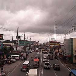 View of Manila South Road (Old national highway). San Pedro Doctors at the right side. | |
 Seal | |
| Nickname(s): Sampaguita Capital of the Philippines and the Shrine city of the South Laguna's Gateway to Metro Manila[1] | |
| Motto(s): Sipag at Pananampalataya sa Diyos tungo sa Kaunlaran ng San Pedro (Hard work and Faith in God towards San Pedro's progress); Magandang San Pedro Po | |
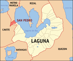 Map of Laguna with San Pedro highlighted | |
OpenStreetMap 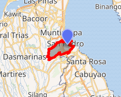
| |
.svg.png) San Pedro Location within the Philippines | |
| Coordinates: 14°21′30″N 121°03′30″E | |
| Country | |
| Region | Calabarzon (Region IV-A) |
| Province | Laguna |
| District | 1st District |
| Founded | January 18, 1725 |
| Cityhood | December 28, 2013[2][3] |
| Named for | St. Peter the Apostle |
| Barangays | 27 (see Barangays) |
| Government | |
| • Type | Sangguniang Panlungsod |
| • Mayor | Lourdes S. Catáquiz |
| • Vice Mayor | Art Joseph Francis Mercado |
| • Congressman | Danilo Ramon S. Fernandez |
| • Electorate | 186,049 voters (2019) |
| Area | |
| • Total | 24.05 km2 (9.29 sq mi) |
| Area rank | 29 out of 30 (in Laguna |
| Highest elevation | 117.348 m (385.000 ft) |
| Population (2015 census)[6] | |
| • Total | 325,809 |
| • Rank | 4 out of 30 (in Laguna)[7] |
| • Density | 14,000/km2 (35,000/sq mi) |
| • Households | 71,496 |
| Economy | |
| • Poverty incidence | 2.69% (2015)[8] |
| • Revenue (₱) | 979,746,719.97 (2016) |
| Time zone | UTC+8 (PST) |
| ZIP code | 4023 |
| PSGC | |
| IDD : area code | +63 (0)2 |
| Climate type | tropical monsoon climate |
| Native languages | Tagalog |
| Website | cityofsanpedrolaguna |
It is named after its patron saint, Peter the Apostle.[9]
Despite being the third smallest in the entire province, with a total land surface area of only 24.05 km2, San Pedro is the fourth largest city in terms of population after the cities of Calamba, Biñan, and Santa Rosa. The city also has the highest population density in the province of Laguna and in the whole Calabarzon region, having 14,000 people/km2.[9]
History
San Pedro de Tunasán became a town on January 18, 1725, when King Charles II of Spain decreed that the town formerly known as "Tabuko" be a separate town from "Kabullaw" (now known as the city of Cabuyao).[9]
By virtue of the last will of Philip V of Spain, Rodriguez de Figueroa or "Don Esteban", a group of Augustinian Fathers gained the ownership of the Tunasán Estate. Later on, San Pedro became an hacienda of Colegio de San José, a group of Jesuits friars who took over the property which now is known as "San Pedro Tunasán". Tunasán literally means "a place where there is Tunás" (Nymphaea nouchali[10]), a medicinal plant abundant on shoreline area.[9]
During that period, agriculture, fishing, duck raising, fruit trees, and sampaguita were the main source of income of its residents. This period was highlighted by the growing tenant/landlord dispute. The tenants of Hacienda San Pedro Tunasán fought for their birthrights over their ancestral lands. This struggle took almost 423 years of unsuccessful resistance to Colegio de San José, and in 1938, the government bought the home sites of the San Pedro Tunasán Hacienda from the Colegio for re-sale to its tenants. This event laid to rest the tenants/landlord problem in the town.
In the year 1902, the name San Pedro de Tunasán was simplified to San Pedro.
From the Spanish time until after the Japanese occupation of the Philippines, the scenario did change a bit, when on August 30, 1954, beginning to the Philippine Commonwealth forces against the Japanese, President Ramón Magsaysay signed at the historic town plaza the Land Tenancy Act. By virtue of this law, farm lots of the hacienda were bought by the Philippine government to be sold at cost to the tenants or occupants of the farm lots in Bayan-Bayanan under the Narra Settlement Project of the Magsaysay Administration.
Cityhood
On March 27, 2013, President Benigno Aquino III signed the Republic Act No. 10420[11] converting the municipality into a new component city of the province of Laguna. The cityhood of San Pedro was ratified through a plebiscite scheduled by the Commission on Elections (COMELEC). The date for the ratification is December 28, 2013 after the National Barangay Elections. It became the sixth city of Laguna after the cities of Biñan, Cabuyao, Calamba, San Pablo, and Santa Rosa, and also the third to be a city in the 1st congressional district of Laguna - making it the first city district in the province.
COMELEC officially proclaimed the first-class municipality of San Pedro as a component city of Laguna on December 29, 2013. Juanito Icarro, regional director of Calabarzon and Mimaropa, and Marianne Marfori, provincial election supervisor, made the proclamation at the municipal hall after San Pedro residents voted for the cityhood in a plebiscite held on December 28, 2013. "Yes" votes for cityhood totaled 16,996 (which is an additional 50 votes added in some precincts mostly in the San Vicente area to win the "yes" vote), and "no" votes, only 869, in 501 clustered precincts in San Pedro. Only 11% of 165,777 registered voters in San Pedro's 27 barangays took part in the plebiscite.
San Pedro City eyed as 18th member of Metro Manila
Support groups from the local government and non-government organizations are striving to incorporate San Pedro into Metro Manila.[12][13]
Former Metro Manila Development Authority (MMDA) Chairman Francis Tolentino is pushing for the inclusion of San Pedro City in the National Capital Region, and eventually become its 18th member city. Tolentino said that in the first meeting of the MMDA Council of mayors in January 2015, he will push for the inclusion of the city to the MMDA.[14]
Senator Aquilino "Koko" Pimentel III is seeking the separation of the City of San Pedro from the first legislative district of Laguna province to constitute a lone congressional district. In 2015, Pimentel filed Senate Bill No. 3029 for the creation of the San Pedro City as a separate district to commence in the next national and local elections.[15]
Geography
San Pedro is located in Region IV-A or Calabarzon. San Pedro is the boundary between Laguna and Metro Manila, so San Pedro is known as "Laguna's Gateway to Metro Manila". San Pedro shares boundaries with Metro Manila's southernmost city, Muntinlupa (North) bounded with Tunasan River, Biñan (South), Dasmariñas (West), Carmona and Gen. Mariano Alvarez (Southwest) bound with San Isidro River. Its position makes San Pedro a popular suburban residential community, where many residents commute daily to Metro Manila for work.[9]
Barangays
San Pedro is politically subdivided into 27 barangays. Barangay San Antonio is the largest barangay, which has a total of 780 hectares, while Barangay San Vicente is the most populous with a total population of 92,092.[16]
- Bagong Silang
- Calendola
- Chrysanthemum1
- Cuyab
- Estrella
- Fatima2
- G.S.I.S.
- Landayan
- Langgam
- Laram
- Maharlika3
- Magsaysay
- Narra
- Nueva
- Pacita 14
- Pacita 25
- Poblacion
- Riverside
- Rosario6
- Sampaguita Village
- San Antonio
- San Roque
- San Vicente
- San Lorenzo Ruiz7
- Santo Niño
- United Bayanihan
- United Better Living
1 2 3 4 5 6 7^Seven new barangays created as separate and distinct from its mother Barangay San Vicente after it was ratified and approved through a plebiscite held on July 11, 2015 under COMELEC Resolution No. 9969.[17]
Climate
| Climate data for San Pedro City, Laguna | |||||||||||||
|---|---|---|---|---|---|---|---|---|---|---|---|---|---|
| Month | Jan | Feb | Mar | Apr | May | Jun | Jul | Aug | Sep | Oct | Nov | Dec | Year |
| Average high °C (°F) | 29 (84) |
30 (86) |
32 (90) |
34 (93) |
32 (90) |
31 (88) |
29 (84) |
29 (84) |
29 (84) |
30 (86) |
30 (86) |
29 (84) |
30 (87) |
| Average low °C (°F) | 21 (70) |
20 (68) |
21 (70) |
22 (72) |
24 (75) |
24 (75) |
24 (75) |
24 (75) |
24 (75) |
23 (73) |
22 (72) |
21 (70) |
23 (73) |
| Average precipitation mm (inches) | 10 (0.4) |
10 (0.4) |
12 (0.5) |
27 (1.1) |
94 (3.7) |
153 (6.0) |
206 (8.1) |
190 (7.5) |
179 (7.0) |
120 (4.7) |
54 (2.1) |
39 (1.5) |
1,094 (43) |
| Average rainy days | 5.2 | 4.5 | 6.4 | 9.2 | 19.7 | 24.3 | 26.9 | 25.7 | 24.4 | 21.0 | 12.9 | 9.1 | 189.3 |
| Source: Meteoblue[18] | |||||||||||||
Demographics
|
| ||||||||||||||||||||||||||||||||||||||||||||||||
| Source: Philippine Statistics Authority[6][19][20][21] | |||||||||||||||||||||||||||||||||||||||||||||||||
The City of San Pedro is the 37th most populous city in the Philippines. As of 2015, the population is 325,809, up from 294,310 in 2010, or an increase of almost 11%. Its area is 24.05 square kilometres (9.29 sq mi) with a density of 13,547/km2 (35,087/sq mi).
Religion
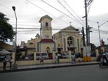
San Pedro is home for the famous Krus ng San Pedro Tunasán. Majority of the people are Roman Catholics. Other religious groups include are the Members Church of God International (MCGI), Jesus Miracle Crusade International Ministry (JMCIM), United Church of Christ in the Philippines (UCCP), Jesus Is Lord Church (JIL), Jesus Christ the Lifegiver Ministries (JCLM), Iglesia Ni Cristo (INC), The United Methodist Church, Presbyterian Churches, Christian Bible Baptist Church, other Baptist and Bible Fundamental churches. Islam is also practiced within the community. There are 15 Catholic parishes in the city, and one mosque.
Economy
Most economic activity in San Pedro is concentrated at San Antonio, also the city's largest and most populous barangay. Barangay Nueva, the city center, is home to a central public market (palengke) as well as clothing and homeware stores, and some supermarkets. San Pedro also has a large number of factories, most notably the Alaska Milk Corporation factory in San Antonio.
Agriculture
Agricultural lands now account for only thirteen hectares of the total land area due to residential, commercial and industrial conversions. There are lands with slope ranging from 8%-15% of the total land area located in parts of barangays San Antonio and San Vicente planted with mangoes and siniguelas trees. Livestock and poultry businesses operate in the area.
Commerce and industry
There are 4,705 total business establishments, 40+ commercial, savings and rural banks, 110+ restaurant, cafeteria, and other refreshment parlor, and two public and five private markets and supermarkets. There are 40 banks, over 60 pawnshops, over 30 lending institutions and 11 insurance companies operating in the city. Commercial and business establishments are mostly concentrated at Pacita Complex and Rosario. A large percentage of industrial and manufacturing establishments of San Pedro is located on the adjacent barangays of San Vicente and San Antonio; E&E Industrial Complex is located in San Antonio where some of the city's factories are situated.
Malls
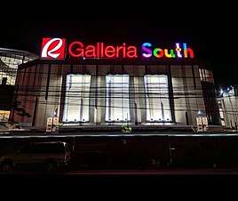
Robinsons Galleria South, San Pedro's first major mall located at Barangay Nueva, opened in July 19, 2019. Galleria South is the 1st Robinsons Galleria mall in South Luzon and 3rd nationwide. The mall houses government offices like Philhealth, Pag-ibig, LTO, etc, and also has art pieces at every corner.[22]
Tourism
Sampaguita Festival
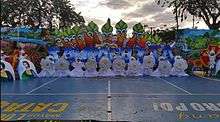
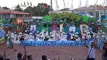
The annual City Festival is celebrated in the second week of February. This week-long festival includes various activities ranging from cultural to sports, trade fairs, amateur singing contests, parades, historical exhibits, social and religious gatherings, tribal dances, street dances, cheering and sport exhibitions. The highlight of the festival is the coronation night of the "Hiyas ng San Pedro". The festival aims to promote tourism in San Pedro and to revitalize Sampaguita industry in the community.The celebration was formerly known as "Manok ni San Pedro Festival", which started in 1999 and was renamed to "Sampaguita Festival" in 2002. The celebration kicked off with a grand parade.
San Pedro City holds the record of laying the longest sampaguita (flower lei) line, spanning 3.6 km (2 mi), from Biñan City - San Pedro City boundary to San Pedro City - Muntinlupa City boundary on the National Highway; this was listed in the Guinness World Records in 2009.
Christmas Festival
Paskuhan Sa San Pedro is an annually celebrated festival in San Pedro City. It starts at the beginning of December and runs to the end of the month. The opening is a grand parade which is participated in by public and private schools in the city, local government and other socio-civic organizations. The main event of the opening is the lighting of the whole plaza, fireworks display, and various school performances. Every night a variety of shows are performed by the participants, which last up to midnight. On 29 December of every year the cityhood anniversary of San Pedro is celebrated.
Salvador Laurel Museum and Library
The museum preserves and celebrates the insurmountable professional and Political avchievement of the late statesman, located at Holliday hills.[23]
Transportation
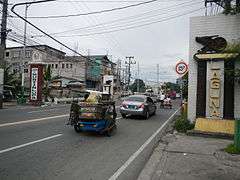
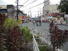
San Pedro is traversed by the South Luzon Expressway, which roughly cuts through the middle of town, and the older National Highway (Route 1), an at-grade route mostly used by public transportation.
San Pedro is at the terminus of numerous city bus routes, and the central bus terminal is at Pacita Complex. Jeepneys ply the highway, and there are also jeepneys that connects the barangays to the west. Most of the city is served by tricycles, while barangay Landayan and some subdivisions (gated communities) have pedicabs as well.
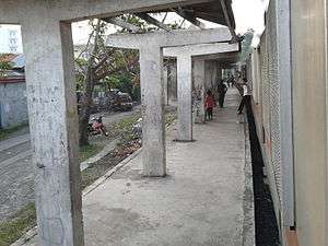
The PNR Metro Commuter Line serves the city, with two stations: San Pedro (at barangay San Vicente) and Pacita Main Gate (at Nueva).
Healthcare
Throughout the city, healthcare is primarily provided at the Barangay Health Centers in every barangay. Also, several medical missions are operated and provided by local and international organizations. The major hospitals in the city are:
- Jose L. Amante Emergency Hospital (Barangay Santo Niño)
- Gavino Alvarez Lying-In Center (Barangay Narra)
- San Pedro Doctors Hospital (Manila South Road-Landayan)
- Divine Mercy Hospital (Guevara Subd.)
- Westlake Medical Center (Manila South Road-Pacita Complex)
- Evangelista Medical Specialty Hospital (Macaria Ave.-Pacita Complex)
- Family Care Hospital (Macaria Ave.-Pacita Complex)
Housing
Most people in San Pedro live in over 59 subdivisions, that are either gated communities or open residential areas. The city is also a location of several government-led relocation projects. Squatters, or informal settlers, are scattered over the city.
Education
The Department of Education Region IV-A - Division of San Pedro supervises the operation of over 12 public elementary schools and 7 public high schools and provides permits to over 35 private schools, including Catholic schools. Private schools are scattered throughout the city, especially on the subdivisions. With the implementation of the K-12 program, some private schools added senior high schools, and many public high schools still have limited facilities for the senior high school.
Tertiary education and technical education are provided by several institutions scattered on the city. The Laguna Northwestern College has two campuses in San Pedro, one being a branch on Pacita Complex and the other one at A. Mabini St.. Polytechnic University of the Philippines has one campus in the city. San Pedro College of Business Administration in Barangay Nueva provides courses related to business administration. And recently, San Pedro City Polytechnic College located at Barangay Narra has opened it's door last 2017 to students of San Pedro
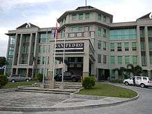
Local government
List of former mayors
Municipal mayors:
- Turibio Almieda (1901-1902)
- Jose Guevarra (1908-1910)
- Apolonio Morando (1910-1912)
- Jose H. Guevarra (1921-1922)
- Tiburcio Morando (1916-1921;1922-1925)
- Victor Vergara (1925-1926)
- Jose Martinez (1928-1934)
- Ciriaco M. Limpiahoy (1934-1942)
- Antonio Partoza (1945)
- Benedictio Austria
- Gavino Y. Alvarez
- Mario M. Brigola (1960-1963)
- Jose L. Amante (1941;1946-1947)
- Felicismo Vierneza (1972-1986; 1998-2007)
- Calixto R. Catáquiz (1986-1998; 2007-2013)
City mayors:
- Lourdes S. Catáquiz (2013–present)
City Seal
The City of San Pedro logo represents San Pedro's identity – a Gateway City:
- Being the first city of Laguna from Metro Manila, San Pedro is gateway to the Province and likewise to the Calabarzon Region, the country's premier growth area.
- Being a pilgrimage tourism destination on account of the miraculous Lolo Uweng Shrine, San Pedro is a place for holiness and religious devotion that can lead the Christian believer to eternal life in God's Kingdom, thus, it is Gateway to Heaven.
- San Pedro is named after Saint Peter to whom Christ entrusted the keys to the gates of heaven. Matthew 16:19: ”I will give you the keys of the kingdom of heaven, and whatever you bind on earth shall be bound in heaven, and whatever you loose on earth shall be loosed in heaven.”
- Shapes and colors
- Circles have no beginning nor end. They protect, they endure, they restrict. They confine what's within and keep things out. They offer safety and connection. They suggest community, integrity, and perfection.
- White is color at its most complete and pure, the color of perfection. It means purity, innocence, wholeness and completion. White is the base color of the logo.
- The Red Circle suggests excitement, energy, passion, love, desire, speed, strength, power, thus contributing to the success of all things intense and passionate.
- The Black Circle suggests power, sophistication, formality, and elegance.
- The Green Circle suggests balance, growth and self-reliance.
- Gold is the color of success, achievement and triumph. It is also associated with abundance and prosperity, luxury and quality, prestige and sophistication, value and elegance. Its color psychology implies affluence, material wealth and extravagance.
- Blue stands for peace, tranquility, calm, stability, harmony, unity, trust, truth, confidence, conservatism, security, cleanliness, order, loyalty, sky, water, and technology. It is the color of trust and peace. It can suggest loyalty and integrity.
- San Pedro Arch, the logo's main element, reflect the city's status as a gateway to and from Metro Manila, Laguna Province and the whole of Calabarzon.
- Roosters
- These roosters, porched on the Arch, represent the incident where Peter denied Jesus, followed by the crowing of the roosters. The Christian world calls this the Incident of Repentance. For the crowing of the rooster was followed by Saint Peter's bitter cry and plea for forgiveness.
- Keys
- The keys symbolize the power to enter the kingdom of heaven, and Saint Peter holding the keys tightly means he holds the most important thing that leads to heaven, that is Knowledge of God.
- The Gold Ancient Keys in the Arch also represent greatness and power, among others. These keys symbolize the city's never-ending quest for opportunities that will contribute to its growth and progress.
- Sampaguita garland
- This symbolizes San Pedro's distinction as the Sampaguita Capital of the Philippines. Some would question this title due to the absence now of a tangible heritage, which are the vast tracks of Sampaguita farms that gave rise to the Sampaguita industry in San Pedro during the olden times. But the claim to this title is justified by the fact that the city still owns the intangible heritage of having the most skillful and most creative makers of Sampaguita products in the country. Moreover, the Sampaguita Festival which is being celebrated annually by San Pedro is the only festival in the country which gives honor and recognition to the national flower.
- The twenty Sampaguita buds forming a lei represent the 20 barangays of San Pedro. It also symbolizes unity and harmony among the city constituents. The number of buds may be increased through time should new barangays are created in the future.
- Sun
- This Star is our logo's connection to the Philippine National Flag. Its 8 rays symbolize the 8 provinces (including Laguna) which first revolted against Spanish colonization during the 19th century.
- Words and date
- The words and date of 2013 note the city's status as a component city of the province of Laguna and as part of the number of cities of the Philippines, as well as the very year of the granting of its city charter. NOTE: Approved by the Sangguniang Panlungsod on February 17, 2014 under Resolution 2014-26 and City Ordinance 2014–10.
Notable people
- Casa Tipo
Entertainment
- Cacai Bautista, comedian
- Julia Clarete, TV host, actress
- John Lloyd Cruz, actor, model
- Jane De Leon, actress
- Ogie Diaz, comedian, columnist and TV host
- Paw Diaz, actress
- Marlann Flores, actress
- Kristine Hermosa, actress
- Jan Manual, actor
- Rocco Nacino, actor
- Jamilla Obispo, actress
- Gladys Reyes, actress
- Christopher Roxas, actor
- Princess Snell, actress
- Nikki Valdez, actress
Music
- Rico Blanco, singer, former vocalist of Rivermaya
Pageants
- Jennifer Hammond, Miss Intercontinental 2016 Top 15 Semi-finalist.
- Stephanie Retuya, contestant and runner-up in Asia's Next Top Model (cycle 1)
- Desiree Verdadero, Miss Universe 1984 3rd runner-up
Politics
Journalism and Broadcasting
- Tony Calvento, print/broadcast journalist for The Calvento Files
Sports
- Jema Galanza, PVL MVP, UAAP Beach Volleyball champion for Adamson University Lady Falcons
- Chris Javier, basketball player
References
- San Pedro City, Laguna, Philippines - Welcome Message
- San Pedro now a component city of Laguna - Philstar.com
- http://www.comelec.gov.ph/?r=Archives/Plebiscites/PlebiscitesSanPedroLaguna
- "City". Quezon City, Philippines: Department of the Interior and Local Government. Retrieved 30 May 2013.
- "Province: Laguna". PSGC Interactive. Quezon City, Philippines: Philippine Statistics Authority. Retrieved 12 November 2016.
- Census of Population (2015). "Region IV-A (Calabarzon)". Total Population by Province, City, Municipality and Barangay. PSA. Retrieved 20 June 2016.
- Laguna (province)#Administrative divisions
- "PSA releases the 2015 Municipal and City Level Poverty Estimates". Quezon City, Philippines. Retrieved 1 January 2020.
- San Pedro, Laguna Official Website - History
- Nymphaea nouchali
- gov.ph
- http://www.pna.gov.ph/index.php?&sid=10++.&pfn=720424&arch=1&go=Go&search_arch&andor&mdte_arch=12&ddte_arch=30&ydte_arch=2014
- "Archived copy". Manila Bulletin. Archived from the original on 2014-12-31. Retrieved 2015-03-08.CS1 maint: archived copy as title (link)
- "San Pedro City eyed as 18th member of MMDA". Manila Bulletin. 2014-12-31. Archived from the original on 2014-12-31. Retrieved 2018-09-07.
- "Press Release - Koko seeks the creation of San Pedro City as a separate congressional district". www.senate.gov.ph. Senate of the Philippines. Retrieved 2018-09-07.
- "MUNICIPALITY/CITY:City of San Pedro". Philippine Statistics Authority (National Statistical Coordination Board).
- "PLEBISCITE TO RATIFY THE CREATION OF SEVEN (7) NEW BARANGAYS SEPARATE AND DISTINCT FROM ITS MOTHER BARANGAY OF SAN VICENTE, SAN PEDRO CITY, LAGUNA". Philippines: Commission of Elections. June 11, 2015. Archived from the original on July 20, 2015.
- "San Pedro: Average Temperatures and Rainfall". Meteoblue. Retrieved 11 May 2020.
- Census of Population and Housing (2010). "Region IV-A (Calabarzon)". Total Population by Province, City, Municipality and Barangay. NSO. Retrieved 29 June 2016.
- Censuses of Population (1903–2007). "Region IV-A (Calabarzon)". Table 1. Population Enumerated in Various Censuses by Province/Highly Urbanized City: 1903 to 2007. NSO.
- "Province of Laguna". Municipality Population Data. Local Water Utilities Administration Research Division. Retrieved 17 December 2016.
- "This new mall in Laguna has art in every corner". ABS-CBN News. Retrieved 2019-09-09.
- "Salvador H Laurel museum and library". Salvador H. Laurel.
External links
| Wikivoyage has a travel guide for San Pedro City. |
| Wikimedia Commons has media related to San Pedro, Laguna. |
- San Pedro Profile at PhilAtlas.com
- Philippine Standard Geographic Code
- Philippine Census Information
- Local Governance Performance Management System
Places adjacent to San Pedro, Laguna | ||||||||||
|---|---|---|---|---|---|---|---|---|---|---|
| ||||||||||