Mamburao
Mamburao (pronounced [mɐmbʊraw]), officially the Municipality of Mamburao (Tagalog: Bayan ng Mamburao), is a 2nd class municipality and capital of the province of Occidental Mindoro, Philippines. According to the 2015 census, it has a population of 42,975 people.[3]
Mamburao | |
|---|---|
| Municipality of Mamburao | |
 Downtown area | |
 Seal | |
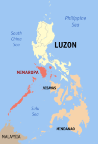
 Map of Occidental Mindoro with Mamburao highlighted | |
OpenStreetMap 
| |
.svg.png) Mamburao Location within the Philippines | |
| Coordinates: 13°13′24″N 120°35′46″E | |
| Country | |
| Region | Mimaropa (Region IV-B) |
| Province | Occidental Mindoro |
| District | Lone District |
| Founded | 1955 |
| Barangays | 15 (see Barangays) |
| Government | |
| • Type | Sangguniang Bayan |
| • Mayor | Angelina F. Tria |
| • Vice Mayor | Joel C. Panaligan |
| • Congressman | Josephine R. Sato |
| • Electorate | 28,550 voters (2019) |
| Area | |
| • Total | 283.51 km2 (109.46 sq mi) |
| Population (2015 census)[3] | |
| • Total | 42,975 |
| • Density | 150/km2 (390/sq mi) |
| • Households | 9,912 |
| Economy | |
| • Income class | 2nd municipal income class |
| • Poverty incidence | 21.09% (2015)[4] |
| • Revenue (₱) | 132,318,636.29 (2016) |
| Time zone | UTC+8 (PST) |
| ZIP code | 5106 |
| PSGC | |
| IDD : area code | +63 (0)43 |
| Climate type | tropical climate |
| Native languages | Iraya Tagalog |
| Website | mamburao |
History
Mamburao was originally settled by the Moro people and was one of their strongholds in the island of Mindoro. The settlement was the first one in Mindoro to be plundered by the Spaniards. Hearing that it was a rich town, the Spanish and their Pintado allies attacked and captured the population. The wealthy among their captives were then allowed to ransom themselves free. With their superior weapons and knowledge of war strategies used in their just concluded Reconquista, they utilised this method all around the islands, and by this the Spanish earned their gold.
On January 1, 1560, wanting more, Miguel López de Legazpi sent a fleet of 15 boats from Panay, led by his grandson Juan de Salcedo, to conquer the Moro town. Another expedition was sent to Mamburao, led by Salcedo and Martin de Goiti, with the intent of establishing Spanish presence in Mindoro.[5]
Catholicism was propagated in Mamburao and the town was placed under the third convent district based in Cavite. Mamburao was subjected to attack by the Mindanao Moro, guided by its former Mamburao inhabitants who wanted to claim their lands and have a prosperous life there between the 17th and 18th centuries. Mamburao, supported by its population, was even made into a sea haven by the Moros, who used it as base of their sea attacks against Friar induced settlements on coastal towns in Mindoro, Luzon and Visayas.
In the late 19th century, encouraged by Spanish authorities promising them rich lands to till, with weapons but in exchange for working as its ready foot soldiers on quick notice, Mamburao then saw an influx of Ilocano and Tagalog immigrants.[5]
Near the end of the Spanish colonial period in the Philippines, the settlement of Sablayan was incorporated to Mamburao as a barrio. In 1905 Paluan and Abra de Ilog were likewise incorporated under Act 1280. Abra de Ilog, Paluan and Sablayan were later carved out from Mamburao as separate municipalities. Another barrio of Mamburao, Santa Cruz, was also made into a separate municipality.[5]
Mamburao was designated as the capital of Occidental Mindoro when the island province of Mindoro was divided into two separate provinces on June 13, 1950: Oriental and Occidental Mindoro.[5]
Barangays
Mamburao is politically subdivided into 15 barangays. Eight barangays are found in the population created under P.D. 86 and seven are outside the poblacion area.
| Barangay | Urban/rural | Population (2015) |
|---|---|---|
| Balansay | ||
| Fatima (Tii) | ||
| Payompon | ||
| San Luis (Ligang) | ||
| Talabaan | ||
| Tangkalan | ||
| Tayamaan | ||
| Poblacion 1 (Barangay 1) | ||
| Poblacion 2 (Barangay 2) | ||
| Poblacion 3 (Barangay 3) | ||
| Poblacion 4 (Barangay 4) | ||
| Poblacion 5 (Barangay 5) | ||
| Poblacion 6 (Barangay 6) | ||
| Poblacion 7 (Barangay 7) | ||
| Poblacion 8 (Barangay 8) |
Climate
| Climate data for Mamburao, Occidental Mindoro | |||||||||||||
|---|---|---|---|---|---|---|---|---|---|---|---|---|---|
| Month | Jan | Feb | Mar | Apr | May | Jun | Jul | Aug | Sep | Oct | Nov | Dec | Year |
| Average high °C (°F) | 28 (82) |
29 (84) |
30 (86) |
31 (88) |
31 (88) |
30 (86) |
29 (84) |
29 (84) |
29 (84) |
29 (84) |
29 (84) |
28 (82) |
29 (85) |
| Average low °C (°F) | 22 (72) |
21 (70) |
22 (72) |
23 (73) |
25 (77) |
25 (77) |
25 (77) |
25 (77) |
25 (77) |
24 (75) |
23 (73) |
22 (72) |
24 (74) |
| Average precipitation mm (inches) | 48 (1.9) |
32 (1.3) |
41 (1.6) |
54 (2.1) |
257 (10.1) |
410 (16.1) |
466 (18.3) |
422 (16.6) |
429 (16.9) |
300 (11.8) |
137 (5.4) |
92 (3.6) |
2,688 (105.7) |
| Average rainy days | 10.8 | 8.0 | 9.8 | 11.7 | 23.1 | 27.5 | 29.2 | 28.7 | 28.7 | 25.5 | 18.2 | 12.8 | 234 |
| Source: Meteoblue [6] | |||||||||||||
Demographics
| Year | Pop. | ±% p.a. |
|---|---|---|
| 1903 | 1,927 | — |
| 1918 | 2,595 | +2.00% |
| 1939 | 4,423 | +2.57% |
| 1948 | 5,571 | +2.60% |
| 1960 | 5,822 | +0.37% |
| 1970 | 10,559 | +6.13% |
| 1975 | 12,655 | +3.70% |
| 1980 | 15,533 | +4.18% |
| 1990 | 21,781 | +3.44% |
| 1995 | 25,627 | +3.09% |
| 2000 | 30,378 | +3.71% |
| 2007 | 34,487 | +1.77% |
| 2010 | 39,237 | +4.81% |
| 2015 | 42,975 | +1.75% |
| Source: Philippine Statistics Authority[3][7][8][9] | ||
Transportation
Tricycles are a common mode of transportation in Mamburao. Vans, jeepneys, and buses are also available and are a means of traveling to other parts of the island of Mindoro such as the port of Abra de Ilog and the southern municipality of San Jose. Mamburao Airport serves chartered flights, although Philippine Airlines used to schedule regular flights at the airport.[10]
Economy
According to the Bureau of Local Government Finance, the annual regular revenue of Mamburao for the fiscal year of 2016 was ₱132,318,636.29.[11]
The economy of Mamburao is highly dependent on its agricultural produce. The two major crops are rice and corn. Rice production accounts to 25,527.80 MT with 4.484 MT/ha while corn production accounts to 16,273.60 MT or 7 MT/ha. This production has increased in both area and volume in the year 2016 to 2017. Exportation to Region IV-A or CALABARZON is also one of the municipality's roles.
Additionally, agricultural production is also varied with some farmers venturing on cassava, onion, mango, legumes, watermelon, and other products. There are also several livestock and dairy farmers particularly in Barangays Balansay, Tayamaan, and Payompon while there are also poultry farmer in Barangays Fatima, Balansay, Payompon, and Tayamaan.
Fisheries and aquaculture also play a vital role in the economy of the municipality. Among the three sectors of the fishing industry, marine fishery is the most prominent with Barangays Talabaan, Fatima, Balansay, Payompon, Poblacion 2, Poblacion 7, and Tayamaan being engaged in it. Products include yellow fin tuna, giant squid, roundscad/galunggong, lapu-lapu, Spanish mackerel, dalagang bukid, dilis, talakitok, bisugo, stonefish, prawns, crabs, and lobsters. Among these, yellow fin tuna, giant squid, and lobsters are exported to Europe, Japan, Dubai, and Hongkong.
In terms of Mamburao's commerce and trade, a concentration of commercial areas is seen in the Poblacion barangays as well as in Barangay Payompon. In 2017, there was a total of 701 establishments with space rental having the highest count. General merchandise stores are also numerous in the municipality. Local revenue has also accounted to more than 1 billion coming from commerce and trade. Industry, on the other hand, account to more than 47 million with several bagoong making establishments, rice mills, ice plants, and others. Some of these establishments also export to neighboring municipalities as well as in CALABARZON.[12]
Local government

Elected local government officials (2019-2022):
- Mayor: Angelina "Lyn" F. Tria
- Vice Mayor: Joel "Big J" C. Panaligan
- Sangguniang Bayan:
- Jenny C. Villar
- Fe Abeleda-Agoncillo
- Raul Masangkay
- Damaso Abeleda
- Eduardo "Boy" Maneja
- Boy Olfato
- Abel Pantoja
- Bito Alastre
Ex Officio members:
- ABC President: Alan T. Aquino
References
- "Municipality". Quezon City, Philippines: Department of the Interior and Local Government. Retrieved 31 May 2013.
- "Province: Occidental Mindoro". PSGC Interactive. Quezon City, Philippines: Philippine Statistics Authority. Retrieved 12 November 2016.
- Census of Population (2015). "Region IV-B (Mimaropa)". Total Population by Province, City, Municipality and Barangay. PSA. Retrieved 20 June 2016.
- "PSA releases the 2015 Municipal and City Level Poverty Estimates". Quezon City, Philippines. Retrieved 12 October 2019.
- "History". The Municipality of Mamburao. Mamburao Philippines. Archived from the original on 2 April 2015. Retrieved 1 April 2015.
- "Mamburao: Average Temperatures and Rainfall". Meteoblue. Retrieved 26 April 2020.
- Census of Population and Housing (2010). "Region IV-B (Mimaropa)". Total Population by Province, City, Municipality and Barangay. NSO. Retrieved 29 June 2016.
- Censuses of Population (1903–2007). "Region IV-B (Mimaropa)". Table 1. Population Enumerated in Various Censuses by Province/Highly Urbanized City: 1903 to 2007. NSO.
- "Province of Occidental Mindoro". Municipality Population Data. Local Water Utilities Administration Research Division. Retrieved 17 December 2016.
- "Transportation". The Municipality of Mamburao. Mamburao Philippines. Archived from the original on 2 April 2015. Retrieved 1 April 2015.
- "Economy". Mamburao, Occidental Mindoro - PhilAtlas. PhilAtlas. Retrieved 3 March 2020.
- "Economy". Hataw Mamburao. Hataw Mamburao. Retrieved 3 March 2020.
External links
| Wikimedia Commons has media related to Mamburao, Occidental Mindoro. |
- Mamburao Profile at PhilAtlas.com
- Official website
- Philippine Standard Geographic Code
- Philippine Census Information
- Local Governance Performance Management System
Places adjacent to Mamburao | ||||||||||
|---|---|---|---|---|---|---|---|---|---|---|
| ||||||||||
| Authority control |
|
|---|