Datu Odin Sinsuat, Maguindanao
Datu Odin Sinsuat, officially the Municipality of Datu Odin Sinsuat (Maguindanaon: Ingud nu Datu Odin Sinsuat; Iranun: Inged a Datu Odin Sinsuat; Tagalog: Bayan ng Datu Odin Sinsuat), is a 2nd class municipality in the province of Maguindanao, Philippines. According to the 2015 census, it has a population of 99,210 people.[3]
Datu Odin Sinsuat | |
|---|---|
| Municipality of Datu Odin Sinsuat | |
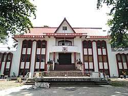 Datu Odin Sinsuat Town Hall | |
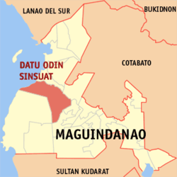 Map of Maguindanao with Datu Odin Sinsuat highlighted | |
OpenStreetMap 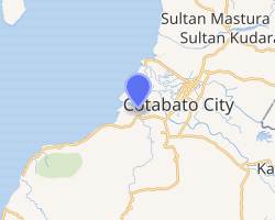
| |
.svg.png) Datu Odin Sinsuat Location within the Philippines | |
| Coordinates: 7°11′20″N 124°11′02″E | |
| Country | |
| Region | Bangsamoro Autonomous Region in Muslim Mindanao (BARMM) |
| Province | Maguindanao |
| District | 1st District |
| Barangays | 34 (see Barangays) |
| Government | |
| • Type | Sangguniang Bayan |
| • Mayor | Cheryl Mary Rose Ann F. Lu-Sinsuat |
| • Vice Mayor | Mohammad Khalid A. Ampatuan |
| • Congressman | Datu Roonie Q. Sinsuat Sr. |
| • Electorate | 70,319 voters (2019) |
| Area | |
| • Total | 461.80 km2 (178.30 sq mi) |
| Population (2015 census)[3] | |
| • Total | 99,210 |
| • Density | 210/km2 (560/sq mi) |
| • Households | 16,943 |
| Economy | |
| • Income class | 2nd municipal income class |
| • Poverty incidence | 44.59% (2015)[4] |
| • Revenue (₱) | 205,354,753.68 (2016) |
| Time zone | UTC+8 (PST) |
| ZIP code | 9601 |
| PSGC | |
| IDD : area code | +63 (0)64 |
| Climate type | tropical climate |
| Native languages | Maguindanao Tagalog |
| Website | www |
It is formerly known as Dinaig.
In 1955, the barrio of Upi was separated from Datu Odin Sinsuat to become the town of Upi.[5]
The town's name, Dinaig, was changed to Datu Odin Sinsuat in 1994, by virtue of Muslim Mindanao Autonomy Act No. 29.[6]
The town was part of the province of Shariff Kabunsuan and served as its capital from October 2006 until its nullification by the Supreme Court in July 2008.
The municipality hosts the Awang Domestic Airport that serves the province and Cotabato City.
Barangays
Datu Odin Sinsuat is politically subdivided into 34 barangays.
- Ambolodto
- Awang
- Badak
- Bagoenged
- Baka
- Benolen
- Bitu
- Bongued
- Bugawas
- Capiton
- Dados
- Dalican Poblacion
- Dinaig Proper
- Dulangan
- Kakar
- Kenebeka
- Kurintem
- Kusiong
- Labungan
- Linek
- Makir
- Margues
- Mompong
- Nekitan
- Sapalan
- Semba
- Sibuto
- Sifaren (Sifaran)
- Tambak
- Tamontaka
- Tanuel
- Tapian
- Taviran
- Tenonggos
Climate
| Climate data for Datu Odin Sinsuat, Maguindanao | |||||||||||||
|---|---|---|---|---|---|---|---|---|---|---|---|---|---|
| Month | Jan | Feb | Mar | Apr | May | Jun | Jul | Aug | Sep | Oct | Nov | Dec | Year |
| Average high °C (°F) | 31 (88) |
32 (90) |
32 (90) |
32 (90) |
31 (88) |
29 (84) |
29 (84) |
29 (84) |
30 (86) |
29 (84) |
30 (86) |
31 (88) |
30 (87) |
| Average low °C (°F) | 21 (70) |
21 (70) |
21 (70) |
23 (73) |
23 (73) |
23 (73) |
23 (73) |
23 (73) |
23 (73) |
23 (73) |
23 (73) |
22 (72) |
22 (72) |
| Average precipitation mm (inches) | 30 (1.2) |
19 (0.7) |
25 (1.0) |
24 (0.9) |
64 (2.5) |
88 (3.5) |
102 (4.0) |
105 (4.1) |
76 (3.0) |
82 (3.2) |
60 (2.4) |
26 (1.0) |
701 (27.5) |
| Average rainy days | 9.8 | 8.5 | 11.3 | 11.9 | 21.6 | 23.9 | 24.1 | 24.5 | 20.9 | 21.8 | 16.8 | 11.8 | 206.9 |
| Source: Meteoblue (modeled/calculated data, not measured locally) [7] | |||||||||||||
Demographics
|
| ||||||||||||||||||||||||||||||||||||||||||
| Source: Philippine Statistics Authority[3][8][9][10] | |||||||||||||||||||||||||||||||||||||||||||
Tourism
- Mount Minandar is known for its green color due to being dominantly covered with grass. It is a two hour hike from the foot to the summit of the mountain. It is located at the Barangay kusiong.
- Blue Lagoon is also known as Enchanted Lagoon because, according to the old people living nearby, there are enchantresses living in it. This deep lagoon situated at the Barangay Margues is the top tourist attraction of the municipality.
- Kusiong Beach is a grayish sand beach with a lot of resorts like Amayah Beach Resort, Sahara Beach Resort, and Club Cusiong. This is the nearest beach in Cotabato City.
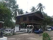
- Masjid Datu Untong Balabaran of Taviran is a pagoda-style mosque, one of the last pagoda-style mosques in the Philippines.
See also
References
- "Municipality". Quezon City, Philippines: Department of the Interior and Local Government. Retrieved 31 May 2013.
- "Province: Maguindanao". PSGC Interactive. Quezon City, Philippines: Philippine Statistics Authority. Retrieved 12 November 2016.
- Census of Population (2015). "ARMM – Autonomous Region in Muslim Mindanao". Total Population by Province, City, Municipality and Barangay. PSA. Retrieved 20 June 2016.
- "PSA releases the 2015 Municipal and City Level Poverty Estimates". Quezon City, Philippines. Retrieved 12 October 2019.
- "An Act to Create the Municipality of Upi in the Province of Cotabato". LawPH.com. Retrieved 2011-04-11.
- "Regional Act No. 3; An Act Changing the Name of the Municipality of Dinaig in the Province of Maguindanao to the Municipality of Datu Odin Sinsuat" (PDF). Regional Legislative Assembly, Autonomous Region in Muslim Mindanao. Retrieved 27 January 2016.
- "Datu Odin Sinsuat, Maguindanao: Average Temperatures and Rainfall". Meteoblue. Retrieved 19 January 2019.
- Census of Population and Housing (2010). "ARMM – Autonomous Region in Muslim Mindanao". Total Population by Province, City, Municipality and Barangay. NSO. Retrieved 29 June 2016.
- Censuses of Population (1903–2007). "ARMM – Autonomous Region in Muslim Mindanao". Table 1. Population Enumerated in Various Censuses by Province/Highly Urbanized City: 1903 to 2007. NSO.
- "Province of Maguindanao". Municipality Population Data. Local Water Utilities Administration Research Division. Retrieved 17 December 2016.
External links
- Datu Odin Sinsuat Profile at PhilAtlas.com
- MMA Act No. 29: An Act Changing the name of the Municipality of Dinaig in the Province of Maguindanao to the Municipality of Datu Odin Sinsuat
- Philippine Standard Geographic Code
- Philippine Census Information
- Local Governance Performance Management System
Places adjacent to Datu Odin Sinsuat, Maguindanao | ||||||||||
|---|---|---|---|---|---|---|---|---|---|---|
| ||||||||||
Buluan (capital) | |
| Municipalities |
|
| Independent component city |
|