Upi, Maguindanao
Upi, officially the Municipality of Upi (Maguindanaon: Ingud nu Upi; Iranun: Inged a Upi; Tagalog: Bayan ng Upi), is a 1st class municipality in the province of Maguindanao, Philippines. According to the 2015 census, it has a population of 53,583 people.[3]
Upi | |
|---|---|
| Municipality of Upi | |
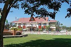 Municipal Hall of Upi | |
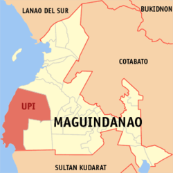 Map of Maguindanao with Upi highlighted | |
OpenStreetMap 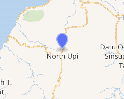
| |
.svg.png) Upi Location within the Philippines | |
| Coordinates: 7°01′44″N 124°09′54″E | |
| Country | |
| Region | Bangsamoro Autonomous Region in Muslim Mindanao (BARMM) |
| Province | Maguindanao |
| District | 1st District |
| Founded | June 10, 1955 |
| Barangays | 23 (see Barangays) |
| Government | |
| • Type | Sangguniang Bayan |
| • Mayor | Ramon A. Piang Sr. |
| • Vice Mayor | Alexis M. Platon |
| • Congressman | Datu Roonie Q. Sinsuat Sr. |
| • Electorate | 38,108 voters (2019) |
| Area | |
| • Total | 742.95 km2 (286.85 sq mi) |
| Population (2015 census)[3] | |
| • Total | 53,583 |
| • Density | 72/km2 (190/sq mi) |
| • Households | 10,879 |
| Economy | |
| • Income class | 1st municipal income class |
| • Poverty incidence | 43.67% (2015)[4] |
| • Revenue (₱) | 189,824,572.55 (2016) |
| Time zone | UTC+8 (PST) |
| ZIP code | 9602 |
| PSGC | |
| IDD : area code | +63 (0)64 |
| Climate type | tropical climate |
| Native languages | Maguindanao Tiruray Tagalog |
| Website | www |
The municipality was part of the province of Shariff Kabunsuan from October 2006 until its nullification by the Supreme Court in July 2008.
Etymology
Upi was probably derived from the term "ufi". It is a Teduray name for a certain tree (piper betel) that grows abundantly in the place in the early years. The bark of “Ufi” is used with betel nuts for chewing or "mama" in Teduray. Tedurays are the native inhabitants of the place.
History
The beginning of Upi as a district geographical and political entity largely began on the early part of 1901 to 1910 when the American forces set foot in the then Province of Cotabato.
An American Army Officer Captain Irving Bryant Edwards was assigned in Awang. He showed great interest in bringing the government closer to the people by establishing schools in the far-flung areas. He reached the fertile valley of Upi and founded the Upi Agricultural School on August 19, 1919. From a USAFFE soldier, Capt. Irving Bryant Edwards turned educator.
Upi was formerly a barrio of Dinaig. It was separated from the said town by virtue of Republic Act No. 1248, approved June 10, 1955.[5]
The first Municipal Mayor, Vice Mayor and Councilors of Upi were appointed by the President of the Philippines to hold office. Maria Badoy was appointed as the first Municipal Mayor. In 1956, the citizens were encouraged to participate in the political affairs of the local government and there took place the first election wherein Mayor Ignacio Tenorio Labina, a Teduray leader, was the first elected mayor of Upi and held his office for four years.
In 2006, Upi lost about 147 square kilometres (57 sq mi) when the coastal barangays Kinimi, Laguitan, Lapaken, Matuber, Meti, Nalkan, Penansaran, Sedem, Sinipak, Resa, Tambak and Tubuan in the Municipality of Upi were separated to create the new municipality of Datu Blah T. Sinsuat.[6]
Geography
Upi is a mountainous town situated in the south-western coastal portion of Maguindanao Province.
Barangays
Upi is politically subdivided into 23 barangays.
- Bantek
- Bayabas
- Blensong
- Borongotan
- Bugabungan
- Bungcog
- Darugao
- Ganasi
- Kabakaba
- Kibleg
- Kibucay
- Kiga
- Kinitaan
- Mirab
- Nangi
- Nuro (Poblacion)
- Ranao Pilayan
- Rempes
- Renede
- Renti
- Rifao
- Sefegefen
- Tinungkaan
Climate
| Climate data for Upi, Maguindanao | |||||||||||||
|---|---|---|---|---|---|---|---|---|---|---|---|---|---|
| Month | Jan | Feb | Mar | Apr | May | Jun | Jul | Aug | Sep | Oct | Nov | Dec | Year |
| Average high °C (°F) | 29 (84) |
29 (84) |
29 (84) |
29 (84) |
28 (82) |
27 (81) |
26 (79) |
27 (81) |
27 (81) |
27 (81) |
27 (81) |
28 (82) |
28 (82) |
| Average low °C (°F) | 18 (64) |
19 (66) |
19 (66) |
20 (68) |
21 (70) |
21 (70) |
20 (68) |
20 (68) |
20 (68) |
20 (68) |
20 (68) |
19 (66) |
20 (68) |
| Average precipitation mm (inches) | 30 (1.2) |
19 (0.7) |
25 (1.0) |
24 (0.9) |
64 (2.5) |
88 (3.5) |
102 (4.0) |
105 (4.1) |
76 (3.0) |
82 (3.2) |
60 (2.4) |
26 (1.0) |
701 (27.5) |
| Average rainy days | 9.8 | 8.5 | 11.3 | 11.9 | 21.6 | 23.9 | 24.1 | 24.5 | 20.9 | 21.8 | 16.8 | 11.8 | 206.9 |
| Source: Meteoblue (modeled/calculated data, not measured locally)[7] | |||||||||||||
Demographics
|
| ||||||||||||||||||||||||||||||||||||
| Source: Philippine Statistics Authority[3][8][9][10] | |||||||||||||||||||||||||||||||||||||
Local government
The current mayor of Upi is Ramon A. Piang Sr., a former principal of Notre Dame of Upi, a local high school managed by the Archdiocesan Notre Dame Schools of Cotabato.
List of former mayors:
- Maria Badoy - 1955 - 1956 - Appointed Mayor
- Ignacio Tenorio Labina - 1956 - 1960 - First Elected Mayor
- Datu Abdullah "Ugcog" Sinsuat - 1960 - 1963 - Elected Mayor
- Datu Michael "Puti" P. Sinsuat - 1963 - 1980 - Elected Mayor
- Bai Fatima P. Sinsuat -1980 - 1986- Elected Mayor
- Datu Mohammad "Unting" Sinsuat - 1986 - 1987- Appointed Mayor
- Datu Mohammad "Unting" Sinsuat - 1987 - 1992- Elected Mayor
- Datu Michael "Puti" P. Sinsuat -1992 - 2001- Elected Mayor
- Ramon A. Piang, Sr. -2001 - 2010 - Elected Mayor
- Ruben D. Platon -2010-2011 - Elected Mayor
- Ramon A. Piang, Sr 2011–present Appointed Mayor
Meguyaya Festival
Meguyaya, a Teduray term for thanksgiving for the bountiful harvest, is an annual festival celebrated every December. The festivities incorporate street dancing competition depicting tri-people culture, Teduray, Moro and Settlers . Other activities includes the Cultural Nights, Local Government Unit Night, Ginoong Meguyaya male pageant, trade fair and Maisan Na. This is an activity in which a long stretch of grillers are placed by the roadside where everyone enjoys roasting corns, a symbol of togetherness and feasting.
References
- "Municipality". Quezon City, Philippines: Department of the Interior and Local Government. Retrieved 31 May 2013.
- "Province: Maguindanao". PSGC Interactive. Quezon City, Philippines: Philippine Statistics Authority. Retrieved 12 November 2016.
- Census of Population (2015). "ARMM – Autonomous Region in Muslim Mindanao". Total Population by Province, City, Municipality and Barangay. PSA. Retrieved 20 June 2016.
- "PSA releases the 2015 Municipal and City Level Poverty Estimates". Quezon City, Philippines. Retrieved 12 October 2019.
- "An Act to Create the Municipality of Upi in the Province of Cotabato". LawPH.com. Retrieved 2011-04-11.
- "Muslim Mindanao Autonomy Act No.198: An Act Creating The Municipality of Datu Blah T. Sinsuat in The Province of Maguindanao, Providing Funds Therfor, and for Other Purposes" (PDF). lawphil.net. Cotabato City: Arellano Law Foundation. 2006. Retrieved 28 July 2020.
- "Upi, Maguindanao : Average Temperatures and Rainfall". Meteoblue. Retrieved 19 January 2019.
- Census of Population and Housing (2010). "ARMM – Autonomous Region in Muslim Mindanao". Total Population by Province, City, Municipality and Barangay. NSO. Retrieved 29 June 2016.
- Censuses of Population (1903–2007). "ARMM – Autonomous Region in Muslim Mindanao". Table 1. Population Enumerated in Various Censuses by Province/Highly Urbanized City: 1903 to 2007. NSO.
- "Province of Maguindanao". Municipality Population Data. Local Water Utilities Administration Research Division. Retrieved 17 December 2016.
External links
| Wikimedia Commons has media related to Upi, Maguindanao. |
- Philippine Standard Geographic Code
- Philippine Census Information
- Local Governance Performance Management System
Places adjacent to Upi, Maguindanao | ||||||||||
|---|---|---|---|---|---|---|---|---|---|---|
| ||||||||||
Buluan (capital) | |
| Municipalities |
|
| Independent component city |
|