Pualas, Lanao del Sur
Pualas, officially the Municipality of Pualas (Maranao: Inged a Pualas; Tagalog: Bayan ng Pualas), is a 5th class municipality in the province of Lanao del Sur, Philippines. According to the 2015 census, it has a population of 12,866 people.[3]
Pualas | |
|---|---|
| Municipality of Pualas | |
 Municipal Hall and the Masjid at Talambo, Pualas | |
Seal | |
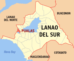 Map of Lanao del Sur with Pualas highlighted | |
OpenStreetMap 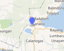
| |
.svg.png) Pualas Location within the Philippines | |
| Coordinates: 7°49′N 124°04′E | |
| Country | |
| Region | Bangsamoro Autonomous Region in Muslim Mindanao (BARMM) |
| Province | Lanao del Sur |
| District | 2nd District |
| Barangays | 23 (see Barangays) |
| Government | |
| • Type | Sangguniang Bayan |
| • Mayor | Shariefullah A. Tanog |
| • Vice Mayor | Dialalodin L. Maruhom |
| • Congressman | Yasser A. Balindong |
| • Electorate | 6,917 voters (2019) |
| Area | |
| • Total | 182.89 km2 (70.61 sq mi) |
| Population (2015 census)[3] | |
| • Total | 12,866 |
| • Density | 70/km2 (180/sq mi) |
| • Households | 1,415 |
| Economy | |
| • Income class | 5th municipal income class |
| • Poverty incidence | 64.5% (2015)[4] |
| • Revenue (₱) | 68,188,365.01 (2016) |
| Time zone | UTC+8 (PST) |
| ZIP code | 9313 |
| PSGC | |
| IDD : area code | +63 (0)63 |
| Climate type | tropical climate |
| Native languages | Maranao Tagalog |
Barangays
Pualas is politically subdivided into 23 barangays.
- Badak
- Bantayan
- Basagad
- Bolinsong
- Boring
- Bualan
- Danugan
- Dapao
- Diamla
- Gadongan
- Ingud
- Linuk
- Lumbac
- Maligo
- Masao
- Notong
- Porug
- Romagondong
- Talambo (Poblacion)
- Tamlang
- Tuka
- Tomarompong
- Yaran
Climate
| Climate data for Pualas, Lanao del Sur | |||||||||||||
|---|---|---|---|---|---|---|---|---|---|---|---|---|---|
| Month | Jan | Feb | Mar | Apr | May | Jun | Jul | Aug | Sep | Oct | Nov | Dec | Year |
| Average high °C (°F) | 25 (77) |
25 (77) |
25 (77) |
26 (79) |
25 (77) |
24 (75) |
24 (75) |
24 (75) |
24 (75) |
24 (75) |
24 (75) |
25 (77) |
25 (76) |
| Average low °C (°F) | 19 (66) |
19 (66) |
19 (66) |
20 (68) |
20 (68) |
20 (68) |
19 (66) |
19 (66) |
19 (66) |
20 (68) |
20 (68) |
19 (66) |
19 (67) |
| Average precipitation mm (inches) | 236 (9.3) |
225 (8.9) |
244 (9.6) |
235 (9.3) |
304 (12.0) |
287 (11.3) |
200 (7.9) |
175 (6.9) |
158 (6.2) |
200 (7.9) |
287 (11.3) |
243 (9.6) |
2,794 (110.2) |
| Average rainy days | 24.3 | 22.3 | 26.0 | 27.2 | 28.3 | 27.2 | 25.8 | 24.8 | 22.2 | 25.4 | 27.2 | 25.8 | 306.5 |
| Source: Meteoblue [5] | |||||||||||||
Demographics
| Year | Pop. | ±% p.a. |
|---|---|---|
| 1918 | 3,307 | — |
| 1939 | 4,708 | +1.70% |
| 1948 | 6,704 | +4.01% |
| 1960 | 8,242 | +1.74% |
| 1970 | 7,705 | −0.67% |
| 1975 | 11,776 | +8.88% |
| 1980 | 6,284 | −11.80% |
| 1990 | 7,177 | +1.34% |
| 1995 | 8,259 | +2.67% |
| 2000 | 7,887 | −0.98% |
| 2007 | 17,962 | +12.02% |
| 2010 | 11,163 | −15.89% |
| 2015 | 12,866 | +2.74% |
| Source: Philippine Statistics Authority[3][6][7][8] | ||
History
On June 21, 1953 by the virtue of Executive Order No. 1516 Pualas was created with 39 barangay. By December 14, 1985 by the issuance of executive order no. 108 Only 23 were retained.[9]
Local Government
Pualas is governed primarily by the mayor, the vice mayor and the SB Members
Language
Maranao is the native language of Pualas. However, most of the inhabitants can speak Filipino, Cebuana, and English.
Religion
Pualas, which has a predominantly Muslim population.
Education
Pualas National High School is a public High School Located at Barangay Talambo. It was founded on 1969. It offers education for junior and senior high school.[10]
Culture
Pualas has a predominantly Muslim populace wherein selling and distribution of alcoholic drinks, illegal drugs, and gambling is forbidden.
Gallery
.jpg) Mayor of Pualas LDS Engr. Cabib A. Tanog (2nd to d left)
Mayor of Pualas LDS Engr. Cabib A. Tanog (2nd to d left)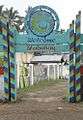 Pualas NHS Main Gate
 At Bantyan, Pualas
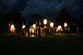 Flying lanterns
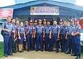 Pualas Police
.jpg) Youth Summit
Youth Summit
See also
References
- "Municipality". Quezon City, Philippines: Department of the Interior and Local Government. Retrieved 31 May 2013.
- "Province: Lanao del Sur". PSGC Interactive. Quezon City, Philippines: Philippine Statistics Authority. Retrieved 12 November 2016.
- Census of Population (2015). "ARMM – Autonomous Region in Muslim Mindanao". Total Population by Province, City, Municipality and Barangay. PSA. Retrieved 20 June 2016.
- "PSA releases the 2015 Municipal and City Level Poverty Estimates". Quezon City, Philippines. Retrieved 12 October 2019.
- "Ganassi, Lanao del Sur : Average Temperatures and Rainfall". Meteoblue. Retrieved 24 January 2019.
- Census of Population and Housing (2010). "ARMM – Autonomous Region in Muslim Mindanao". Total Population by Province, City, Municipality and Barangay. NSO. Retrieved 29 June 2016.
- Censuses of Population (1903–2007). "ARMM – Autonomous Region in Muslim Mindanao". Table 1. Population Enumerated in Various Censuses by Province/Highly Urbanized City: 1903 to 2007. NSO.
- "Province of Lanao del Sur". Municipality Population Data. Local Water Utilities Administration Research Division. Retrieved 17 December 2016.
- http://lgu-profile.dilg-armm.ph/municipality/eyJpdiI6IjZOUnRuNkdNeDgrR09aWHp1Z0wwZ1E9PSIsInZhbHVlIjoidStXQnJMWElIdHRJT3IxYkpOdVU2UT09IiwibWFjIjoiODlhMDNjMjk2NmU2MDRmNjRhMzBkZTQ5NGExZjRjOWI1YTllYTVkMWMyYjFkYzIyZmMzN2Q1YWJiZjM3MWI3ZSJ9/eyJpdiI6IkpleXZrTk40VW1LZUducUhRQ1RGMXc9PSIsInZhbHVlIjoiekYycjZ3eFJrbzIzNklsTEhXOFRoZz09IiwibWFjIjoiM2I3YTllNmI4MzI0ODUzNTAzNzg5MTY1YmI3MmU0NjRiM2Y2YzYwNzRiNzk3YWYxNGExOTYwMDYxY2FmMTU4NyJ9
- https://www.edukasyon.ph/schools/pualas-national-high-school
External links
| Wikimedia Commons has media related to Pualas, Lanao del Sur. |
- Pualas Profile at PhilAtlas.com
- Philippine Standard Geographic Code
- Philippine Census Information
- Local Governance Performance Management System
Places adjacent to Pualas, Lanao del Sur | ||||||||||
|---|---|---|---|---|---|---|---|---|---|---|
| ||||||||||