Baugy, Cher
Baugy is a commune in the Cher department in the Centre-Val de Loire region of central France. On 1 January 2019, the former communes Laverdines and Saligny-le-Vif were merged into Baugy.[2]
Baugy | |
|---|---|
The church in Baugy | |
.svg.png) Coat of arms | |
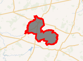
Location of Baugy 
| |
 Baugy  Baugy | |
| Coordinates: 47°04′56″N 2°43′42″E | |
| Country | France |
| Region | Centre-Val de Loire |
| Department | Cher |
| Arrondissement | Bourges |
| Canton | Avord |
| Intercommunality | CC La Septaine |
| Area 1 | 47.78 km2 (18.45 sq mi) |
| Population (2017-01-01)[1] | 1,721 |
| • Density | 36/km2 (93/sq mi) |
| Time zone | UTC+01:00 (CET) |
| • Summer (DST) | UTC+02:00 (CEST) |
| INSEE/Postal code | 18023 /18800 |
| Elevation | 157–202 m (515–663 ft) |
| 1 French Land Register data, which excludes lakes, ponds, glaciers > 1 km2 (0.386 sq mi or 247 acres) and river estuaries. | |
Geography
A farming village with a little light industry situated in the upper valley of the river Yèvre, some 13 miles (21 km) east of Bourges at the junction of the D10, D12, D43 and the D71 roads.
Population
| Year | Pop. | ±% |
|---|---|---|
| 1962 | 1,103 | — |
| 1968 | 1,116 | +1.2% |
| 1975 | 1,106 | −0.9% |
| 1982 | 1,144 | +3.4% |
| 1990 | 1,159 | +1.3% |
| 1999 | 1,146 | −1.1% |
| 2008 | 1,321 | +15.3% |
Sights
- The church of St.Martin, dating from the twelfth century.
- Vestiges of Roman occupation.
- Ruins of a ninth-century castle.
- A feudal motte at Montifaut.
gollark: It's basically a reflection of the fact that Java is bad and Kotlin less bad.
gollark: Should it not be a node tree, anyway?
gollark: Can you recommend a different way to keep the weird vector-of-node thing?
gollark: <@337621533369303042> I guess you want that then if you *must* be C++y and evil.
gollark: I don't actually want to do this, but I mean check which subtype a node is.
See also
References
- "Populations légales 2017". INSEE. Retrieved 6 January 2020.
- Arrêté préfectoral 18 October 2018 (in French)
| Wikimedia Commons has media related to Baugy (Cher). |
This article is issued from Wikipedia. The text is licensed under Creative Commons - Attribution - Sharealike. Additional terms may apply for the media files.