Laverdines
Laverdines is a former commune in the Cher department in the Centre-Val de Loire region of France. On 1 January 2019, it was merged into the commune Baugy.[2]
Laverdines | |
|---|---|
Part of Baugy | |
Location of Laverdines 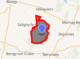
| |
 Laverdines  Laverdines | |
| Coordinates: 47°01′53″N 2°47′56″E | |
| Country | France |
| Region | Centre-Val de Loire |
| Department | Cher |
| Arrondissement | Bourges |
| Canton | Avord |
| Commune | Baugy |
| Area 1 | 9.89 km2 (3.82 sq mi) |
| Population (2017)[1] | 42 |
| • Density | 4.2/km2 (11/sq mi) |
| Time zone | UTC+01:00 (CET) |
| • Summer (DST) | UTC+02:00 (CEST) |
| Postal code | 18800 |
| Elevation | 177–221 m (581–725 ft) (avg. 215 m or 705 ft) |
| 1 French Land Register data, which excludes lakes, ponds, glaciers > 1 km2 (0.386 sq mi or 247 acres) and river estuaries. | |
Geography
A tiny farming village, one of the smallest in France by population, situated some 16 miles (26 km) east of Bourges, at the junction of the D43 and the D72 roads. The river Vauvise flows north through the eastern part of the commune.
Population
| Year | Pop. | ±% |
|---|---|---|
| 1962 | 93 | — |
| 1968 | 102 | +9.7% |
| 1975 | 58 | −43.1% |
| 1982 | 58 | +0.0% |
| 1990 | 47 | −19.0% |
| 1999 | 43 | −8.5% |
| 2008 | 52 | +20.9% |
Sights
- A nineteenth-century chapel.
- The church of St. Sylvain, dating from the twelfth century.
gollark: So I'm still deciding between that and another university with no particularly unusual characteristics.
gollark: It is also apparently known for large workload (the people I asked have been very inconsistent about this though), but the course has very cool content compared to other ones.
gollark: REAL programmers work with nobody but GPT-3.
gollark: It's worrying.
gollark: One of the universities I'm considering firming apparently is quite big on group projects because something something industry.
See also
References
- Téléchargement du fichier d'ensemble des populations légales en 2017, INSEE
- Arrêté préfectoral 18 October 2018 (in French)
| Wikimedia Commons has media related to Laverdines. |
| Authority control |
|
|---|
This article is issued from Wikipedia. The text is licensed under Creative Commons - Attribution - Sharealike. Additional terms may apply for the media files.