Morthomiers
Morthomiers is a commune in the Cher department in the Centre-Val de Loire region of France.
Morthomiers | |
|---|---|
 Coat of arms | |
Location of Morthomiers 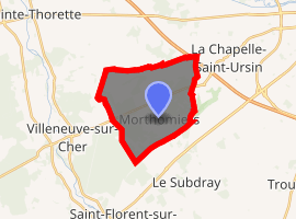
| |
 Morthomiers  Morthomiers | |
| Coordinates: 47°02′16″N 2°16′39″E | |
| Country | France |
| Region | Centre-Val de Loire |
| Department | Cher |
| Arrondissement | Bourges |
| Canton | Chârost |
| Intercommunality | CA Bourges Plus |
| Government | |
| • Mayor (2001–2008) | Daniel Gravelet |
| Area 1 | 14.54 km2 (5.61 sq mi) |
| Population (2017-01-01)[1] | 761 |
| • Density | 52/km2 (140/sq mi) |
| Time zone | UTC+01:00 (CET) |
| • Summer (DST) | UTC+02:00 (CEST) |
| INSEE/Postal code | 18157 /18570 |
| Elevation | 124–157 m (407–515 ft) |
| 1 French Land Register data, which excludes lakes, ponds, glaciers > 1 km2 (0.386 sq mi or 247 acres) and river estuaries. | |
Geography
An area of forestry and farming comprising the village and a hamlet situated some 6 miles (9.7 km) southwest of Vierzon at the junction of the D16 and the D135 roads. The commune lies on the pilgrimage route known as Saint James's Way.
Population
| Year | Pop. | ±% |
|---|---|---|
| 1962 | 193 | — |
| 1968 | 204 | +5.7% |
| 1975 | 218 | +6.9% |
| 1982 | 409 | +87.6% |
| 1990 | 590 | +44.3% |
| 1999 | 589 | −0.2% |
| 2008 | 676 | +14.8% |
gollark: I believe it is "return oriented programming". I wanted to do it for one of the code guessing things, but just did a highly SIMD implementation instead.
gollark: They disallow all runtime code-loading except browsers, I think?
gollark: "Jesus" is contained at Site 2-α.
gollark: I use syncthing and the firefox tab sync thing for synchronization purposes.
gollark: I ensure that I'm not tied to any particular company by using commodity hardware and randomly changing OS and such unnecessarily.
See also
References
- "Populations légales 2017". INSEE. Retrieved 6 January 2020.
| Wikimedia Commons has media related to Morthomiers. |
| Authority control |
|
|---|
This article is issued from Wikipedia. The text is licensed under Creative Commons - Attribution - Sharealike. Additional terms may apply for the media files.