Veaugues
Veaugues is a commune in the Cher department in the Centre-Val de Loire region of France.
Veaugues | |
|---|---|
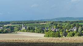 A general view of Veaugues | |
Location of Veaugues 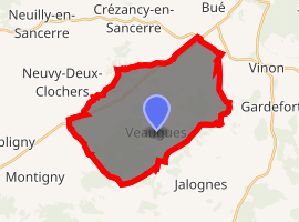
| |
 Veaugues  Veaugues | |
| Coordinates: 47°15′29″N 2°45′31″E | |
| Country | France |
| Region | Centre-Val de Loire |
| Department | Cher |
| Arrondissement | Bourges |
| Canton | Sancerre |
| Intercommunality | CC Pays Fort Sancerrois Val de Loire |
| Government | |
| • Mayor (2008–2014) | Sylvie Barbouche |
| Area 1 | 27.92 km2 (10.78 sq mi) |
| Population (2017-01-01)[1] | 633 |
| • Density | 23/km2 (59/sq mi) |
| Time zone | UTC+01:00 (CET) |
| • Summer (DST) | UTC+02:00 (CEST) |
| INSEE/Postal code | 18272 /18300 |
| Elevation | 180–346 m (591–1,135 ft) |
| 1 French Land Register data, which excludes lakes, ponds, glaciers > 1 km2 (0.386 sq mi or 247 acres) and river estuaries. | |
Geography
An area of winegrowing, forestry and farming comprising the village and a couple of hamlets situated on the banks of the small Planche-Goddard river, about 24 miles (39 km) northeast of Bourges at the junction of the D86 with the D49, D59 and D955 roads. The commune is one of 14 that grow grapes for the production of Sancerre AOC wine.
Population
| Year | Pop. | ±% |
|---|---|---|
| 1962 | 541 | — |
| 1968 | 610 | +12.8% |
| 1975 | 631 | +3.4% |
| 1982 | 603 | −4.4% |
| 1990 | 564 | −6.5% |
| 1999 | 610 | +8.2% |
| 2008 | 653 | +7.0% |
Sights
gollark: This is actually bad.
gollark: I'm sure it would be possible with facial recognition and some massive privacy violations.
gollark: So maybe the i5-11600K.
gollark: You will need a GPU of some sort, to update the BIOS settings and whatever.
gollark: It uses the Linux kernel and accursed userspace.
See also
References
- "Populations légales 2017". INSEE. Retrieved 6 January 2020.
External links
| Wikimedia Commons has media related to Veaugues. |
- Veaugues on the Quid website (in French)
| Authority control |
|
|---|
This article is issued from Wikipedia. The text is licensed under Creative Commons - Attribution - Sharealike. Additional terms may apply for the media files.