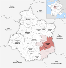
Arrondissement of Bourges
The arrondissement of Bourges is an arrondissement of France in the Cher department in the Centre-Val de Loire region. It has 128 communes.[1] Its population is 173,037 (2016), and its area is 2,783.9 km2 (1,074.9 sq mi).[2]
Bourges | |
|---|---|
 Location within the region Centre-Val de Loire | |
| Country | France |
| Region | Centre-Val de Loire |
| Department | Cher |
| No. of communes | 128 |
| Prefecture | Bourges |
| Area | |
| • Total | 2,783.9 km2 (1,074.9 sq mi) |
| Population (2016) | |
| • Total | 173,037 |
| • Density | 62/km2 (160/sq mi) |
| INSEE code | 181 |
Composition
The communes of the arrondissement of Bourges, and their INSEE codes, are:[1]
- Achères (18001)
- Les Aix-d'Angillon (18003)
- Allogny (18004)
- Annoix (18006)
- Arçay (18008)
- Argenvières (18012)
- Assigny (18014)
- Aubinges (18016)
- Avord (18018)
- Azy (18019)
- Bannay (18020)
- Barlieu (18022)
- Baugy (18023)
- Beffes (18025)
- Belleville-sur-Loire (18026)
- Bengy-sur-Craon (18027)
- Boulleret (18032)
- Bourges (18033)
- Brécy (18035)
- Bué (18039)
- La Chapelle-Montlinard (18049)
- La Chapelle-Saint-Ursin (18050)
- La Chapelotte (18051)
- Charentonnay (18053)
- Chârost (18055)
- Chassy (18056)
- Chaumoux-Marcilly (18061)
- Civray (18066)
- Concressault (18070)
- Couargues (18074)
- Couy (18077)
- Crézancy-en-Sancerre (18079)
- Crosses (18081)
- Dampierre-en-Crot (18084)
- Étréchy (18090)
- Farges-en-Septaine (18092)
- Feux (18094)
- Fussy (18097)
- Gardefort (18098)
- Garigny (18099)
- Groises (18104)
- Gron (18105)
- Henrichemont (18109)
- Herry (18110)
- Humbligny (18111)
- Jalognes (18116)
- Jars (18117)
- Jussy-Champagne (18119)
- Jussy-le-Chaudrier (18120)
- Lapan (18122)
- Léré (18125)
- Levet (18126)
- Lissay-Lochy (18129)
- Lugny-Champagne (18132)
- Lunery (18133)
- Mareuil-sur-Arnon (18137)
- Marmagne (18138)
- Marseilles-lès-Aubigny (18139)
- Menetou-Râtel (18144)
- Menetou-Salon (18145)
- Ménétréol-sous-Sancerre (18146)
- Montigny (18151)
- Morogues (18156)
- Morthomiers (18157)
- Moulins-sur-Yèvre (18158)
- Neuilly-en-Sancerre (18162)
- Neuvy-Deux-Clochers (18163)
- Nohant-en-Goût (18166)
- Le Noyer (18168)
- Osmoy (18174)
- Parassy (18176)
- Pigny (18179)
- Plaimpied-Givaudins (18180)
- Plou (18181)
- Poisieux (18182)
- Précy (18184)
- Primelles (18188)
- Quantilly (18189)
- Rians (18194)
- Saint-Ambroix (18198)
- Saint-Bouize (18200)
- Saint-Caprais (18201)
- Saint-Céols (18202)
- Saint-Doulchard (18205)
- Sainte-Gemme-en-Sancerrois (18208)
- Saint-Éloy-de-Gy (18206)
- Sainte-Solange (18235)
- Saint-Florent-sur-Cher (18207)
- Saint-Georges-sur-Moulon (18211)
- Saint-Germain-du-Puy (18213)
- Saint-Just (18218)
- Saint-Léger-le-Petit (18220)
- Saint-Martin-d'Auxigny (18223)
- Saint-Martin-des-Champs (18224)
- Saint-Michel-de-Volangis (18226)
- Saint-Palais (18229)
- Saint-Satur (18233)
- Sancergues (18240)
- Sancerre (18241)
- Santranges (18243)
- Saugy (18244)
- Savigny-en-Sancerre (18246)
- Savigny-en-Septaine (18247)
- Senneçay (18248)
- Sens-Beaujeu (18249)
- Sévry (18251)
- Soulangis (18253)
- Soye-en-Septaine (18254)
- Le Subdray (18255)
- Subligny (18256)
- Sury-en-Vaux (18258)
- Sury-ès-Bois (18259)
- Sury-près-Léré (18257)
- Thauvenay (18262)
- Thou (18264)
- Trouy (18267)
- Vailly-sur-Sauldre (18269)
- Vasselay (18271)
- Veaugues (18272)
- Verdigny (18274)
- Vignoux-sous-les-Aix (18280)
- Villabon (18282)
- Villegenon (18284)
- Villeneuve-sur-Cher (18285)
- Villequiers (18286)
- Vinon (18287)
- Vorly (18288)
- Vornay (18289)
History
The arrondissement of Bourges was created in 1800.[3]
As a result of the reorganisation of the cantons of France which came into effect in 2015, the borders of the cantons are no longer related to the borders of the arrondissements. The cantons of the arrondissement of Bourges were, as of January 2015:[4]
- Les Aix-d'Angillon
- Baugy
- Bourges 1st Canton
- Bourges 2nd Canton
- Bourges 3rd Canton
- Bourges 4th Canton
- Bourges 5th Canton
- Chârost
- Henrichemont
- Léré
- Levet
- Saint-Doulchard
- Saint-Martin-d'Auxigny
- Sancergues
- Sancerre
- Vailly-sur-Sauldre
gollark: Like I said, reducing the numbers just means people will spam them, like dayblooms in Botania ages ago.
gollark: Er, no.
gollark: NuclearCraft does not actually have these, nor would I want it to.
gollark: Also, what would "harder" involve? Lower output from the collectors would just induce grind.
gollark: What would you actually reasonably use it for anyway other than cooling?
References
- "Arrondissement de Bourges (181)". INSEE. Retrieved 2019-09-28.
- "Comparateur de territoire, géographie au 01/01/2019". INSEE. Retrieved 2019-09-28.
- Historique du Cher
- "Populations légales 2012" (PDF). INSEE. December 2014. Retrieved 2019-10-08.
This article is issued from Wikipedia. The text is licensed under Creative Commons - Attribution - Sharealike. Additional terms may apply for the media files.