Villabon
Villabon is a commune in the Cher department in the Centre-Val de Loire region of France.
Villabon | |
|---|---|
.svg.png) Coat of arms | |
Location of Villabon 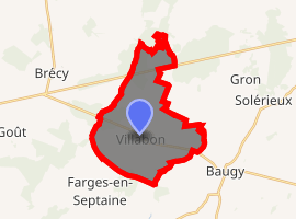
| |
 Villabon  Villabon | |
| Coordinates: 47°05′51″N 2°40′32″E | |
| Country | France |
| Region | Centre-Val de Loire |
| Department | Cher |
| Arrondissement | Bourges |
| Canton | Avord |
| Intercommunality | CC La Septaine |
| Government | |
| • Mayor (2008–2014) | Philippe Frérard |
| Area 1 | 18.28 km2 (7.06 sq mi) |
| Population (2017-01-01)[1] | 577 |
| • Density | 32/km2 (82/sq mi) |
| Time zone | UTC+01:00 (CET) |
| • Summer (DST) | UTC+02:00 (CEST) |
| INSEE/Postal code | 18282 /18800 |
| Elevation | 163–220 m (535–722 ft) (avg. 212 m or 696 ft) |
| 1 French Land Register data, which excludes lakes, ponds, glaciers > 1 km2 (0.386 sq mi or 247 acres) and river estuaries. | |
Geography
A farming village and a hamlet situated on the banks of the small Villabon river about 12 miles (19 km) east of Bourges, at the junction of the D12, D36 and the D235 roads.
Population
| Year | Pop. | ±% |
|---|---|---|
| 1962 | 435 | — |
| 1968 | 480 | +10.3% |
| 1975 | 405 | −15.6% |
| 1982 | 462 | +14.1% |
| 1990 | 521 | +12.8% |
| 1999 | 463 | −11.1% |
| 2008 | 554 | +19.7% |
Sights
- The church dating from the nineteenth century.
- A watermill.
- The sixteenth-century chateau of Savoye.
gollark: Also no round corners ever.
gollark: Minoteaur gets this right in all cases, by using visible grayish borders and either links or rectangular colored buttons.
gollark: Such things generally are.
gollark: > google search
gollark: I really do not like how it looks without them.
See also
References
- "Populations légales 2017". INSEE. Retrieved 6 January 2020.
| Wikimedia Commons has media related to Villabon. |
| Authority control |
|
|---|
This article is issued from Wikipedia. The text is licensed under Creative Commons - Attribution - Sharealike. Additional terms may apply for the media files.