Montigny, Cher
Montigny is a commune in the Cher department in the Centre-Val de Loire region of France.
Montigny | |
|---|---|
Location of Montigny 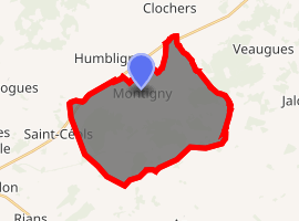
| |
 Montigny  Montigny | |
| Coordinates: 47°15′05″N 2°40′52″E | |
| Country | France |
| Region | Centre-Val de Loire |
| Department | Cher |
| Arrondissement | Bourges |
| Canton | Saint-Germain-du-Puy |
| Intercommunality | CC Terres du Haut Berry |
| Government | |
| • Mayor (2011–2014) | Joël Drault |
| Area 1 | 28.65 km2 (11.06 sq mi) |
| Population (2017-01-01)[1] | 387 |
| • Density | 14/km2 (35/sq mi) |
| Time zone | UTC+01:00 (CET) |
| • Summer (DST) | UTC+02:00 (CEST) |
| INSEE/Postal code | 18151 /18250 |
| Elevation | 191–353 m (627–1,158 ft) (avg. 222 m or 728 ft) |
| 1 French Land Register data, which excludes lakes, ponds, glaciers > 1 km2 (0.386 sq mi or 247 acres) and river estuaries. | |
Geography
An area of forestry and farming comprising the village and four hamlets situated some 15 miles (24 km) northeast of Bourges, at the junction of the D955 with the D44, D59 and D93 roads.
Population
| Year | Pop. | ±% |
|---|---|---|
| 1962 | 422 | — |
| 1968 | 489 | +15.9% |
| 1975 | 432 | −11.7% |
| 1982 | 422 | −2.3% |
| 1990 | 375 | −11.1% |
| 1999 | 373 | −0.5% |
| 2008 | 354 | −5.1% |
Places of interest
- The church of St. Martial, dating from the twelfth century.
- A sixteenth-century chapel.
gollark: <:chips:453465151132139521> <:chips:453465151132139521> <:chips:453465151132139521> <:chips:453465151132139521> <:chips:453465151132139521> <:chips:453465151132139521> <:chips:453465151132139521> <:chips:453465151132139521> <:chips:453465151132139521> <:chips:453465151132139521> <:chips:453465151132139521> <:chips:453465151132139521> <:chips:453465151132139521> <:chips:453465151132139521> <:chips:453465151132139521> <:chips:453465151132139521> <:chips:453465151132139521> <:chips:453465151132139521> <:chips:453465151132139521> <:chips:453465151132139521> <:chips:453465151132139521> <:chips:453465151132139521> <:chips:453465151132139521> <:chips:453465151132139521> <:chips:453465151132139521> <:chips:453465151132139521> <:chips:453465151132139521> <:chips:453465151132139521> <:chips:453465151132139521> <:chips:453465151132139521> <:chips:453465151132139521> <:chips:453465151132139521> <:chips:453465151132139521> <:chips:453465151132139521> <:chips:453465151132139521> <:chips:453465151132139521> <:chips:453465151132139521> <:chips:453465151132139521> <:chips:453465151132139521> <:chips:453465151132139521> <:chips:453465151132139521> <:chips:453465151132139521> <:chips:453465151132139521> <:chips:453465151132139521> <:chips:453465151132139521> <:chips:453465151132139521> <:chips:453465151132139521> <:chips:453465151132139521> <:chips:453465151132139521> <:chips:453465151132139521> <:chips:453465151132139521> <:chips:453465151132139521> <:chips:453465151132139521> <:chips:453465151132139521> <:chips:453465151132139521> <:chips:453465151132139521> <:chips:453465151132139521> <:chips:453465151132139521> <:chips:453465151132139521> <:chips:453465151132139521> <:chips:453465151132139521> <:chips:453465151132139521> <:chips:453465151132139521> <:chips:453465151132139521>
gollark: <:chips:453465151132139521> <:chips:453465151132139521> <:chips:453465151132139521> <:chips:453465151132139521> <:chips:453465151132139521> <:chips:453465151132139521> <:chips:453465151132139521> <:chips:453465151132139521> <:chips:453465151132139521> <:chips:453465151132139521> <:chips:453465151132139521> <:chips:453465151132139521> <:chips:453465151132139521> <:chips:453465151132139521> <:chips:453465151132139521> <:chips:453465151132139521> <:chips:453465151132139521> <:chips:453465151132139521> <:chips:453465151132139521> <:chips:453465151132139521> <:chips:453465151132139521> <:chips:453465151132139521> <:chips:453465151132139521> <:chips:453465151132139521> <:chips:453465151132139521> <:chips:453465151132139521> <:chips:453465151132139521> <:chips:453465151132139521> <:chips:453465151132139521> <:chips:453465151132139521> <:chips:453465151132139521> <:chips:453465151132139521> <:chips:453465151132139521> <:chips:453465151132139521> <:chips:453465151132139521> <:chips:453465151132139521> <:chips:453465151132139521> <:chips:453465151132139521> <:chips:453465151132139521> <:chips:453465151132139521> <:chips:453465151132139521> <:chips:453465151132139521> <:chips:453465151132139521> <:chips:453465151132139521> <:chips:453465151132139521> <:chips:453465151132139521> <:chips:453465151132139521> <:chips:453465151132139521> <:chips:453465151132139521> <:chips:453465151132139521> <:chips:453465151132139521> <:chips:453465151132139521> <:chips:453465151132139521> <:chips:453465151132139521> <:chips:453465151132139521> <:chips:453465151132139521> <:chips:453465151132139521> <:chips:453465151132139521> <:chips:453465151132139521> <:chips:453465151132139521> <:chips:453465151132139521> <:chips:453465151132139521> <:chips:453465151132139521> <:chips:453465151132139521>
gollark: <:chips:453465151132139521> <:chips:453465151132139521> <:chips:453465151132139521> <:chips:453465151132139521> <:chips:453465151132139521> <:chips:453465151132139521> <:chips:453465151132139521> <:chips:453465151132139521> <:chips:453465151132139521> <:chips:453465151132139521> <:chips:453465151132139521> <:chips:453465151132139521> <:chips:453465151132139521> <:chips:453465151132139521> <:chips:453465151132139521> <:chips:453465151132139521> <:chips:453465151132139521> <:chips:453465151132139521> <:chips:453465151132139521> <:chips:453465151132139521> <:chips:453465151132139521> <:chips:453465151132139521> <:chips:453465151132139521> <:chips:453465151132139521> <:chips:453465151132139521> <:chips:453465151132139521> <:chips:453465151132139521> <:chips:453465151132139521> <:chips:453465151132139521> <:chips:453465151132139521> <:chips:453465151132139521> <:chips:453465151132139521> <:chips:453465151132139521> <:chips:453465151132139521> <:chips:453465151132139521> <:chips:453465151132139521> <:chips:453465151132139521> <:chips:453465151132139521> <:chips:453465151132139521> <:chips:453465151132139521> <:chips:453465151132139521> <:chips:453465151132139521> <:chips:453465151132139521> <:chips:453465151132139521> <:chips:453465151132139521> <:chips:453465151132139521> <:chips:453465151132139521> <:chips:453465151132139521> <:chips:453465151132139521> <:chips:453465151132139521> <:chips:453465151132139521> <:chips:453465151132139521> <:chips:453465151132139521> <:chips:453465151132139521> <:chips:453465151132139521> <:chips:453465151132139521> <:chips:453465151132139521> <:chips:453465151132139521> <:chips:453465151132139521> <:chips:453465151132139521> <:chips:453465151132139521> <:chips:453465151132139521> <:chips:453465151132139521> <:chips:453465151132139521>
gollark: <:chips:453465151132139521> <:chips:453465151132139521> <:chips:453465151132139521> <:chips:453465151132139521> <:chips:453465151132139521> <:chips:453465151132139521> <:chips:453465151132139521> <:chips:453465151132139521> <:chips:453465151132139521> <:chips:453465151132139521> <:chips:453465151132139521> <:chips:453465151132139521> <:chips:453465151132139521> <:chips:453465151132139521> <:chips:453465151132139521> <:chips:453465151132139521> <:chips:453465151132139521> <:chips:453465151132139521> <:chips:453465151132139521> <:chips:453465151132139521> <:chips:453465151132139521> <:chips:453465151132139521> <:chips:453465151132139521> <:chips:453465151132139521> <:chips:453465151132139521> <:chips:453465151132139521> <:chips:453465151132139521> <:chips:453465151132139521> <:chips:453465151132139521> <:chips:453465151132139521> <:chips:453465151132139521> <:chips:453465151132139521> <:chips:453465151132139521> <:chips:453465151132139521> <:chips:453465151132139521> <:chips:453465151132139521> <:chips:453465151132139521> <:chips:453465151132139521> <:chips:453465151132139521> <:chips:453465151132139521> <:chips:453465151132139521> <:chips:453465151132139521> <:chips:453465151132139521> <:chips:453465151132139521> <:chips:453465151132139521> <:chips:453465151132139521> <:chips:453465151132139521> <:chips:453465151132139521> <:chips:453465151132139521> <:chips:453465151132139521> <:chips:453465151132139521> <:chips:453465151132139521> <:chips:453465151132139521> <:chips:453465151132139521> <:chips:453465151132139521> <:chips:453465151132139521> <:chips:453465151132139521> <:chips:453465151132139521> <:chips:453465151132139521> <:chips:453465151132139521> <:chips:453465151132139521> <:chips:453465151132139521> <:chips:453465151132139521> <:chips:453465151132139521>
gollark: <:chips:453465151132139521> <:chips:453465151132139521> <:chips:453465151132139521> <:chips:453465151132139521> <:chips:453465151132139521> <:chips:453465151132139521> <:chips:453465151132139521> <:chips:453465151132139521> <:chips:453465151132139521> <:chips:453465151132139521> <:chips:453465151132139521> <:chips:453465151132139521> <:chips:453465151132139521> <:chips:453465151132139521> <:chips:453465151132139521> <:chips:453465151132139521> <:chips:453465151132139521> <:chips:453465151132139521> <:chips:453465151132139521> <:chips:453465151132139521> <:chips:453465151132139521> <:chips:453465151132139521> <:chips:453465151132139521> <:chips:453465151132139521> <:chips:453465151132139521> <:chips:453465151132139521> <:chips:453465151132139521> <:chips:453465151132139521> <:chips:453465151132139521> <:chips:453465151132139521> <:chips:453465151132139521> <:chips:453465151132139521> <:chips:453465151132139521> <:chips:453465151132139521> <:chips:453465151132139521> <:chips:453465151132139521> <:chips:453465151132139521> <:chips:453465151132139521> <:chips:453465151132139521> <:chips:453465151132139521> <:chips:453465151132139521> <:chips:453465151132139521> <:chips:453465151132139521> <:chips:453465151132139521> <:chips:453465151132139521> <:chips:453465151132139521> <:chips:453465151132139521> <:chips:453465151132139521> <:chips:453465151132139521> <:chips:453465151132139521> <:chips:453465151132139521> <:chips:453465151132139521> <:chips:453465151132139521> <:chips:453465151132139521> <:chips:453465151132139521> <:chips:453465151132139521> <:chips:453465151132139521> <:chips:453465151132139521> <:chips:453465151132139521> <:chips:453465151132139521> <:chips:453465151132139521> <:chips:453465151132139521> <:chips:453465151132139521> <:chips:453465151132139521>
See also
References
- "Populations légales 2017". INSEE. Retrieved 6 January 2020.
| Wikimedia Commons has media related to Montigny (Cher). |
| Authority control |
|
|---|
This article is issued from Wikipedia. The text is licensed under Creative Commons - Attribution - Sharealike. Additional terms may apply for the media files.