Couargues
Couargues is a commune in the Cher department in the Centre-Val de Loire region of France.
Couargues | |
|---|---|
Location of Couargues 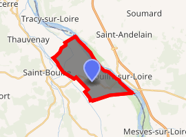
| |
 Couargues  Couargues | |
| Coordinates: 47°16′41″N 2°55′47″E | |
| Country | France |
| Region | Centre-Val de Loire |
| Department | Cher |
| Arrondissement | Bourges |
| Canton | Sancerre |
| Intercommunality | CC Pays Fort Sancerrois Val de Loire |
| Government | |
| • Mayor (2008–2014) | Maurice Rat |
| Area 1 | 11.62 km2 (4.49 sq mi) |
| Population (2017-01-01)[1] | 205 |
| • Density | 18/km2 (46/sq mi) |
| Time zone | UTC+01:00 (CET) |
| • Summer (DST) | UTC+02:00 (CEST) |
| INSEE/Postal code | 18074 /18300 |
| Elevation | 141–155 m (463–509 ft) (avg. 178 m or 584 ft) |
| 1 French Land Register data, which excludes lakes, ponds, glaciers > 1 km2 (0.386 sq mi or 247 acres) and river estuaries. | |
Geography
A farming area comprising five hamlets situated between the banks of the Loire River and the canal parallel to the Loire, some 30 miles (48 km) northeast of Bourges at the junction of the D59 with the D206 and D259 roads.
Population
| Year | Pop. | ±% |
|---|---|---|
| 1962 | 199 | — |
| 1968 | 238 | +19.6% |
| 1975 | 224 | −5.9% |
| 1982 | 211 | −5.8% |
| 1990 | 207 | −1.9% |
| 1999 | 228 | +10.1% |
| 2008 | 210 | −7.9% |
Sights

The presbytery
- The presbytery of St. Aignan, dating from the fifteenth century.
- Two watermills.
gollark: The market, I think.
gollark: You can have it back for just 133KST.
gollark: <@!156933717628026880>
gollark: - blaze XP farms in the nether from kepler and danygames
gollark: - fatmanchummy managed to get the first kill at the newly opened end portal
See also
References
- "Populations légales 2017". INSEE. Retrieved 6 January 2020.
External links
| Wikimedia Commons has media related to Couargues. |
- Website about Couargues (in French)
| Authority control |
|
|---|
This article is issued from Wikipedia. The text is licensed under Creative Commons - Attribution - Sharealike. Additional terms may apply for the media files.